TopoQuest Logo
Do you find TopoQuest useful?
Help keep TopoQuest running and adding new maps/features by donating!
Bitcoin:  19c7KJd3qBynnjoSw5npx9KScwjBe4ifkT
Litecoin:  LXs6TkuXGGXo1vDsWCkWVdjQX94eUKd6ui
Home View Maps Find Maps Find Places Resources & Links


Neenach School, California Topographic Map

USGS Map Title: Neenach School, CA
USGS Map MRC: 34118G5
DRG (GeoTIFF) Download: o34118g5.tif


Neighboring USGS Topographic Map Quads:


  Winters Ridge, CA  
34118H6
 

  Liebre Twins, CA  
34118H5
 

  Tylerhorse Canyon, CA  
34118H4
 

  La Liebre Ranch, CA  
34118G6
 

  Neenach School, CA  
34118G5
 

  Fairmont Butte, CA  
34118G4
 

  Liebre Mountain, CA  
34118F6
 

  Burnt Peak, CA  
34118F5
 

  Lake Hughes, CA  
34118F4


Map MRC Location:

N35°
W119°
N35°
W118°
H8 H7 H6 H5 H4 H3 H2 H1
G8 G7 G6 G5 G4 G3 G2 G1
F8 F7 F6 F5 F4 F3 F2 F1
E8 E7 E6 E5 E4 E3 E2 E1
D8 D7 D6 D5 D4 D3 D2 D1
C8 C7 C6 C5 C4 C3 C2 C1
B8 B7 B6 B5 B4 B3 B2 B1
A8 A7 A6 A5 A4 A3 A2 A1
N34°
W119°
N34°
W118°

Neenach School, CA USGS 1:24K Topographic Map Preview:
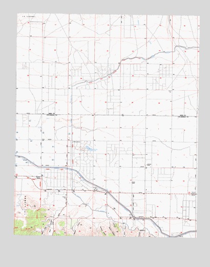
Neenach School, CA USGS Topographic Map
Click on map above to begin viewing in our Map Viewer.

This topographic map contains these locations and features:
Feature Name Type Latitude Longitude GNIS ID View Map
Adams CanyonValleyN34.7597°W118.5598°238409View Map
Antelope StationLocaleN34.8030°W118.5862°238641View Map
Arthur B. Ripley Desert Woodland State ParkParkN34.7597°W118.5019°2570593View Map
Baldwin Grade CanyonValleyN34.7530°W118.5334°238925View Map
Belle Louise Ranch (historical)LocaleN34.7605°W118.5448°1669820View Map
Burnside CanyonValleyN34.7586°W118.5645°239866View Map
Canyon Del SecretarioValleyN34.8547°W118.5304°1682587View Map
Cole RanchLocaleN34.7519°W118.6073°1682629View Map
Gorrindo RanchLocaleN34.7905°W118.5356°242864View Map
Happy ValleyValleyN34.7561°W118.6023°243193View Map
Holiday LakeLakeN34.7997°W118.5753°243533View Map
Manzana RanchLocaleN34.7644°W118.5281°1669878View Map
Neenach Elementary SchoolSchoolN34.7822°W118.6079°246455View Map
Neenach RanchLocaleN34.7758°W118.5684°1669887View Map
Neenach SubstationLocaleN34.7747°W118.5015°1654744View Map
Pecks RanchLocaleN34.7761°W118.5854°1669895View Map
Pine CanyonValleyN34.7650°W118.5965°247487View Map
Rivera CanyonValleyN34.7569°W118.5493°248233View Map
Snyder RanchLocaleN34.7805°W118.5456°249630View Map
Spencer CanyonValleyN34.7591°W118.5737°249794View Map
Spencer RanchLocaleN34.7539°W118.5868°1669927View Map

Note: Coordinates in the location and feature list above are referenced to NAD83 datum.


Copyright (C) 2008-2025 Ryan Niemi / Sunset Dynamics ... All Rights Reserved