TopoQuest Logo
Do you find TopoQuest useful?
Help keep TopoQuest running and adding new maps/features by donating!
Bitcoin:  19c7KJd3qBynnjoSw5npx9KScwjBe4ifkT
Litecoin:  LXs6TkuXGGXo1vDsWCkWVdjQX94eUKd6ui
Home View Maps Find Maps Find Places Resources & Links


Liebre Mountain, California Topographic Map

USGS Map Title: Liebre Mountain, CA
USGS Map MRC: 34118F6
DRG (GeoTIFF) Download: o34118f6.tif


Neighboring USGS Topographic Map Quads:


  Lebec, CA  
34118G7
 

  La Liebre Ranch, CA  
34118G6
 

  Neenach School, CA  
34118G5
 

  Black Mountain, CA  
34118F7
 

  Liebre Mountain, CA  
34118F6
 

  Burnt Peak, CA  
34118F5
 

  Cobblestone Mountain, CA  
34118E7
 

  Whitaker Peak, CA  
34118E6
 

  Warm Springs Mountain, CA  
34118E5


Map MRC Location:

N35°
W119°
N35°
W118°
H8 H7 H6 H5 H4 H3 H2 H1
G8 G7 G6 G5 G4 G3 G2 G1
F8 F7 F6 F5 F4 F3 F2 F1
E8 E7 E6 E5 E4 E3 E2 E1
D8 D7 D6 D5 D4 D3 D2 D1
C8 C7 C6 C5 C4 C3 C2 C1
B8 B7 B6 B5 B4 B3 B2 B1
A8 A7 A6 A5 A4 A3 A2 A1
N34°
W119°
N34°
W118°

Liebre Mountain, CA USGS 1:24K Topographic Map Preview:
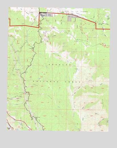
Liebre Mountain, CA USGS Topographic Map
Click on map above to begin viewing in our Map Viewer.

This topographic map contains these locations and features:
Feature Name Type Latitude Longitude GNIS ID View Map
Angeles TunnelTunnelN34.6330°W118.7373°269537View Map
Bald MountainSummitN34.7441°W118.7279°1660295View Map
Bear CanyonValleyN34.6589°W118.6706°269719View Map
Bear Gulch CampLocaleN34.7130°W118.6315°269740View Map
Burro CanyonValleyN34.6380°W118.6276°270105View Map
Cienaga CanyonValleyN34.6378°W118.6698°270460View Map
Cold CanyonValleyN34.6992°W118.7065°270533View Map
Gillette MineMineN34.6761°W118.6515°271298View Map
Gookins Dry LakeLakeN34.7427°W118.6310°271361View Map
Halfway InnLocaleN34.6842°W118.7295°271474View Map
Horse TrailTrailN34.7239°W118.6556°271652View Map
Horse TrailLocaleN34.7389°W118.6548°1802853View Map
Horse Trail CampgroundLocaleN34.7383°W118.6548°271653View Map
Kelly RanchLocaleN34.6880°W118.6640°271860View Map
Liebre MountainSummitN34.7166°W118.6640°1660909View Map
Pine CanyonValleyN34.6728°W118.6534°272975View Map
Pine Grove RanchLocaleN34.7341°W118.6351°272989View Map
Poison Oak CanyonValleyN34.7455°W118.6809°273065View Map
Quarry SpringSpringN34.6254°W118.7387°273151View Map
Rancho Corona Del ValleLocaleN34.7464°W118.6820°273190View Map
Redrock MountainSummitN34.6592°W118.6393°273254View Map
Reservoir HillSummitN34.6625°W118.7245°1661303View Map
Reservoir SummitSummitN34.6622°W118.7293°273268View Map
Richardson CanyonValleyN34.7344°W118.6315°273276View Map
Robinson CanyonValleyN34.7428°W118.6684°273301View Map
Rogers CampLocaleN34.6353°W118.6270°273335View Map
Salt CreekStreamN34.6375°W118.6698°273419View Map
SandbergPopulated PlaceN34.7411°W118.7095°273532View Map
The Pianobox ProspectMineN34.6314°W118.6379°274095View Map
Trough CanyonValleyN34.6508°W118.6901°274191View Map
Tumble InnLocaleN34.7086°W118.7206°274218View Map
Tumble Inn CampgroundLocaleN34.7153°W118.7168°274219View Map
United States Forest Service Angeles National Forest Station - Quail LakeBuildingN34.7443°W118.7125°273147View Map
United States Weather Bureau StationLocaleN34.7436°W118.7248°274275View Map
West Liebre LookoutLocaleN34.7264°W118.7023°274447View Map

Note: Coordinates in the location and feature list above are referenced to NAD83 datum.


Copyright (C) 2008-2024 Ryan Niemi / Sunset Dynamics ... All Rights Reserved