TopoQuest Logo
Do you find TopoQuest useful?
Help keep TopoQuest running and adding new maps/features by donating!
Bitcoin:  19c7KJd3qBynnjoSw5npx9KScwjBe4ifkT
Litecoin:  LXs6TkuXGGXo1vDsWCkWVdjQX94eUKd6ui
Home View Maps Find Maps Find Places Resources & Links


Nelson Canyon West, New Mexico Topographic Map

USGS Map Title: Nelson Canyon West, NM
USGS Map MRC: 33105D2
DRG (GeoTIFF) Download: o33105d2.tif


Neighboring USGS Topographic Map Quads:


  Capitan Peak, NM  
33105E3
 

  Arabela, NM  
33105E2
 

  Granville Canyon, NM  
33105E1
 

  San Patricio, NM  
33105D3
 

  Nelson Canyon West, NM  
33105D2
 

  Nelson Canyon East, NM  
33105D1
 

  Wahalee Canyon, NM  
33105C3
 

  Tinnie, NM  
33105C2
 

  Sunset, NM  
33105C1


Map MRC Location:

N34°
W106°
N34°
W105°
H8 H7 H6 H5 H4 H3 H2 H1
G8 G7 G6 G5 G4 G3 G2 G1
F8 F7 F6 F5 F4 F3 F2 F1
E8 E7 E6 E5 E4 E3 E2 E1
D8 D7 D6 D5 D4 D3 D2 D1
C8 C7 C6 C5 C4 C3 C2 C1
B8 B7 B6 B5 B4 B3 B2 B1
A8 A7 A6 A5 A4 A3 A2 A1
N33°
W106°
N33°
W105°

Nelson Canyon West, NM USGS 1:24K Topographic Map Preview:
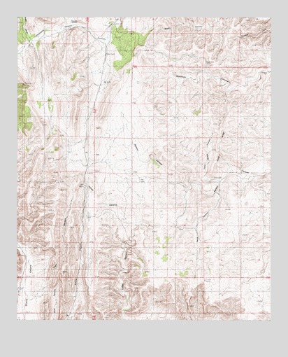
Nelson Canyon West, NM USGS Topographic Map
Click on map above to begin viewing in our Map Viewer.

This topographic map contains these locations and features:
Feature Name Type Latitude Longitude GNIS ID View Map
Cooper RanchLocaleN33.4951°W105.1264°887811View Map
Deadman WellWellN33.4779°W105.1278°902231View Map
Escondido (historical)Populated PlaceN33.4898°W105.2450°920205View Map
Escondido CanyonValleyN33.4929°W105.2061°906184View Map
Escondido CemeteryCemeteryN33.4981°W105.2244°888904View Map
Kemp CanyonValleyN33.4279°W105.1525°890662View Map
Long RidgeRidgeN33.4470°W105.1497°891309View Map
Long Ridge CanyonValleyN33.4326°W105.1508°891310View Map
Middle WellWellN33.4815°W105.1586°892001View Map
Nelson RanchLocaleN33.4345°W105.1347°892418View Map
Old Fears RanchLocaleN33.4545°W105.1980°892855View Map
Percella RanchLocaleN33.3759°W105.2250°893183View Map
Sawset CanyonValleyN33.4912°W105.2430°912562View Map
Sisneros RanchLocaleN33.4984°W105.2022°894875View Map
Talley CanyonValleyN33.3768°W105.1978°895494View Map
Torres RanchLocaleN33.3862°W105.2489°895766View Map
Trail CanyonValleyN33.3840°W105.2430°895786View Map
Wood RanchLocaleN33.4895°W105.2447°896746View Map

Note: Coordinates in the location and feature list above are referenced to NAD83 datum.


Copyright (C) 2008-2025 Ryan Niemi / Sunset Dynamics ... All Rights Reserved