TopoQuest Logo
Do you find TopoQuest useful?
Help keep TopoQuest running and adding new maps/features by donating!
Bitcoin:  19c7KJd3qBynnjoSw5npx9KScwjBe4ifkT
Litecoin:  LXs6TkuXGGXo1vDsWCkWVdjQX94eUKd6ui
Home View Maps Find Maps Find Places Resources & Links


Nelson Creek Bay, Montana Topographic Map

USGS Map Title: Nelson Creek Bay, MT
USGS Map MRC: 47106E2
DRG (GeoTIFF) Download: o47106e2.tif


Neighboring USGS Topographic Map Quads:


  Ash Creek East, MT  
47106F3
 

  Bug Creek, MT  
47106F2
 

  Crow Springs, MT  
47106F1
 

  Short Creek, MT  
47106E3
 

  Nelson Creek Bay, MT  
47106E2
 

  Rodgers Hall, MT  
47106E1
 

  Frank Coulee, MT  
47106D3
 

  Fortyfour Coulee, MT  
47106D2
 

  Johnson Coulee West, MT  
47106D1


Map MRC Location:

N48°
W107°
N48°
W106°
H8 H7 H6 H5 H4 H3 H2 H1
G8 G7 G6 G5 G4 G3 G2 G1
F8 F7 F6 F5 F4 F3 F2 F1
E8 E7 E6 E5 E4 E3 E2 E1
D8 D7 D6 D5 D4 D3 D2 D1
C8 C7 C6 C5 C4 C3 C2 C1
B8 B7 B6 B5 B4 B3 B2 B1
A8 A7 A6 A5 A4 A3 A2 A1
N47°
W107°
N47°
W106°

Nelson Creek Bay, MT USGS 1:24K Topographic Map Preview:
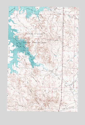
Nelson Creek Bay, MT USGS Topographic Map
Click on map above to begin viewing in our Map Viewer.

This topographic map contains these locations and features:
Feature Name Type Latitude Longitude GNIS ID View Map
01N45E29BBCC01 WellWellN47.5236°W106.1722°823598View Map
01N45E31BCBA01 WellWellN47.5075°W106.1903°823466View Map
20N43E01AABD01 WellWellN47.5269°W106.1734°823608View Map
21N43E36BCCD01 WellWellN47.5369°W106.1525°823668View Map
21N43E36DAAC01 WellWellN47.5319°W106.1422°823638View Map
21N43E36DAAD01 WellWellN47.5333°W106.1395°823643View Map
Carney SpringsSpringN47.5484°W106.1714°769611View Map
Coal Bank CouleeValleyN47.6153°W106.2003°769948View Map
Deer CouleeValleyN47.5447°W106.1761°770563View Map
Jacks PointCapeN47.6108°W106.2342°772772View Map
Jacks RidgeRidgeN47.5939°W106.1970°772773View Map
Jim CouleeValleyN47.5431°W106.1645°772823View Map
McGuire CreekStreamN47.6239°W106.1861°774020View Map
McGuire Creek BayBayN47.6222°W106.2109°774021View Map
McGuire Creek Recreation AreaParkN47.6083°W106.2089°1716253View Map
Nelson CreekStreamN47.5553°W106.1947°774577View Map
Nelson Creek BayBayN47.5642°W106.2097°774578View Map
Nelson Creek Recreation AreaParkN47.5583°W106.2256°1716252View Map
North Fork Jim CouleeValleyN47.5539°W106.1617°774771View Map
North Twitchell PointCapeN47.5714°W106.2470°774864View Map
Pine CouleeValleyN47.5356°W106.1522°775232View Map
R C Mothershead Number 1 DamDamN47.5000°W106.1672°797564View Map
Racetrack RidgeRidgeN47.5856°W106.1689°775523View Map
Romine CouleeValleyN47.5339°W106.1467°775917View Map
Rough Prong McGuire CreekStreamN47.6197°W106.1703°775973View Map
South Foster CouleeValleyN47.5525°W106.2056°776893View Map
South Twitchell PointCapeN47.5594°W106.2220°776911View Map
Steer CouleeValleyN47.5481°W106.2367°777188View Map

Note: Coordinates in the location and feature list above are referenced to NAD83 datum.


Copyright (C) 2008-2025 Ryan Niemi / Sunset Dynamics ... All Rights Reserved