TopoQuest Logo
Do you find TopoQuest useful?
Help keep TopoQuest running and adding new maps/features by donating!
Bitcoin:  19c7KJd3qBynnjoSw5npx9KScwjBe4ifkT
Litecoin:  LXs6TkuXGGXo1vDsWCkWVdjQX94eUKd6ui
Home View Maps Find Maps Find Places Resources & Links


New Galilee, Pennsylvania Topographic Map

USGS Map Title: New Galilee, PA
USGS Map MRC: 40080G4
DRG (GeoTIFF) Download: o40080g4.tif


Neighboring USGS Topographic Map Quads:


  New Middletown, OH  
40080H5
 

  Bessemer, PA  
40080H4
 

  New Castle South, PA  
40080H3
 

  East Palestine, OH  
40080G5
 

  New Galilee, PA  
40080G4
 

  Beaver Falls, PA  
40080G3
 

  East Liverpool North, OH  
40080F5
 

  Midland, PA  
40080F4
 

  Beaver, PA  
40080F3


Map MRC Location:

N41°
W81°
N41°
W80°
H8 H7 H6 H5 H4 H3 H2 H1
G8 G7 G6 G5 G4 G3 G2 G1
F8 F7 F6 F5 F4 F3 F2 F1
E8 E7 E6 E5 E4 E3 E2 E1
D8 D7 D6 D5 D4 D3 D2 D1
C8 C7 C6 C5 C4 C3 C2 C1
B8 B7 B6 B5 B4 B3 B2 B1
A8 A7 A6 A5 A4 A3 A2 A1
N40°
W81°
N40°
W80°

New Galilee, PA USGS 1:24K Topographic Map Preview:
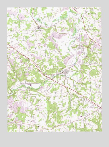
New Galilee, PA USGS Topographic Map
Click on map above to begin viewing in our Map Viewer.

This topographic map contains these locations and features:
Feature Name Type Latitude Longitude GNIS ID View Map
Beaver County AirportAirportN40.7742°W80.3908°1194100View Map
Beaverdam RunStreamN40.8703°W80.4137°1169068View Map
Black Hawk Golf CourseLocaleN40.7626°W80.4092°1206100View Map
Blackhawk High SchoolSchoolN40.7567°W80.4023°1214253View Map
Blackhawk KindergartenSchoolN40.7701°W80.3759°1211604View Map
Borough of DarlingtonCivilN40.8102°W80.4242°1214868View Map
Borough of Enon ValleyCivilN40.8559°W80.4565°1215354View Map
Borough of New GalileeCivilN40.8334°W80.4010°1214886View Map
CanneltonPopulated PlaceN40.7990°W80.4756°1171160View Map
Chippewa Township Police DepartmentBuildingN40.7796°W80.3926°2776983View Map
Chippewa Township Volunteer Fire Department Station 22BuildingN40.7736°W80.3766°2645898View Map
Coalbank RunStreamN40.7973°W80.4815°1172079View Map
DarlingtonPopulated PlaceN40.8095°W80.4226°1213618View Map
Darlington LakeLakeN40.8165°W80.4133°1172958View Map
Darlington Post OfficePost OfficeN40.8099°W80.4234°2773112View Map
Darlington Township Police DepartmentBuildingN40.8080°W80.4375°2777127View Map
Darlington Township Volunteer Fire Department Station 18BuildingN40.8081°W80.4372°2645304View Map
Dilworth RunStreamN40.8026°W80.4453°1173276View Map
Enon ValleyPopulated PlaceN40.8548°W80.4570°1213198View Map
Enon Valley Community Volunteer Fire DepartmentBuildingN40.8557°W80.4576°2645687View Map
Enon Valley Post OfficePost OfficeN40.8549°W80.4569°2772690View Map
Honey CreekStreamN40.8670°W80.4665°1177343View Map
Jordan RunStreamN40.8231°W80.4070°1178171View Map
Little Beaver CemeteryCemeteryN40.8689°W80.4745°1179469View Map
Madden RunStreamN40.8340°W80.4181°1180172View Map
McCautry RunStreamN40.8048°W80.4181°1180622View Map
Miskita LakeLakeN40.7654°W80.4667°1181361View Map
New GalileePopulated PlaceN40.8356°W80.3995°1182321View Map
New Galilee Community Volunteer Fire Department Station 15BuildingN40.8343°W80.3990°2645319View Map
New Galilee Post OfficePost OfficeN40.8347°W80.4010°2768353View Map
Northwestern Elementary SchoolSchoolN40.8109°W80.4153°1211627View Map
Northwestern Emergency Medical ServicesBuildingN40.8344°W80.3999°2719604View Map
Northwestern Emergency Medical ServicesBuildingN40.8080°W80.4372°2719544View Map
Old Free Presbyterian Church CemeteryCemeteryN40.8089°W80.4206°2776023View Map
Painter RunStreamN40.7940°W80.4687°1183204View Map
Reformed Presbyterian Church CemeteryCemeteryN40.8435°W80.4128°2776025View Map
Reformed Presbyterian White Church CemeteryCemeteryN40.8426°W80.4081°2776026View Map
Rocky Spring CemeteryCemeteryN40.8309°W80.3878°1185373View Map
Rowe Post Office (historical)Post OfficeN40.7572°W80.4695°2556582View Map
RowtownPopulated PlaceN40.7581°W80.4695°1212716View Map
Seceder United Presbyterian CemeteryCemeteryN40.7975°W80.4267°1829106View Map
Small RunStreamN40.8620°W80.4820°1201638View Map
South Beaver Police DepartmentBuildingN40.7569°W80.4246°2777164View Map
South Beaver Township Volunteer Fire Company Station 61 - 1BuildingN40.7754°W80.4628°2644806View Map
South Beaver Township Volunteer Fire Company Station 61 - 2BuildingN40.7569°W80.4246°2645722View Map
Township of Big Beaver (historical)CivilN40.8042°W80.3820°1215866View Map
Township of ChippewaCivilN40.7614°W80.3791°1215869View Map
Township of DarlingtonCivilN40.8238°W80.4675°1215870View Map
Township of South BeaverCivilN40.7590°W80.4588°1215886View Map
Walt MillsLocaleN40.7856°W80.4876°1212715View Map
White ChurchChurchN40.8428°W80.4081°1191258View Map
White Family CemeteryCemeteryN40.7985°W80.4727°2776032View Map
Wilson / Mount Pleasant CemeteryCemeteryN40.8244°W80.4066°1191530View Map

Note: Coordinates in the location and feature list above are referenced to NAD83 datum.


Copyright (C) 2008-2025 Ryan Niemi / Sunset Dynamics ... All Rights Reserved