TopoQuest Logo
Do you find TopoQuest useful?
Help keep TopoQuest running and adding new maps/features by donating!
Bitcoin:  19c7KJd3qBynnjoSw5npx9KScwjBe4ifkT
Litecoin:  LXs6TkuXGGXo1vDsWCkWVdjQX94eUKd6ui
Home View Maps Find Maps Find Places Resources & Links


New Middletown, Ohio Topographic Map

USGS Map Title: New Middletown, OH
USGS Map MRC: 40080H5
DRG (GeoTIFF) Download: o40080h5.tif


Neighboring USGS Topographic Map Quads:


  Youngstown, OH  
41080A6
 

  Campbell, OH  
41080A5
 

  Edinburg, PA  
41080A4
 

  Columbiana, OH  
40080H6
 

  New Middletown, OH  
40080H5
 

  Bessemer, PA  
40080H4
 

  Elkton, OH  
40080G6
 

  East Palestine, OH  
40080G5
 

  New Galilee, PA  
40080G4


Map MRC Location:

N41°
W81°
N41°
W80°
H8 H7 H6 H5 H4 H3 H2 H1
G8 G7 G6 G5 G4 G3 G2 G1
F8 F7 F6 F5 F4 F3 F2 F1
E8 E7 E6 E5 E4 E3 E2 E1
D8 D7 D6 D5 D4 D3 D2 D1
C8 C7 C6 C5 C4 C3 C2 C1
B8 B7 B6 B5 B4 B3 B2 B1
A8 A7 A6 A5 A4 A3 A2 A1
N40°
W81°
N40°
W80°

New Middletown, OH USGS 1:24K Topographic Map Preview:
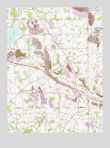
New Middletown, OH USGS Topographic Map
Click on map above to begin viewing in our Map Viewer.

This topographic map contains these locations and features:
Feature Name Type Latitude Longitude GNIS ID View Map
Beard Road CemeteryCemeteryN40.9364°W80.5962°1963251View Map
Beaver LakeReservoirN40.8838°W80.6235°1037761View Map
Bethel CemeteryCemeteryN40.9790°W80.6064°1037913View Map
Bethel Church of the BrethrenChurchN40.9723°W80.5773°1056712View Map
Bethel Evangelical Friends ChurchChurchN40.9978°W80.5987°1072328View Map
Carbon Limestone LandfillLocaleN40.9950°W80.5294°2678520View Map
Center School (historical)SchoolN40.9439°W80.5770°1051746View Map
Collier LakeReservoirN40.9972°W80.5872°1078332View Map
Collier Lake DamDamN40.9984°W80.5881°1078331View Map
Deer Meadow Mobile Home ParkPopulated PlaceN40.9308°W80.6119°2513520View Map
Esterly School (historical)SchoolN40.9431°W80.6145°1051748View Map
Evans LakeReservoirN40.9708°W80.6185°1040260View Map
Evans Lake DamDamN40.9812°W80.6184°1078723View Map
Ginger HillPopulated PlaceN40.9728°W80.5692°1080495View Map
Go-Tag-A-Long Lake DamDamN40.8901°W80.5815°1078198View Map
Go-Tag-Along LakeReservoirN40.8897°W80.5850°1078199View Map
Harman RunStreamN40.9267°W80.5451°1070771View Map
Hass School (historical)SchoolN40.9723°W80.6154°1051747View Map
Honey CreekStreamN40.9112°W80.5190°1063501View Map
J And H Mobile Home ParkPopulated PlaceN40.9092°W80.5303°2513569View Map
Kansas CornersLocaleN40.9948°W80.5442°1042173View Map
Koch CemeteryCemeteryN40.8892°W80.5534°1042334View Map
Mahoning LandfillLocaleN40.9183°W80.5833°2677745View Map
MeadowoodPopulated PlaceN40.9797°W80.5542°2513519View Map
Morris FieldAirportN40.8805°W80.6011°1082667View Map
New MiddletownPopulated PlaceN40.9612°W80.5576°1084862View Map
New Middletown Elementary SchoolSchoolN40.9642°W80.5612°1051745View Map
New Middletown Plaza Shopping CenterLocaleN40.9673°W80.5623°1056659View Map
New Middletown Post OfficePost OfficeN40.9612°W80.5581°2035707View Map
New Middletown Village Fire DepartmentBuildingN40.9626°W80.5586°2549754View Map
New SpringfieldPopulated PlaceN40.9173°W80.6062°1056908View Map
New Springfield CemeteryCemeteryN40.9269°W80.6208°1043848View Map
New Springfield Elementary SchoolSchoolN40.9162°W80.6095°1051782View Map
Old Petersburg CemeteryCemeteryN40.9115°W80.5314°1963280View Map
Old Springfield CemeteryCemeteryN40.9443°W80.5408°1963281View Map
Old Springfield United Church of ChristChurchN40.9451°W80.5423°1056912View Map
Pa-21 DamDamN40.9301°W80.5081°1195159View Map
PetersburgPopulated PlaceN40.9126°W80.5303°1061535View Map
Petersburg AirportAirportN40.9002°W80.5547°1082954View Map
Richey AirportAirportN40.9079°W80.5496°1082955View Map
Saint Johns CemeteryCemeteryN40.9226°W80.5327°1045516View Map
Saint Lukes ChurchChurchN40.9445°W80.5420°1045615View Map
Schroy CemeteryCemeteryN40.9268°W80.5857°1046025View Map
Schroy CemeteryCemeteryN40.9304°W80.5798°1046026View Map
Smith CornersPopulated PlaceN40.9906°W80.5848°1056944View Map
Springfield High SchoolSchoolN40.9112°W80.5320°1051742View Map
Springfield Intermediate SchoolSchoolN40.9551°W80.5481°1051744View Map
Springfield Township Fire Department Station 21BuildingN40.9624°W80.5571°2550616View Map
Springfield Township Fire Department Station 23BuildingN40.9179°W80.6068°2550301View Map
Springfield Township Fire StationBuildingN40.9167°W80.5321°2549080View Map
Springfield Township Police DepartmentBuildingN40.9434°W80.5863°2733041View Map
Subrosa (historical)Populated PlaceN40.9437°W80.5415°1067467View Map
Subrosa Post Office (historical)Post OfficeN40.9431°W80.5415°2035723View Map
Subrosa School (historical)SchoolN40.9437°W80.5415°1051743View Map
Township of SpringfieldCivilN40.9434°W80.5759°1086571View Map
Village of New MiddletownCivilN40.9648°W80.5597°1086567View Map
Village of New MiddletownCivilN40.9648°W80.5597°2399476View Map
Village of New Middletown Police DepartmentBuildingN40.9626°W80.5585°2732705View Map
WKBN-AM (Youngstown)TowerN40.9853°W80.6004°1085304View Map
WYWR-AM (Campbell)TowerN40.9751°W80.5881°1085258View Map
Zion Lutheran CemeteryCemeteryN40.9593°W80.5389°1963292View Map

Note: Coordinates in the location and feature list above are referenced to NAD83 datum.


Copyright (C) 2008-2024 Ryan Niemi / Sunset Dynamics ... All Rights Reserved