TopoQuest Logo
Do you find TopoQuest useful?
Help keep TopoQuest running and adding new maps/features by donating!
Bitcoin:  19c7KJd3qBynnjoSw5npx9KScwjBe4ifkT
Litecoin:  LXs6TkuXGGXo1vDsWCkWVdjQX94eUKd6ui
Home View Maps Find Maps Find Places Resources & Links


New Greenleaf, Michigan Topographic Map

USGS Map Title: New Greenleaf, MI
USGS Map MRC: 43083F1
DRG (GeoTIFF) Download: o43083f1.tif


Neighboring USGS Topographic Map Quads:


  Elkton, MI  
43083G2
 

  Bad Axe West, MI  
43083G1
 

  Bad Axe East, MI  
43082G8
 

  Gagetown, MI  
43083F2
 

  New Greenleaf, MI  
43083F1
 

  Ubly, MI  
43082F8
 

  Cass City, MI  
43083E2
 

  Shabbona, MI  
43083E1
 

  Argyle, MI  
43082E8


Map MRC Location:

N44°
W84°
N44°
W83°
H8 H7 H6 H5 H4 H3 H2 H1
G8 G7 G6 G5 G4 G3 G2 G1
F8 F7 F6 F5 F4 F3 F2 F1
E8 E7 E6 E5 E4 E3 E2 E1
D8 D7 D6 D5 D4 D3 D2 D1
C8 C7 C6 C5 C4 C3 C2 C1
B8 B7 B6 B5 B4 B3 B2 B1
A8 A7 A6 A5 A4 A3 A2 A1
N43°
W84°
N43°
W83°

New Greenleaf, MI USGS 1:24K Topographic Map Preview:
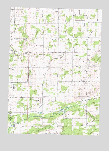
New Greenleaf, MI USGS Topographic Map
Click on map above to begin viewing in our Map Viewer.

This topographic map contains these locations and features:
Feature Name Type Latitude Longitude GNIS ID View Map
Appin DrainCanalN43.7100°W83.0436°620172View Map
Appin Post Office (historical)Post OfficeN43.7208°W83.0403°2548605View Map
Appin SchoolSchoolN43.7039°W83.0180°620173View Map
Batie SchoolSchoolN43.7203°W83.0880°620749View Map
Blair DrainCanalN43.7342°W83.1052°621558View Map
Clift DrainCanalN43.7317°W83.1194°623470View Map
Elk DrainCanalN43.7192°W83.0919°625450View Map
Faith Gospel Tabernacle ChurchChurchN43.7195°W83.1022°625636View Map
Fraser ChurchChurchN43.6764°W83.0986°626433View Map
Greenlead Station (historical)LocaleN43.6611°W83.0783°2554177View Map
Greenleaf CreekStreamN43.6428°W83.0869°627355View Map
Greenleaf Post Office (historical)Post OfficeN43.6617°W83.0783°2554229View Map
Holbrook ChurchChurchN43.6497°W83.0183°628405View Map
Holbrook Post Office (historical)Post OfficeN43.6497°W83.0178°2554227View Map
Holbrook SchoolSchoolN43.6347°W83.0274°628408View Map
IvanhoePopulated PlaceN43.7056°W83.0941°1617645View Map
Ivanhoe Post Office (historical)Post OfficeN43.7056°W83.0942°2548563View Map
Livingston DrainCanalN43.6872°W83.0730°630837View Map
McIntyre SchoolSchoolN43.7495°W83.0894°631926View Map
McNeil DrainCanalN43.6825°W83.0986°632012View Map
McTaggart CemeteryCemeteryN43.7192°W83.1030°632028View Map
New GreenleafPopulated PlaceN43.6617°W83.0783°1617738View Map
New Life Ministries ChurchChurchN43.7339°W83.0994°2548528View Map
North Branch Shier DrainCanalN43.6961°W83.0063°633537View Map
Northburns Post Office (historical)Post OfficeN43.7342°W83.1083°2548551View Map
Patterson DrainCanalN43.7100°W83.0724°634468View Map
Reid DrainCanalN43.7103°W83.0363°635782View Map
Saint Columbkille ChurchChurchN43.7050°W83.0991°636611View Map
Saint Columbkille Roman Catholic CemeteryCemeteryN43.7042°W83.1000°2548553View Map
Sandy DrainCanalN43.7467°W83.0669°637229View Map
Sanilac Huron CreekStreamN43.6422°W83.0716°637246View Map
Sanilac Petroglyphs Historic State ParkParkN43.6578°W83.0186°2554174View Map
Sanilac State Game AreaParkN43.6256°W83.0375°2554173View Map
School Number 2SchoolN43.6617°W83.0899°637388View Map
Shier DrainCanalN43.6928°W83.0244°637800View Map
Simpkins DrainCanalN43.6378°W83.0113°637984View Map
Skinner DrainCanalN43.6509°W83.0947°638063View Map
Slack DrainCanalN43.7261°W83.0138°638080View Map
South Fork Cass RiverStreamN43.6547°W83.0311°638349View Map
Stoner SchoolSchoolN43.6325°W83.0872°638887View Map
Township of GreenleafCivilN43.6337°W83.0568°1626399View Map
Township of SheridanCivilN43.7208°W83.0589°1627066View Map

Note: Coordinates in the location and feature list above are referenced to NAD83 datum.


Copyright (C) 2008-2024 Ryan Niemi / Sunset Dynamics ... All Rights Reserved