TopoQuest Logo
Do you find TopoQuest useful?
Help keep TopoQuest running and adding new maps/features by donating!
Bitcoin:  19c7KJd3qBynnjoSw5npx9KScwjBe4ifkT
Litecoin:  LXs6TkuXGGXo1vDsWCkWVdjQX94eUKd6ui
Home View Maps Find Maps Find Places Resources & Links


Elkton, Michigan Topographic Map

USGS Map Title: Elkton, MI
USGS Map MRC: 43083G2
DRG (GeoTIFF) Download: o43083g2.tif


Neighboring USGS Topographic Map Quads:


  Caseville, MI  
43083H3
 

  Rush Lake, MI  
43083H2
 

  Kinde West, MI  
43083H1
 

  Bay Port East, MI  
43083G3
 

  Elkton, MI  
43083G2
 

  Bad Axe West, MI  
43083G1
 

  Owendale, MI  
43083F3
 

  Gagetown, MI  
43083F2
 

  New Greenleaf, MI  
43083F1


Map MRC Location:

N44°
W84°
N44°
W83°
H8 H7 H6 H5 H4 H3 H2 H1
G8 G7 G6 G5 G4 G3 G2 G1
F8 F7 F6 F5 F4 F3 F2 F1
E8 E7 E6 E5 E4 E3 E2 E1
D8 D7 D6 D5 D4 D3 D2 D1
C8 C7 C6 C5 C4 C3 C2 C1
B8 B7 B6 B5 B4 B3 B2 B1
A8 A7 A6 A5 A4 A3 A2 A1
N43°
W84°
N43°
W83°

Elkton, MI USGS 1:24K Topographic Map Preview:
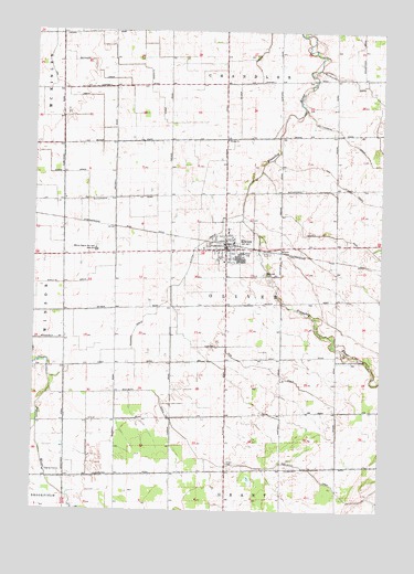
Elkton, MI USGS Topographic Map
Click on map above to begin viewing in our Map Viewer.

This topographic map contains these locations and features:
Feature Name Type Latitude Longitude GNIS ID View Map
Beaubien DrainCanalN43.7617°W83.1813°620892View Map
Bechler DrainCanalN43.8645°W83.2286°620965View Map
Century Oaks Golf CourseLocaleN43.8194°W83.1667°2548461View Map
ElktonPopulated PlaceN43.8195°W83.1808°625466View Map
Elkton ChurchChurchN43.8467°W83.1805°625467View Map
Elkton DrainCanalN43.8197°W83.1891°625468View Map
Elkton Fair DrainCanalN43.7881°W83.1691°625469View Map
Elkton Family Medicine ClinicHospitalN43.8192°W83.1797°2548457View Map
Elkton Police DepartmentBuildingN43.8196°W83.1814°2548458View Map
Elkton Post OfficePost OfficeN43.8186°W83.1783°2548451View Map
Elkton StationLocaleN43.8197°W83.1814°2548460View Map
Elkton United Methodist ChurchChurchN43.8150°W83.1811°2548455View Map
Fluegge DrainCanalN43.8650°W83.2091°626198View Map
Fritz FarmsLocaleN43.7861°W83.2217°2743268View Map
Grant CemeteryCemeteryN43.7628°W83.1794°627147View Map
Hill DrainCanalN43.8350°W83.1386°628277View Map
Kasserman FarmsLocaleN43.7889°W83.2160°2743265View Map
Laker Elementary SchoolSchoolN43.8172°W83.2319°2548405View Map
Laker High SchoolSchoolN43.8181°W83.2277°625470View Map
Nettle RunCanalN43.8225°W83.1500°633307View Map
Oliver DrainCanalN43.8736°W83.1661°634033View Map
Oliver Township Fire DepartmentBuildingN43.8195°W83.1819°2626826View Map
Renn FarmsLocaleN43.8611°W83.2294°2743326View Map
Riverside CemeteryCemeteryN43.8120°W83.1672°635991View Map
Schuette Dairy FarmLocaleN43.8169°W83.2464°2743330View Map
Schultz DrainCanalN43.8089°W83.2461°637441View Map
Silver CreekStreamN43.8183°W83.1283°637919View Map
Squarno DrainCanalN43.7970°W83.2133°638661View Map
Township of OliverCivilN43.8038°W83.1800°1626842View Map
Trinity Evangelical Lutheran ChurchChurchN43.8214°W83.1786°2548454View Map
Village of ElktonCivilN43.8183°W83.1810°2398806View Map
Wesleyan ChurchChurchN43.8181°W83.1844°2548450View Map
Whipple Tree FarmLocaleN43.8536°W83.2386°2743328View Map
Wolfton Post Office (historical)Post OfficeN43.7583°W83.2347°2548484View Map

Note: Coordinates in the location and feature list above are referenced to NAD83 datum.


Copyright (C) 2008-2025 Ryan Niemi / Sunset Dynamics ... All Rights Reserved