TopoQuest Logo
Do you find TopoQuest useful?
Help keep TopoQuest running and adding new maps/features by donating!
Bitcoin:  19c7KJd3qBynnjoSw5npx9KScwjBe4ifkT
Litecoin:  LXs6TkuXGGXo1vDsWCkWVdjQX94eUKd6ui
Home View Maps Find Maps Find Places Resources & Links


Gagetown, Michigan Topographic Map

USGS Map Title: Gagetown, MI
USGS Map MRC: 43083F2
DRG (GeoTIFF) Download: o43083f2.tif


Neighboring USGS Topographic Map Quads:


  Bay Port East, MI  
43083G3
 

  Elkton, MI  
43083G2
 

  Bad Axe West, MI  
43083G1
 

  Owendale, MI  
43083F3
 

  Gagetown, MI  
43083F2
 

  New Greenleaf, MI  
43083F1
 

  Ellington, MI  
43083E3
 

  Cass City, MI  
43083E2
 

  Shabbona, MI  
43083E1


Map MRC Location:

N44°
W84°
N44°
W83°
H8 H7 H6 H5 H4 H3 H2 H1
G8 G7 G6 G5 G4 G3 G2 G1
F8 F7 F6 F5 F4 F3 F2 F1
E8 E7 E6 E5 E4 E3 E2 E1
D8 D7 D6 D5 D4 D3 D2 D1
C8 C7 C6 C5 C4 C3 C2 C1
B8 B7 B6 B5 B4 B3 B2 B1
A8 A7 A6 A5 A4 A3 A2 A1
N43°
W84°
N43°
W83°

Gagetown, MI USGS 1:24K Topographic Map Preview:
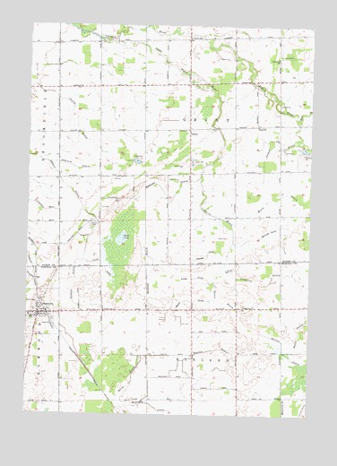
Gagetown, MI USGS Topographic Map
Click on map above to begin viewing in our Map Viewer.

This topographic map contains these locations and features:
Feature Name Type Latitude Longitude GNIS ID View Map
Battle DrainCanalN43.6514°W83.1286°620760View Map
Boulton DrainCanalN43.6456°W83.1591°621777View Map
Canboro Post Office (historical)Post OfficeN43.7467°W83.1806°2548607View Map
Canboro SchoolSchoolN43.7458°W83.1794°622683View Map
Church of the NazareneChurchN43.6597°W83.2439°2554613View Map
Columbia ExitCanalN43.6931°W83.2497°623638View Map
Cooley DrainCanalN43.7189°W83.2330°623764View Map
Crawford DrainCanalN43.6695°W83.1413°624033View Map
Elkland Post Office (historical)Post OfficeN43.6597°W83.1542°2553977View Map
GagetownPopulated PlaceN43.6572°W83.2450°626592View Map
Gagetown - Elmwood Township Fire DepartmentBuildingN43.6556°W83.2455°2627017View Map
Gagetown CemeteryCemeteryN43.6533°W83.2453°2554503View Map
Gagetown Police DepartmentBuildingN43.6557°W83.2455°2737596View Map
Gagetown Post OfficePost OfficeN43.6575°W83.2447°2554607View Map
Gagetown Public SchoolSchoolN43.6564°W83.2406°2554615View Map
Gagetown Station (historical)LocaleN43.6578°W83.2411°2554610View Map
Gagetown United Methodist ChurchChurchN43.6764°W83.2356°2548291View Map
Gagetown Village HallBuildingN43.6567°W83.2456°2554608View Map
Grant CemeteryCemeteryN43.6858°W83.2222°627146View Map
Grant ChurchChurchN43.7178°W83.1488°627149View Map
Greenwood SchoolSchoolN43.7395°W83.1402°627397View Map
Huron DrainCanalN43.6786°W83.1602°628862View Map
Jameson DrainCanalN43.7039°W83.2283°629205View Map
Jordan DrainCanalN43.7117°W83.1394°629389View Map
Knight DrainCanalN43.6689°W83.1766°629818View Map
Little Pigeon RiverStreamN43.7456°W83.2119°630727View Map
Marsh DrainCanalN43.6356°W83.2030°631616View Map
Mathews DrainCanalN43.6864°W83.1980°631735View Map
McComb DrainCanalN43.6839°W83.1427°631837View Map
Moore DrainCanalN43.6922°W83.1297°632643View Map
Mud LakeLakeN43.6814°W83.2085°632972View Map
Muntz DrainCanalN43.6617°W83.1772°633132View Map
Owendale SpeedwayLocaleN43.7306°W83.2111°2548416View Map
Puroy DrainCanalN43.6725°W83.2161°635526View Map
Rawson DrainCanalN43.6759°W83.1702°635673View Map
Reorganized Church of Jesus Christ of Latter Days SaintsChurchN43.7311°W83.1792°2548417View Map
RescueLocaleN43.7167°W83.1791°635806View Map
Rescue Post Office (historical)Post OfficeN43.7167°W83.1792°2548515View Map
Saint Agatha's CemeteryCemeteryN43.6555°W83.2492°2554504View Map
Saint Agatha's ChurchChurchN43.6556°W83.2478°2554614View Map
Shebeon DrainCanalN43.6906°W83.2255°637703View Map
Sherwood on the Hill Golf CourseLocaleN43.6583°W83.2478°2554609View Map
Township of ElklandCivilN43.6300°W83.1751°1626226View Map
Township of GrantCivilN43.7170°W83.1779°1626379View Map
Village of GagetownCivilN43.6572°W83.2449°2398934View Map
Westerby DrainCanalN43.6278°W83.1936°1616202View Map

Note: Coordinates in the location and feature list above are referenced to NAD83 datum.


Copyright (C) 2008-2025 Ryan Niemi / Sunset Dynamics ... All Rights Reserved