TopoQuest Logo
Do you find TopoQuest useful?
Help keep TopoQuest running and adding new maps/features by donating!
Bitcoin:  19c7KJd3qBynnjoSw5npx9KScwjBe4ifkT
Litecoin:  LXs6TkuXGGXo1vDsWCkWVdjQX94eUKd6ui
Home View Maps Find Maps Find Places Resources & Links


New Strawn, Kansas Topographic Map

USGS Map Title: New Strawn, KS
USGS Map MRC: 38095C6
DRG (GeoTIFF) Download: o38095c6.tif


Neighboring USGS Topographic Map Quads:


  Lebo, KS  
38095D7
 

  Waverly NW, KS  
38095D6
 

  Waverly, KS  
38095D5
 

  Ottumwa, KS  
38095C7
 

  New Strawn, KS  
38095C6
 

  Waverly SE, KS  
38095C5
 

  John Redmond Dam, KS  
38095B7
 

  Burlington, KS  
38095B6
 

  Aliceville, KS  
38095B5


Map MRC Location:

N39°
W96°
N39°
W95°
H8 H7 H6 H5 H4 H3 H2 H1
G8 G7 G6 G5 G4 G3 G2 G1
F8 F7 F6 F5 F4 F3 F2 F1
E8 E7 E6 E5 E4 E3 E2 E1
D8 D7 D6 D5 D4 D3 D2 D1
C8 C7 C6 C5 C4 C3 C2 C1
B8 B7 B6 B5 B4 B3 B2 B1
A8 A7 A6 A5 A4 A3 A2 A1
N38°
W96°
N38°
W95°

New Strawn, KS USGS 1:24K Topographic Map Preview:
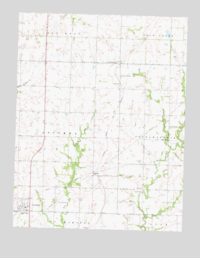
New Strawn, KS USGS Topographic Map
Click on map above to begin viewing in our Map Viewer.

This topographic map contains these locations and features:
Feature Name Type Latitude Longitude GNIS ID View Map
City of New StrawnCivilN38.2620°W95.7424°2395215View Map
Coffey County AirportAirportN38.3023°W95.7273°2675737View Map
Coffey County Fire District 1 Station 8BuildingN38.2590°W95.7425°2111215View Map
Coffey County Library New Strawn BranchBuildingN38.2660°W95.7389°2694697View Map
Glendale CemeteryCemeteryN38.2749°W95.6546°477468View Map
Halls SummitPopulated PlaceN38.3472°W95.6753°477472View Map
Halls Summit CemeteryCemeteryN38.3397°W95.6730°477474View Map
Indian Plains Golf CourseLocaleN38.2673°W95.7444°2694469View Map
New StrawnPopulated PlaceN38.2625°W95.7419°477464View Map
New Strawn City HallBuildingN38.2629°W95.7389°2693193View Map
New Strawn Community CenterBuildingN38.2600°W95.7417°2692742View Map
New Strawn Post OfficePost OfficeN38.2629°W95.7389°2692472View Map
New Strawn Wastewater PlantLocaleN38.2519°W95.7460°2692104View Map
Oread (historical)LocaleN38.3320°W95.6453°482476View Map
Pottawatomie (historical)LocaleN38.2597°W95.6503°482108View Map
Prairie View CemeteryCemeteryN38.3110°W95.6364°477470View Map
Prairie View United Methodist ChurchChurchN38.3033°W95.6371°477469View Map
School CreekStreamN38.2986°W95.6355°477471View Map
SharpePopulated PlaceN38.2820°W95.6919°484819View Map
Stringtown CemeteryCemeteryN38.2506°W95.6942°477466View Map
Township of OttumwaCivilN38.2981°W95.7481°477462View Map

Note: Coordinates in the location and feature list above are referenced to NAD83 datum.


Copyright (C) 2008-2025 Ryan Niemi / Sunset Dynamics ... All Rights Reserved