TopoQuest Logo
Do you find TopoQuest useful?
Help keep TopoQuest running and adding new maps/features by donating!
Bitcoin:  19c7KJd3qBynnjoSw5npx9KScwjBe4ifkT
Litecoin:  LXs6TkuXGGXo1vDsWCkWVdjQX94eUKd6ui
Home View Maps Find Maps Find Places Resources & Links


Burlington, Kansas Topographic Map

USGS Map Title: Burlington, KS
USGS Map MRC: 38095B6
DRG (GeoTIFF) Download: o38095b6.tif


Neighboring USGS Topographic Map Quads:


  Ottumwa, KS  
38095C7
 

  New Strawn, KS  
38095C6
 

  Waverly SE, KS  
38095C5
 

  John Redmond Dam, KS  
38095B7
 

  Burlington, KS  
38095B6
 

  Aliceville, KS  
38095B5
 

  Gridley SE, KS  
38095A7
 

  Le Roy, KS  
38095A6
 

  Neosho Falls, KS  
38095A5


Map MRC Location:

N39°
W96°
N39°
W95°
H8 H7 H6 H5 H4 H3 H2 H1
G8 G7 G6 G5 G4 G3 G2 G1
F8 F7 F6 F5 F4 F3 F2 F1
E8 E7 E6 E5 E4 E3 E2 E1
D8 D7 D6 D5 D4 D3 D2 D1
C8 C7 C6 C5 C4 C3 C2 C1
B8 B7 B6 B5 B4 B3 B2 B1
A8 A7 A6 A5 A4 A3 A2 A1
N38°
W96°
N38°
W95°

Burlington, KS USGS 1:24K Topographic Map Preview:
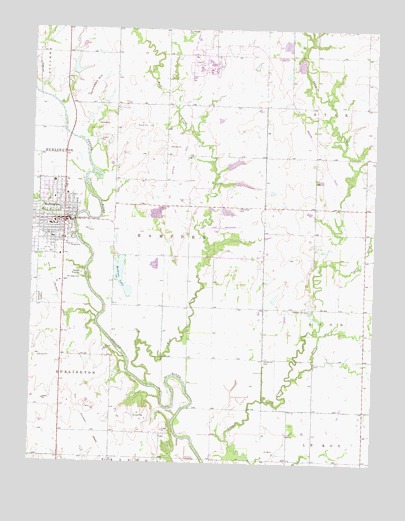
Burlington, KS USGS Topographic Map
Click on map above to begin viewing in our Map Viewer.

This topographic map contains these locations and features:
Feature Name Type Latitude Longitude GNIS ID View Map
Badger CreekStreamN38.1495°W95.6547°477872View Map
Barrett Mobile Home ParkPopulated PlaceN38.1874°W95.7492°2694049View Map
Botham Mobile Home ParkPopulated PlaceN38.1998°W95.7337°2694052View Map
BurlingtonPopulated PlaceN38.1945°W95.7428°477861View Map
Burlington Church of ChristChurchN38.2036°W95.7433°2690198View Map
Burlington Church of the NazareneChurchN38.2037°W95.7419°2690375View Map
Burlington City HallBuildingN38.1944°W95.7372°2692252View Map
Burlington Elementary SchoolSchoolN38.1933°W95.7437°481225View Map
Burlington High SchoolSchoolN38.2078°W95.7460°481224View Map
Burlington Middle SchoolSchoolN38.2077°W95.7435°2437495View Map
Burlington Municipal Power PlantLocaleN38.1935°W95.7495°2692427View Map
Burlington Police DepartmentBuildingN38.1893°W95.7366°2503898View Map
Burlington Post OfficePost OfficeN38.1939°W95.7389°2693645View Map
Burlington Recreation CenterBuildingN38.2057°W95.7438°2692550View Map
Burlington Senior CenterBuildingN38.1949°W95.7360°2692602View Map
Burlington United Methodist ChurchChurchN38.1932°W95.7411°2690960View Map
Burlington Wastewater PlantLocaleN38.1752°W95.7326°2692021View Map
Burlington Water Treatment FacilityLocaleN38.1957°W95.7350°2693251View Map
Center Hill CemeteryCemeteryN38.1555°W95.6643°477853View Map
City of BurlingtonCivilN38.1931°W95.7453°485549View Map
Coffey CountyCivilN38.2368°W95.7341°484985View Map
Coffey County Chamber of CommerceBuildingN38.1944°W95.7375°2692549View Map
Coffey County CourthouseBuildingN38.1943°W95.7419°2625073View Map
Coffey County Emergency Medical ServicesBuildingN38.2025°W95.7379°2696562View Map
Coffey County Fire District 1 Burlington StationBuildingN38.1953°W95.7397°2111210View Map
Coffey County Health DepartmentBuildingN38.1944°W95.7420°2694995View Map
Coffey County Historical MuseumBuildingN38.1944°W95.7496°2694930View Map
Coffey County HospitalHospitalN38.2023°W95.7377°2499110View Map
Coffey County JailBuildingN38.1941°W95.7420°2504287View Map
Coffey County LakeReservoirN38.2254°W95.6920°2741085View Map
Coffey County Library Burlington BranchBuildingN38.1978°W95.7393°2694694View Map
Coffey County Sheriff's OfficeBuildingN38.1943°W95.7421°2503833View Map
First Assembly of God ChurchChurchN38.1908°W95.7464°2689638View Map
First Baptist ChurchChurchN38.2052°W95.7378°2690728View Map
Graceland CemeteryCemeteryN38.1719°W95.7468°477855View Map
Hampden (historical)LocaleN38.1836°W95.6975°482386View Map
Jackrabbit HillSummitN38.2342°W95.7292°477859View Map
Kelley Park Rodeo ArenaLocaleN38.1879°W95.7343°2695093View Map
Lighthouse Fellowship ChurchChurchN38.1968°W95.7495°2690770View Map
Mathias LakeLakeN38.1787°W95.7172°477857View Map
Mount Hope CemeteryCemeteryN38.1781°W95.7378°477856View Map
Pleasant Hill CemeteryCemeteryN38.1693°W95.6481°477854View Map
Rock CreekStreamN38.1900°W95.7342°477860View Map
Saint Francis Xavier Catholic ChurchChurchN38.1976°W95.7367°2690794View Map
Scott CreekStreamN38.1831°W95.6419°477477View Map
Sherwood CemeteryCemeteryN38.1935°W95.6666°477858View Map
Township of HampdenCivilN38.2012°W95.6969°477463View Map
Trinity Lutheran ChurchChurchN38.2045°W95.7468°2690312View Map
Wolf CreekStreamN38.1472°W95.7061°477465View Map
Wolf Creek Airport (historical)AirportN38.2120°W95.6980°481439View Map
Wolf Creek Generating StationLocaleN38.2393°W95.6885°480028View Map

Note: Coordinates in the location and feature list above are referenced to NAD83 datum.


Copyright (C) 2008-2024 Ryan Niemi / Sunset Dynamics ... All Rights Reserved