TopoQuest Logo
Do you find TopoQuest useful?
Help keep TopoQuest running and adding new maps/features by donating!
Bitcoin:  19c7KJd3qBynnjoSw5npx9KScwjBe4ifkT
Litecoin:  LXs6TkuXGGXo1vDsWCkWVdjQX94eUKd6ui
Home View Maps Find Maps Find Places Resources & Links


John Redmond Dam, Kansas Topographic Map

USGS Map Title: John Redmond Dam, KS
USGS Map MRC: 38095B7
DRG (GeoTIFF) Download: o38095b7.tif


Neighboring USGS Topographic Map Quads:


  Hartford, KS  
38095C8
 

  Ottumwa, KS  
38095C7
 

  New Strawn, KS  
38095C6
 

  Gridley NW, KS  
38095B8
 

  John Redmond Dam, KS  
38095B7
 

  Burlington, KS  
38095B6
 

  Gridley, KS  
38095A8
 

  Gridley SE, KS  
38095A7
 

  Le Roy, KS  
38095A6


Map MRC Location:

N39°
W96°
N39°
W95°
H8 H7 H6 H5 H4 H3 H2 H1
G8 G7 G6 G5 G4 G3 G2 G1
F8 F7 F6 F5 F4 F3 F2 F1
E8 E7 E6 E5 E4 E3 E2 E1
D8 D7 D6 D5 D4 D3 D2 D1
C8 C7 C6 C5 C4 C3 C2 C1
B8 B7 B6 B5 B4 B3 B2 B1
A8 A7 A6 A5 A4 A3 A2 A1
N38°
W96°
N38°
W95°

John Redmond Dam, KS USGS 1:24K Topographic Map Preview:
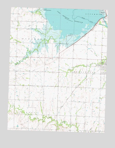
John Redmond Dam, KS USGS Topographic Map
Click on map above to begin viewing in our Map Viewer.

This topographic map contains these locations and features:
Feature Name Type Latitude Longitude GNIS ID View Map
Bailey CemeteryCemeteryN38.2357°W95.8370°477846View Map
Baker CemeteryCemeteryN38.1989°W95.8236°477844View Map
Buffalo CreekStreamN38.2306°W95.8164°477845View Map
Burlington Christian ChurchChurchN38.2061°W95.7542°2690702View Map
Burlington Municipal Airport (historical)AirportN38.2139°W95.8044°481440View Map
Calvary CemeteryCemeteryN38.1875°W95.7742°477849View Map
Cola Hill CemeteryCemeteryN38.1327°W95.7937°477843View Map
John Redmond DamDamN38.2250°W95.7767°477848View Map
John Redmond ReservoirReservoirN38.2250°W95.7767°477467View Map
John Redmond Wildlife AreaParkN38.2250°W95.8211°479824View Map
Otter CreekStreamN38.2197°W95.8114°477850View Map
Otter Creek Recreation AreaParkN38.2234°W95.7953°477847View Map
Rock Creek Country ClubLocaleN38.1971°W95.7594°2694527View Map
Teachout CemeteryCemeteryN38.1278°W95.8573°477842View Map
The Church of Jesus Christ of Latter Day SaintsChurchN38.1987°W95.7642°2690318View Map
Township of BurlingtonCivilN38.1699°W95.7642°477862View Map
Toy Mobile Home ParkPopulated PlaceN38.1952°W95.7545°2694173View Map

Note: Coordinates in the location and feature list above are referenced to NAD83 datum.


Copyright (C) 2008-2025 Ryan Niemi / Sunset Dynamics ... All Rights Reserved