TopoQuest Logo
Do you find TopoQuest useful?
Help keep TopoQuest running and adding new maps/features by donating!
Bitcoin:  19c7KJd3qBynnjoSw5npx9KScwjBe4ifkT
Litecoin:  LXs6TkuXGGXo1vDsWCkWVdjQX94eUKd6ui
Home View Maps Find Maps Find Places Resources & Links


New Vineyard, Maine Topographic Map

USGS Map Title: New Vineyard, ME
USGS Map MRC: 44070G1
DRG (GeoTIFF) Download: o44070g1.tif


Neighboring USGS Topographic Map Quads:


  Kingfield, ME  
44070H2
 

  New Portland, ME  
44070H1
 

  Embden Pond, ME  
44069H8
 

  Strong, ME  
44070G2
 

  New Vineyard, ME  
44070G1
 

  Madison West, ME  
44069G8
 

  Farmington, ME  
44070F2
 

  New Sharon, ME  
44070F1
 

  Mercer, ME  
44069F8


Map MRC Location:

N45°
W71°
N45°
W70°
H8 H7 H6 H5 H4 H3 H2 H1
G8 G7 G6 G5 G4 G3 G2 G1
F8 F7 F6 F5 F4 F3 F2 F1
E8 E7 E6 E5 E4 E3 E2 E1
D8 D7 D6 D5 D4 D3 D2 D1
C8 C7 C6 C5 C4 C3 C2 C1
B8 B7 B6 B5 B4 B3 B2 B1
A8 A7 A6 A5 A4 A3 A2 A1
N44°
W71°
N44°
W70°

New Vineyard, ME USGS 1:24K Topographic Map Preview:
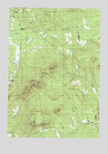
New Vineyard, ME USGS Topographic Map
Click on map above to begin viewing in our Map Viewer.

This topographic map contains these locations and features:
Feature Name Type Latitude Longitude GNIS ID View Map
Barker BrookStreamN44.8498°W70.1098°561601View Map
Bauds PondReservoirN44.8213°W70.1153°561557View Map
Bauds Pond DamDamN44.8230°W70.1115°1774533View Map
Boardman MountainSummitN44.7762°W70.0582°562630View Map
Boardman-True CemeteryCemeteryN44.7592°W70.0045°1908283View Map
Carsley CemeteryCemeteryN44.8714°W70.0409°2737015View Map
Caswell MountainSummitN44.8029°W70.0905°563679View Map
Daggett CemeteryCemeteryN44.8244°W70.1096°2736281View Map
Fish BrookStreamN44.7531°W70.0406°566193View Map
Gamape HillSummitN44.8259°W70.0089°566669View Map
Great WorksLocaleN44.8712°W70.1153°567186View Map
Greenwood BrookStreamN44.8498°W70.0123°567306View Map
Greenwood StreamStreamN44.8506°W70.0128°561009View Map
Griffin MountainSummitN44.7961°W70.0975°567333View Map
Hall BrookStreamN44.8506°W70.0128°561017View Map
Ick Norton MountainSummitN44.8169°W70.0677°568549View Map
Little MountainSummitN44.8133°W70.0790°569920View Map
Luce BrookStreamN44.8701°W70.1190°570567View Map
Mantor CemeteryCemeteryN44.7719°W70.0533°2736295View Map
Mill PondReservoirN44.8034°W70.1228°1773738View Map
Mill PondLakeN44.8006°W70.1247°571346View Map
Mitchell BrookStreamN44.7639°W70.0176°571465View Map
New VineyardPopulated PlaceN44.8042°W70.1215°572128View Map
New Vineyard BasinBasinN44.7742°W70.1126°572129View Map
New Vineyard MountainsSummitN44.8059°W70.0873°572130View Map
New Vineyard Post OfficePost OfficeN44.8050°W70.1226°1908375View Map
New Vineyard Public LibraryBuildingN44.8052°W70.1229°1908376View Map
New Vineyard Volunteer Fire DepartmentBuildingN44.8060°W70.1227°2553114View Map
Norton MountainSummitN44.7649°W70.0905°572497View Map
Pratt Corner CemeteryCemeteryN44.8438°W70.1094°2725114View Map
Pratt Corner SchoolSchoolN44.8428°W70.1090°573754View Map
Rand SchoolSchoolN44.7959°W70.0309°574027View Map
Strickland HillSummitN44.8601°W70.0909°576436View Map
Talcott Corner CemeteryCemeteryN44.8370°W70.0534°2736316View Map
Talcott SchoolSchoolN44.8401°W70.0481°576643View Map
Town of IndustryCivilN44.7582°W70.0504°582528View Map
Town of New VineyardCivilN44.8053°W70.1122°582626View Map
True MountainSummitN44.7637°W70.0771°577366View Map
West MillsPopulated PlaceN44.7639°W70.0162°578172View Map

Note: Coordinates in the location and feature list above are referenced to NAD83 datum.


Copyright (C) 2008-2025 Ryan Niemi / Sunset Dynamics ... All Rights Reserved