TopoQuest Logo
Do you find TopoQuest useful?
Help keep TopoQuest running and adding new maps/features by donating!
Bitcoin:  19c7KJd3qBynnjoSw5npx9KScwjBe4ifkT
Litecoin:  LXs6TkuXGGXo1vDsWCkWVdjQX94eUKd6ui
Home View Maps Find Maps Find Places Resources & Links


New Washington, Ohio Topographic Map

USGS Map Title: New Washington, OH
USGS Map MRC: 40082H7
DRG (GeoTIFF) Download: o40082h7.tif


Neighboring USGS Topographic Map Quads:


  Attica, OH  
41082A8
 

  Centerton, OH  
41082A7
 

  Willard, OH  
41082A6
 

  Chatfield, OH  
40082H8
 

  New Washington, OH  
40082H7
 

  Shelby, OH  
40082H6
 

  Bucyrus, OH  
40082G8
 

  North Robinson, OH  
40082G7
 

  Crestline, OH  
40082G6


Map MRC Location:

N41°
W83°
N41°
W82°
H8 H7 H6 H5 H4 H3 H2 H1
G8 G7 G6 G5 G4 G3 G2 G1
F8 F7 F6 F5 F4 F3 F2 F1
E8 E7 E6 E5 E4 E3 E2 E1
D8 D7 D6 D5 D4 D3 D2 D1
C8 C7 C6 C5 C4 C3 C2 C1
B8 B7 B6 B5 B4 B3 B2 B1
A8 A7 A6 A5 A4 A3 A2 A1
N40°
W83°
N40°
W82°

New Washington, OH USGS 1:24K Topographic Map Preview:
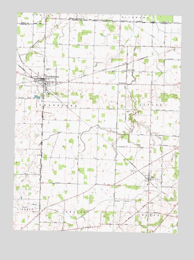
New Washington, OH USGS Topographic Map
Click on map above to begin viewing in our Map Viewer.

This topographic map contains these locations and features:
Feature Name Type Latitude Longitude GNIS ID View Map
Ackerman FarmsLocaleN40.9161°W82.8278°2704539View Map
Buckeye Central High SchoolSchoolN40.9595°W82.8530°1055724View Map
Buckeye East Elementary SchoolSchoolN40.9028°W82.7735°1055723View Map
Cranberry Hills Golf CourseLocaleN40.9584°W82.8282°1055733View Map
De Kalb Post Office (historical)Post OfficeN40.8931°W82.7721°1966940View Map
DekalbPopulated PlaceN40.8926°W82.7727°1064520View Map
Dickson CemeteryCemeteryN40.8864°W82.7641°1039706View Map
Goodwill CemeteryCemeteryN40.9448°W82.7911°1040954View Map
Kaple FarmsLocaleN40.9836°W82.7881°2652018View Map
Keller School (historical)SchoolN40.8959°W82.8268°1055754View Map
Liberty School (historical)SchoolN40.8926°W82.8707°1055758View Map
Lutheran CemeteryCemeteryN40.9648°W82.8546°1963185View Map
Maple Grove School (historical)SchoolN40.9534°W82.8346°1055760View Map
MechanicsburgPopulated PlaceN40.9145°W82.7724°1055761View Map
Muck School (historical)SchoolN40.9962°W82.7538°1050244View Map
New WashingtonPopulated PlaceN40.9623°W82.8544°1056451View Map
New Washington Fire DepartmentBuildingN40.9621°W82.8527°2550091View Map
New Washington Post OfficePost OfficeN40.9626°W82.8541°1966926View Map
New Washington Upground ReservoirReservoirN40.9519°W82.8593°1078977View Map
New Washington Upground Reservoir DamDamN40.9517°W82.8599°1078976View Map
North AuburnPopulated PlaceN40.9676°W82.7921°1065161View Map
North Auburn Post Office (historical)Post OfficeN40.9681°W82.7930°1966934View Map
Oakland CemeteryCemeteryN40.9106°W82.7824°1044058View Map
Our Mother of Sorrows CemeteryCemeteryN40.9679°W82.7922°1963194View Map
Red RunStreamN40.8884°W82.8705°1044901View Map
Ridge School (historical)SchoolN40.9451°W82.7977°1055764View Map
Saint Bernard CemeteryCemeteryN40.9678°W82.8529°1045407View Map
School Number 1 (historical)SchoolN40.8870°W82.7810°1055770View Map
School Number 2 (historical)SchoolN40.8762°W82.8282°1055774View Map
Springer School (historical)SchoolN40.9170°W82.8124°1055801View Map
Tabor School (historical)SchoolN40.9173°W82.8477°1055803View Map
TiroPopulated PlaceN40.9056°W82.7727°1061694View Map
Tiro - Auburn Volunteer Fire DepartmentBuildingN40.9055°W82.7727°2550090View Map
Tiro Post OfficePost OfficeN40.9056°W82.7727°1966930View Map
Township of AuburnCivilN40.9486°W82.7608°1085932View Map
Township of CranberryCivilN40.9498°W82.8390°1085935View Map
Union CemeteryCemeteryN40.8859°W82.8560°1047288View Map
Union CemeteryCemeteryN40.9538°W82.8507°1047290View Map
Village of New WashingtonCivilN40.9605°W82.8547°2399485View Map
Village of TiroCivilN40.9063°W82.7690°2399988View Map
WaynesburgPopulated PlaceN40.9603°W82.7924°1065460View Map

Note: Coordinates in the location and feature list above are referenced to NAD83 datum.


Copyright (C) 2008-2025 Ryan Niemi / Sunset Dynamics ... All Rights Reserved