TopoQuest Logo
Do you find TopoQuest useful?
Help keep TopoQuest running and adding new maps/features by donating!
Bitcoin:  19c7KJd3qBynnjoSw5npx9KScwjBe4ifkT
Litecoin:  LXs6TkuXGGXo1vDsWCkWVdjQX94eUKd6ui
Home View Maps Find Maps Find Places Resources & Links


Newell, California Topographic Map

USGS Map Title: Newell, CA
USGS Map MRC: 41121H3
DRG (GeoTIFF) Download: o41121h3.tif


Neighboring USGS Topographic Map Quads:


  Malin, OR  
42121A4
 

  Bryant Mountain, OR  
42121A3
 

  Langell Valley, OR  
42121A2
 

  Tulelake, CA  
41121H4
 

  Newell, CA  
41121H3
 

  Carr Butte, CA  
41121H2
 

  The Panhandle, CA  
41121G4
 

  Copic, CA  
41121G3
 

  Double Head Mountain, CA  
41121G2


Map MRC Location:

N42°
W122°
N42°
W121°
H8 H7 H6 H5 H4 H3 H2 H1
G8 G7 G6 G5 G4 G3 G2 G1
F8 F7 F6 F5 F4 F3 F2 F1
E8 E7 E6 E5 E4 E3 E2 E1
D8 D7 D6 D5 D4 D3 D2 D1
C8 C7 C6 C5 C4 C3 C2 C1
B8 B7 B6 B5 B4 B3 B2 B1
A8 A7 A6 A5 A4 A3 A2 A1
N41°
W122°
N41°
W121°

Newell, CA USGS 1:24K Topographic Map Preview:
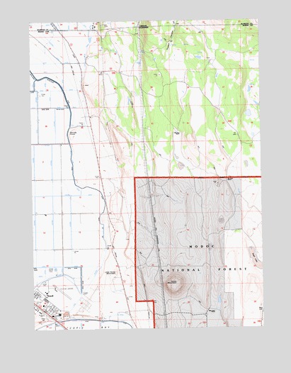
Newell, CA USGS Topographic Map
Click on map above to begin viewing in our Map Viewer.

This topographic map contains these locations and features:
Feature Name Type Latitude Longitude GNIS ID View Map
Bloody PointCapeN41.9549°W121.3578°257212View Map
Bull SpringSpringN41.9868°W121.3158°257672View Map
Horse MountainSummitN41.8935°W121.2989°261496View Map
Horse Mountain QuarryMineN41.8839°W121.2819°2677939View Map
Jim Horn RanchLocaleN41.9340°W121.2692°261947View Map
Little Horse MountainSummitN41.8988°W121.3319°262631View Map
Mike Faine RanchLocaleN41.8821°W121.2769°263561View Map
Mud LakeLakeN41.8829°W121.2503°267041View Map
NewellPopulated PlaceN41.8882°W121.3722°1659219View Map
Newell Census Designated PlaceCensusN41.8898°W121.3674°2583091View Map
Newell Elementary SchoolSchoolN41.8849°W121.3708°1702407View Map
Old Elliot RanchLocaleN41.9543°W121.2955°264322View Map
Russell CanyonValleyN41.9840°W121.3019°265688View Map
Sage LakeLakeN41.8996°W121.2525°265725View Map
Tule Lake Relocation Center (historical)BuildingN41.8893°W121.3747°1968238View Map
Tule Lake ValleyValleyN41.9999°W121.3650°1133281View Map
Tulelake Municipal AirportAirportN41.8921°W121.3643°1654069View Map
World War II Valor in the Pacific National MonumentParkN41.8866°W121.3747°2733431View Map

Note: Coordinates in the location and feature list above are referenced to NAD83 datum.


Copyright (C) 2008-2025 Ryan Niemi / Sunset Dynamics ... All Rights Reserved