TopoQuest Logo
Do you find TopoQuest useful?
Help keep TopoQuest running and adding new maps/features by donating!
Bitcoin:  19c7KJd3qBynnjoSw5npx9KScwjBe4ifkT
Litecoin:  LXs6TkuXGGXo1vDsWCkWVdjQX94eUKd6ui
Home View Maps Find Maps Find Places Resources & Links


Langell Valley, Oregon Topographic Map

USGS Map Title: Langell Valley, OR
USGS Map MRC: 42121A2
DRG (GeoTIFF) Download: o42121a2.tif


Neighboring USGS Topographic Map Quads:


  Lorella, OR  
42121B3
 

  Goodlow Mountain, OR  
42121B2
 

  Gerber Reservoir, OR  
42121B1
 

  Bryant Mountain, OR  
42121A3
 

  Langell Valley, OR  
42121A2
 

  Brady Butte, OR  
42121A1
 

  Newell, CA  
41121H3
 

  Carr Butte, CA  
41121H2
 

  Sagebrush Butte, CA  
41121H1


Map MRC Location:

N43°
W122°
N43°
W121°
H8 H7 H6 H5 H4 H3 H2 H1
G8 G7 G6 G5 G4 G3 G2 G1
F8 F7 F6 F5 F4 F3 F2 F1
E8 E7 E6 E5 E4 E3 E2 E1
D8 D7 D6 D5 D4 D3 D2 D1
C8 C7 C6 C5 C4 C3 C2 C1
B8 B7 B6 B5 B4 B3 B2 B1
A8 A7 A6 A5 A4 A3 A2 A1
N42°
W122°
N42°
W121°

Langell Valley, OR USGS 1:24K Topographic Map Preview:
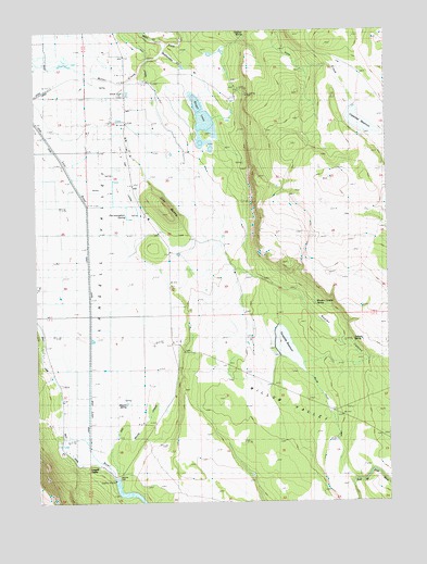
Langell Valley, OR USGS Topographic Map
Click on map above to begin viewing in our Map Viewer.

This topographic map contains these locations and features:
Feature Name Type Latitude Longitude GNIS ID View Map
Black Canyon CreekStreamN42.0790°W121.1942°1133110View Map
Boggs LakeLakeN42.1010°W121.1904°1117900View Map
Copeland ReservoirReservoirN42.1004°W121.1349°1119263View Map
Dry SpringSpringN42.0898°W121.1770°1160674View Map
East LateralCanalN42.1068°W121.2086°1158222View Map
East Malone LateralCanalN42.0185°W121.2189°1120342View Map
Gift ButteSummitN42.0757°W121.2039°1121125View Map
Hargadine SpringSpringN42.0902°W121.2236°1121599View Map
Heffner SpringSpringN42.1237°W121.1759°1133264View Map
Kilgore SpringSpringN42.0240°W121.2205°1122727View Map
Langell ValleyPopulated PlaceN42.0096°W121.2289°1136461View Map
Langell Valley Post Office (historical)Post OfficeN42.0096°W121.2289°1165515View Map
Malone DamDamN42.0064°W121.2233°1123721View Map
Malone Diversion DamDamN42.0068°W121.1747°1131567View Map
Pine CreekStreamN42.1207°W121.2039°1133106View Map
Pre-exemption SpringSpringN42.0757°W121.2185°1133265View Map
Rattlesnake CreekStreamN42.1179°W121.2067°1133109View Map
Sullivan SpringSpringN42.0415°W121.1358°1133112View Map
Threemile DamDamN42.0392°W121.1654°1133691View Map
Threemile FlatFlatN42.0388°W121.1511°1160675View Map
Threemile ReservoirReservoirN42.0408°W121.1619°1128077View Map
Willow ValleyFlatN42.0249°W121.1844°1133114View Map
Willow Valley CanalCanalN42.0138°W121.1428°1133113View Map
Woolen CanyonValleyN42.0618°W121.1800°1129324View Map
Woolen Canyon SpringSpringN42.0528°W121.1516°1133111View Map

Note: Coordinates in the location and feature list above are referenced to NAD83 datum.


Copyright (C) 2008-2025 Ryan Niemi / Sunset Dynamics ... All Rights Reserved