TopoQuest Logo
Do you find TopoQuest useful?
Help keep TopoQuest running and adding new maps/features by donating!
Bitcoin:  19c7KJd3qBynnjoSw5npx9KScwjBe4ifkT
Litecoin:  LXs6TkuXGGXo1vDsWCkWVdjQX94eUKd6ui
Home View Maps Find Maps Find Places Resources & Links


Tulelake, California Topographic Map

USGS Map Title: Tulelake, CA
USGS Map MRC: 41121H4
DRG (GeoTIFF) Download: o41121h4.tif


Neighboring USGS Topographic Map Quads:


  Merrill, OR  
42121A5
 

  Malin, OR  
42121A4
 

  Bryant Mountain, OR  
42121A3
 

  Hatfield, CA  
41121H5
 

  Tulelake, CA  
41121H4
 

  Newell, CA  
41121H3
 

  Captain Jacks Stronghold, CA  
41121G5
 

  The Panhandle, CA  
41121G4
 

  Copic, CA  
41121G3


Map MRC Location:

N42°
W122°
N42°
W121°
H8 H7 H6 H5 H4 H3 H2 H1
G8 G7 G6 G5 G4 G3 G2 G1
F8 F7 F6 F5 F4 F3 F2 F1
E8 E7 E6 E5 E4 E3 E2 E1
D8 D7 D6 D5 D4 D3 D2 D1
C8 C7 C6 C5 C4 C3 C2 C1
B8 B7 B6 B5 B4 B3 B2 B1
A8 A7 A6 A5 A4 A3 A2 A1
N41°
W122°
N41°
W121°

Tulelake, CA USGS 1:24K Topographic Map Preview:
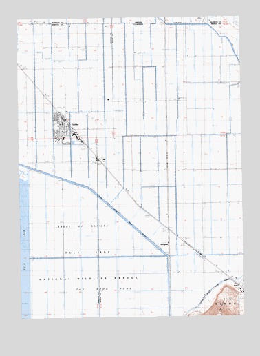
Tulelake, CA USGS Topographic Map
Click on map above to begin viewing in our Map Viewer.

This topographic map contains these locations and features:
Feature Name Type Latitude Longitude GNIS ID View Map
Butte Valley FairgroundsParkN41.9490°W121.4786°1701838View Map
Carr SchoolSchoolN41.9210°W121.4003°220636View Map
City of TulelakeCivilN41.9533°W121.4752°2412108View Map
Community Presbyterian ChurchChurchN41.9557°W121.4778°1878488View Map
DaltonPopulated PlaceN41.9363°W121.4194°1658368View Map
First Baptist Church of TulelakeChurchN41.9552°W121.4778°1878489View Map
Holy Cross ChurchChurchN41.9513°W121.4797°1878490View Map
HomesteadPopulated PlaceN41.9135°W121.4230°252691View Map
KalinaPopulated PlaceN41.9952°W121.4203°1658881View Map
Malin AirportAirportN41.9997°W121.3956°1131628View Map
Otis Roper ParkParkN41.9568°W121.4800°1701889View Map
StaleyPopulated PlaceN41.8882°W121.3808°1665975View Map
StrongholdPopulated PlaceN41.9054°W121.4097°252810View Map
The Frog PondFlatN41.8782°W121.4619°236169View Map
The PeninsulaCapeN41.8793°W121.3894°236211View Map
Trinity Lutheran ChurchChurchN41.9513°W121.4764°1878491View Map
TuberPopulated PlaceN41.9368°W121.4514°252820View Map
Tule Lake National Wildlife RefugeParkN41.8822°W121.4948°268455View Map
TulelakePopulated PlaceN41.9560°W121.4775°1660040View Map
Tulelake Branch Siskiyou County Public LibraryBuildingN41.9554°W121.4772°1701902View Map
Tulelake Christian Fellowship ChurchChurchN41.9577°W121.4797°1878492View Map
Tulelake City HallBuildingN41.9560°W121.4755°1701903View Map
Tulelake High SchoolSchoolN41.9500°W121.4758°1701904View Map
Tulelake Middle SchoolSchoolN41.9552°W121.4786°1701905View Map
Tulelake Police DepartmentBuildingN41.9559°W121.4756°2751069View Map
Tulelake Post OfficePost OfficeN41.9559°W121.4740°1701906View Map
Tulelake Volunteer Fire DepartmentBuildingN41.9497°W121.4692°2621786View Map

Note: Coordinates in the location and feature list above are referenced to NAD83 datum.


Copyright (C) 2008-2025 Ryan Niemi / Sunset Dynamics ... All Rights Reserved