TopoQuest Logo
Do you find TopoQuest useful?
Help keep TopoQuest running and adding new maps/features by donating!
Bitcoin:  19c7KJd3qBynnjoSw5npx9KScwjBe4ifkT
Litecoin:  LXs6TkuXGGXo1vDsWCkWVdjQX94eUKd6ui
Home View Maps Find Maps Find Places Resources & Links


Newsome Sinks, Alabama Topographic Map

USGS Map Title: Newsome Sinks, AL
USGS Map MRC: 34086D5
DRG (GeoTIFF) Download: o34086d5.tif


Neighboring USGS Topographic Map Quads:


  Triana, AL  
34086E6
 

  Farley, AL  
34086E5
 

  New Hope, AL  
34086E4
 

  Center Grove, AL  
34086D6
 

  Newsome Sinks, AL  
34086D5
 

  Guntersville Dam, AL  
34086D4
 

  Lawrence Cove, AL  
34086C6
 

  Hulaco, AL  
34086C5
 

  Arab, AL  
34086C4


Map MRC Location:

N35°
W87°
N35°
W86°
H8 H7 H6 H5 H4 H3 H2 H1
G8 G7 G6 G5 G4 G3 G2 G1
F8 F7 F6 F5 F4 F3 F2 F1
E8 E7 E6 E5 E4 E3 E2 E1
D8 D7 D6 D5 D4 D3 D2 D1
C8 C7 C6 C5 C4 C3 C2 C1
B8 B7 B6 B5 B4 B3 B2 B1
A8 A7 A6 A5 A4 A3 A2 A1
N34°
W87°
N34°
W86°

Newsome Sinks, AL USGS 1:24K Topographic Map Preview:
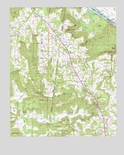
Newsome Sinks, AL USGS Topographic Map
Click on map above to begin viewing in our Map Viewer.

This topographic map contains these locations and features:
Feature Name Type Latitude Longitude GNIS ID View Map
Allens CrossroadsPopulated PlaceN34.4279°W86.5419°155986View Map
Apple GrovePopulated PlaceN34.3987°W86.6103°155996View Map
Ballew PointCliffN34.4826°W86.5492°113426View Map
Benefield SpringSpringN34.4996°W86.6200°148956View Map
Benton Round MountainSummitN34.4601°W86.5058°113938View Map
Billy RidgeRidgeN34.3887°W86.5636°114350View Map
Blowing SpringSpringN34.4390°W86.5783°148958View Map
Boston HollowValleyN34.4248°W86.5725°114750View Map
Bowling BranchStreamN34.4723°W86.5972°114775View Map
Brindlee Mountain Volunteer Fire Department Station 1BuildingN34.4694°W86.5660°2682924View Map
Brindlee Mountain Volunteer Fire Department Station 2BuildingN34.4707°W86.6215°2683209View Map
Brindlee Mountain Volunteer Fire Department Station 3BuildingN34.4198°W86.5356°2683359View Map
Brindlee Mountain Volunteer Fire Department Station 4 SubstationBuildingN34.4619°W86.5551°2683405View Map
BriscoePopulated PlaceN34.4579°W86.5886°163843View Map
Brock ChapelChurchN34.4373°W86.5028°114935View Map
Brock School (historical)SchoolN34.4373°W86.5028°139351View Map
Burden-Childers FarmsLocaleN34.3978°W86.6000°2516605View Map
Cagle HollowValleyN34.4123°W86.5728°115362View Map
Cane CreekStreamN34.4987°W86.5330°115552View Map
Cedar MountainSummitN34.4820°W86.5217°115805View Map
Cherry HollowValleyN34.4740°W86.5297°116009View Map
Clarkesville Ferry (historical)CrossingN34.4856°W86.5053°146799View Map
Clarksville LandingLocaleN34.4876°W86.5050°156185View Map
Clarksville MountainSummitN34.4773°W86.5089°116190View Map
Compton CemeteryCemeteryN34.4298°W86.6005°116479View Map
Cornelius BridgeBridgeN34.4029°W86.6244°139739View Map
Cotaco ValleyValleyN34.3926°W86.6061°139740View Map
Ditto FallsFallsN34.4904°W86.5647°155551View Map
Flint River Towhead (historical)IslandN34.4993°W86.5300°146913View Map
Forman CemeteryCemeteryN34.4026°W86.6175°118507View Map
Greenbriar CoveValleyN34.4909°W86.5300°119356View Map
Greenhaw SpringSpringN34.4395°W86.5705°148975View Map
Gullion MountainSummitN34.4481°W86.5372°119467View Map
Henderson CreekStreamN34.4615°W86.6094°119953View Map
Highland Baptist ChurchChurchN34.4865°W86.6097°139805View Map
Hughes CreekStreamN34.4106°W86.6189°120534View Map
Hughes SpringSpringN34.4172°W86.5938°120536View Map
Kid CreekStreamN34.4240°W86.5722°121183View Map
King HollowValleyN34.4779°W86.5394°121225View Map
Lamons CemeteryCemeteryN34.4284°W86.6192°121361View Map
Lamons CoveValleyN34.4154°W86.6172°151984View Map
Lamons SpringSpringN34.4302°W86.6235°148979View Map
Leeth SpringSpringN34.3809°W86.6153°148980View Map
Lemons SpringSpringN34.4587°W86.6004°148981View Map
Lifegate ChurchChurchN34.3806°W86.5144°163840View Map
Light GapGapN34.3862°W86.5558°121605View Map
Little Cane CreekStreamN34.4798°W86.5361°139422View Map
Little Cotaco CreekStreamN34.3923°W86.6103°152089View Map
Lynn CreekStreamN34.4112°W86.5755°122123View Map
Lynn DamDamN34.4201°W86.5736°152177View Map
Lynn Mill PondReservoirN34.4212°W86.5725°132007View Map
Lynn SpringSpringN34.4218°W86.5736°148982View Map
Mack Ralph MountainSummitN34.4084°W86.5872°122178View Map
Mead HollowValleyN34.4426°W86.5055°122610View Map
Merritt BottomBasinN34.4237°W86.5358°122669View Map
Midway School (historical)SchoolN34.4387°W86.5467°149248View Map
Mill BluffCliffN34.4479°W86.5053°122733View Map
Mill HollowValleyN34.4556°W86.5044°122805View Map
Morgan CityPopulated PlaceN34.4720°W86.5697°123040View Map
Mount OlivePopulated PlaceN34.4570°W86.5567°156750View Map
Mount Olive CemeteryCemeteryN34.4565°W86.5550°147487View Map
Mount Olive ChurchChurchN34.4548°W86.5547°139442View Map
Mount Olive Church of ChristChurchN34.4562°W86.5555°147488View Map
Mount Olive School (historical)SchoolN34.4548°W86.5553°139443View Map
Mount Tabor Baptist ChurchChurchN34.4298°W86.5697°152513View Map
Mount Tabor CemeteryCemeteryN34.4295°W86.5703°147489View Map
New Canaan Baptist ChurchChurchN34.4737°W86.6230°139550View Map
New Canaan CemeteryCemeteryN34.4795°W86.6030°152612View Map
New Howard School (historical)SchoolN34.3945°W86.5075°1729876View Map
Newsome SinksBasinN34.4409°W86.5972°123929View Map
Norrell SinkBasinN34.4118°W86.5239°123976View Map
North Parkway ChurchChurchN34.3784°W86.5147°139451View Map
Old Prince Place SpringSpringN34.4529°W86.5783°148989View Map
OleanderPopulated PlaceN34.4140°W86.5280°124276View Map
Oleander ChurchChurchN34.4154°W86.5494°139457View Map
Pine RidgeRidgeN34.4523°W86.5864°124839View Map
Pine Ridge Baptist ChurchChurchN34.4504°W86.5864°152933View Map
Pine Ridge CemeteryCemeteryN34.4501°W86.5861°139570View Map
Pine Ridge School (historical)SchoolN34.4379°W86.5875°155552View Map
Pleasant Valley ChurchChurchN34.3968°W86.5561°125052View Map
Polly CemeteryCemeteryN34.4895°W86.5400°153028View Map
Prince CemeteryCemeteryN34.4440°W86.5983°125282View Map
Pritchett MountainSummitN34.4129°W86.5492°125291View Map
RescueLocaleN34.4720°W86.5755°125570View Map
Rescue CemeteryCemeteryN34.4704°W86.5755°125571View Map
Robinson SpringSpringN34.4204°W86.6103°148995View Map
Rock SpringSpringN34.4920°W86.5828°148996View Map
Ryan CoveValleyN34.3804°W86.5789°126065View Map
Ryan SpringSpringN34.3962°W86.6136°148999View Map
Saints CemeteryCemeteryN34.4870°W86.6097°126225View Map
Salem RidgeRidgeN34.3851°W86.5850°126254View Map
Saylor GapGapN34.3845°W86.5708°126453View Map
Science Hill School (historical)SchoolN34.4843°W86.5878°163845View Map
Short CemeteryCemeteryN34.4879°W86.5200°126808View Map
Shumate MountainSummitN34.4365°W86.5117°126825View Map
Skidmore CemeteryCemeteryN34.3973°W86.5858°126929View Map
Skidmore ChapelChurchN34.3945°W86.5861°139612View Map
Skidmore SpringSpringN34.4013°W86.5352°126930View Map
Skidmore SpringSpringN34.3940°W86.5836°149001View Map
Southern (historical)Populated PlaceN34.4745°W86.5272°139487View Map
Spout SpringSpringN34.3993°W86.6100°149004View Map
Spout SpringSpringN34.4476°W86.5794°149005View Map
Stone Quarry HollowValleyN34.4562°W86.5047°127433View Map
Toten CreekStreamN34.4284°W86.5636°128023View Map
Union Chapel Community CenterBuildingN34.4054°W86.5089°139497View Map
Union Grove CemeteryCemeteryN34.4918°W86.5922°139623View Map
Union Grove ChurchChurchN34.4904°W86.5925°128325View Map
Union HillPopulated PlaceN34.4737°W86.6219°128330View Map
Union Hill SchoolSchoolN34.4729°W86.6225°139626View Map
Venice School (historical)SchoolN34.4240°W86.5744°1729882View Map
Walker SpringSpringN34.3906°W86.6211°149011View Map
Winton BranchStreamN34.4109°W86.6175°155554View Map
Winton CoveValleyN34.4104°W86.6128°139651View Map
WRSA-FM (Decatur)TowerN34.4887°W86.6189°161217View Map

Note: Coordinates in the location and feature list above are referenced to NAD83 datum.


Copyright (C) 2008-2024 Ryan Niemi / Sunset Dynamics ... All Rights Reserved