TopoQuest Logo
Do you find TopoQuest useful?
Help keep TopoQuest running and adding new maps/features by donating!
Bitcoin:  19c7KJd3qBynnjoSw5npx9KScwjBe4ifkT
Litecoin:  LXs6TkuXGGXo1vDsWCkWVdjQX94eUKd6ui
Home View Maps Find Maps Find Places Resources & Links


Newtonsville, Ohio Topographic Map

USGS Map Title: Newtonsville, OH
USGS Map MRC: 39084B1
DRG (GeoTIFF) Download: o39084b1.tif


Neighboring USGS Topographic Map Quads:


  South Lebanon, OH  
39084C2
 

  Pleasant Plain, OH  
39084C1
 

  Blanchester, OH  
39083C8
 

  Goshen, OH  
39084B2
 

  Newtonsville, OH  
39084B1
 

  Fayetteville, OH  
39083B8
 

  Batavia, OH  
39084A2
 

  Williamsburg, OH  
39084A1
 

  Mount Orab, OH  
39083A8


Map MRC Location:

N40°
W85°
N40°
W84°
H8 H7 H6 H5 H4 H3 H2 H1
G8 G7 G6 G5 G4 G3 G2 G1
F8 F7 F6 F5 F4 F3 F2 F1
E8 E7 E6 E5 E4 E3 E2 E1
D8 D7 D6 D5 D4 D3 D2 D1
C8 C7 C6 C5 C4 C3 C2 C1
B8 B7 B6 B5 B4 B3 B2 B1
A8 A7 A6 A5 A4 A3 A2 A1
N39°
W85°
N39°
W84°

Newtonsville, OH USGS 1:24K Topographic Map Preview:
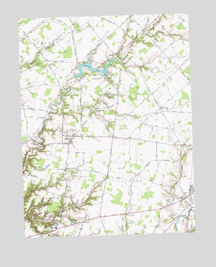
Newtonsville, OH USGS Topographic Map
Click on map above to begin viewing in our Map Viewer.

This topographic map contains these locations and features:
Feature Name Type Latitude Longitude GNIS ID View Map
Antique Acres AirparkAirportN39.2401°W84.1001°1082717View Map
Beechtree TrailTrailN39.2106°W84.0672°1962909View Map
Brick Chapel CemeteryCemeteryN39.1957°W84.0955°1963136View Map
Clearwater AirparkAirportN39.1294°W84.0938°1082930View Map
Clermont NE School LakeReservoirN39.1315°W84.1023°1079377View Map
Clermont NE Schools Lake DamDamN39.1317°W84.1033°1079376View Map
Clermont Northeastern High SchoolSchoolN39.1306°W84.1019°1039179View Map
Crescent Isle LakeReservoirN39.1301°W84.0447°1077585View Map
Davis School (historical)SchoolN39.1495°W84.1030°1054145View Map
Deer Track Golf CourseLocaleN39.1883°W84.1103°2112035View Map
EdentonPopulated PlaceN39.2284°W84.0530°1064599View Map
Edenton CemeteryCemeteryN39.2219°W84.0648°1040075View Map
Edenton Post OfficePost OfficeN39.2303°W84.0527°1965834View Map
Grassy ForkStreamN39.1309°W84.0138°1066731View Map
Greenbush CreekStreamN39.1987°W84.0708°1066734View Map
Hallelujah FieldAirportN39.2011°W84.1046°1082718View Map
Hartman CemeteryCemeteryN39.1359°W84.0497°1041376View Map
Hartman School (historical)SchoolN39.1373°W84.0505°1054142View Map
Hunter CreekStreamN39.2392°W84.0294°1041879View Map
Jackson Township Fire DepartmentBuildingN39.1361°W84.0566°2550490View Map
Lake MontereyReservoirN39.1331°W84.0896°1043451View Map
Lakeview TrailTrailN39.2162°W84.0633°1962910View Map
LeradoPopulated PlaceN39.1748°W84.0083°1064987View Map
Lerado Post Office (historical)Post OfficeN39.1751°W84.0083°1966108View Map
Locust CreekStreamN39.2267°W84.0497°1042704View Map
Lord's Valley Golf CourseLocaleN39.1386°W84.0953°2112041View Map
MarathonPopulated PlaceN39.1448°W84.0063°1061470View Map
Marathon Post OfficePost OfficeN39.1445°W84.0069°1965827View Map
ModestPopulated PlaceN39.1931°W84.1072°1065042View Map
Modest Post Office (historical)Post OfficeN39.1931°W84.1069°1966270View Map
MontereyPopulated PlaceN39.1337°W84.0813°1056432View Map
Monterey CemeteryCemeteryN39.1429°W84.0867°1043450View Map
Monterey Post Office (historical)Post OfficeN39.1334°W84.0819°1966271View Map
Moores ForkStreamN39.2026°W84.0947°1043474View Map
Moores ForkPopulated PlaceN39.1965°W84.0227°1065052View Map
Moores Fork Baptist ChurchChurchN39.1970°W84.0230°1052066View Map
Moores Fork Post OfficePost OfficeN39.1959°W84.0222°1966272View Map
NewtonsvillePopulated PlaceN39.1820°W84.0863°1065150View Map
Newtonsville Post OfficePost OfficeN39.1820°W84.0860°1966276View Map
Northeastern Middle SchoolSchoolN39.1320°W84.1010°1043982View Map
Oak Grove School (historical)SchoolN39.2287°W84.0197°1054140View Map
Old Baptist Church CemeteryCemeteryN39.1786°W84.0894°1963156View Map
Osborne School (historical)SchoolN39.1590°W84.0638°1054143View Map
Patterson RunStreamN39.1353°W84.1199°1044321View Map
Plainview CemeteryCemeteryN39.1798°W84.1177°1044517View Map
Pringle CornersPopulated PlaceN39.1631°W84.0933°1063400View Map
Pringles OrchardLocaleN39.2075°W84.0872°2516119View Map
Red Fox TrailTrailN39.2148°W84.0541°1962911View Map
ShilohPopulated PlaceN39.2301°W84.1088°1065317View Map
Shumard School (historical)SchoolN39.1609°W84.1202°1054144View Map
Southwoods TrailTrailN39.2148°W84.0577°1962912View Map
Stonelick ChurchChurchN39.2087°W84.0908°1046715View Map
Stonelick LakeReservoirN39.2203°W84.0725°1078086View Map
Stonelick Lake DamDamN39.2167°W84.0849°1078085View Map
Stonelick Lake State ParkParkN39.2184°W84.0635°1046716View Map
Terra Agua LakesLakeN39.2060°W84.0594°1046990View Map
Township of JacksonCivilN39.1313°W84.0499°1085864View Map
Township of WayneCivilN39.2130°W84.0541°1085874View Map
Village of NewtonsvilleCivilN39.1811°W84.0896°2399494View Map
Wayne Township Fire and Rescue Station 55BuildingN39.1792°W84.0891°2550124View Map
Wayne Township Fire and Rescue Station 56BuildingN39.2256°W84.0509°2550619View Map
WCNE-FM (Batavia)TowerN39.1292°W84.1013°1083774View Map
Woodland ParkPopulated PlaceN39.1973°W84.0685°1048080View Map
Woodland Park Post Office (historical)Post OfficeN39.1973°W84.0685°1926723View Map
Woodland Park Post Office (historical)Post OfficeN39.1973°W84.0680°1966628View Map
Zionsville School (historical)SchoolN39.1673°W84.0263°1054141View Map

Note: Coordinates in the location and feature list above are referenced to NAD83 datum.


Copyright (C) 2008-2024 Ryan Niemi / Sunset Dynamics ... All Rights Reserved