TopoQuest Logo
Do you find TopoQuest useful?
Help keep TopoQuest running and adding new maps/features by donating!
Bitcoin:  19c7KJd3qBynnjoSw5npx9KScwjBe4ifkT
Litecoin:  LXs6TkuXGGXo1vDsWCkWVdjQX94eUKd6ui
Home View Maps Find Maps Find Places Resources & Links


Fayetteville, Ohio Topographic Map

USGS Map Title: Fayetteville, OH
USGS Map MRC: 39083B8
DRG (GeoTIFF) Download: o39083b8.tif


Neighboring USGS Topographic Map Quads:


  Pleasant Plain, OH  
39084C1
 

  Blanchester, OH  
39083C8
 

  Martinsville, OH  
39083C7
 

  Newtonsville, OH  
39084B1
 

  Fayetteville, OH  
39083B8
 

  Lynchburg, OH  
39083B7
 

  Williamsburg, OH  
39084A1
 

  Mount Orab, OH  
39083A8
 

  Sardinia, OH  
39083A7


Map MRC Location:

N40°
W84°
N40°
W83°
H8 H7 H6 H5 H4 H3 H2 H1
G8 G7 G6 G5 G4 G3 G2 G1
F8 F7 F6 F5 F4 F3 F2 F1
E8 E7 E6 E5 E4 E3 E2 E1
D8 D7 D6 D5 D4 D3 D2 D1
C8 C7 C6 C5 C4 C3 C2 C1
B8 B7 B6 B5 B4 B3 B2 B1
A8 A7 A6 A5 A4 A3 A2 A1
N39°
W84°
N39°
W83°

Fayetteville, OH USGS 1:24K Topographic Map Preview:
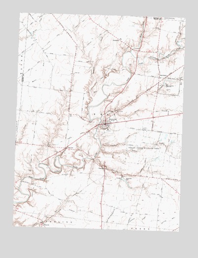
Fayetteville, OH USGS Topographic Map
Click on map above to begin viewing in our Map Viewer.

This topographic map contains these locations and features:
Feature Name Type Latitude Longitude GNIS ID View Map
A And M Farm OrchardLocaleN39.2467°W83.8964°2516111View Map
Bamber CemeteryCemeteryN39.1312°W83.9742°1037609View Map
Bott Wildlife AreaParkN39.2417°W83.9880°1730788View Map
Campbell School (historical)SchoolN39.1756°W83.8849°1053044View Map
ChasetownPopulated PlaceN39.1606°W83.9319°1048595View Map
Chasetown Post Office (historical)Post OfficeN39.1612°W83.9319°1965628View Map
Dieckbrader LakeReservoirN39.1528°W83.9155°1077898View Map
Dieckbrader Lake DamDamN39.1556°W83.9186°1077897View Map
Double J Airport (historical)AirportN39.2184°W83.9580°1082677View Map
Dunham CemeteryCemeteryN39.2048°W83.9421°1039873View Map
Engle CemeteryCemeteryN39.2157°W83.9569°1040203View Map
Evans LakeReservoirN39.1664°W83.9247°1077906View Map
Evans Lake DamDamN39.1667°W83.9266°1077905View Map
FayettevillePopulated PlaceN39.1867°W83.9322°1040400View Map
Fayetteville Elementary SchoolSchoolN39.1876°W83.9285°1055956View Map
Fayetteville Fire DepartmentBuildingN39.1873°W83.9322°2550551View Map
Fayetteville High SchoolSchoolN39.1834°W83.9310°1055957View Map
Fayetteville Methodist ChurchChurchN39.1878°W83.9322°2090475View Map
Fayetteville Middle SchoolSchoolN39.1878°W83.9294°1055958View Map
Fayetteville Police DepartmentBuildingN39.1865°W83.9337°2732702View Map
Fayetteville Post OfficePost OfficeN39.1862°W83.9319°1965569View Map
FerristownPopulated PlaceN39.2359°W83.9238°1064649View Map
Fritz CemeteryCemeteryN39.1944°W83.9236°1040702View Map
Glady RunStreamN39.1612°W83.9747°1040888View Map
Glady School (historical)SchoolN39.2048°W83.9594°1053070View Map
Huber School (historical)SchoolN39.1562°W83.8908°1053078View Map
Indian CreekStreamN39.1715°W83.9355°1041948View Map
Indian Creek Wildlife AreaParkN39.1723°W83.9010°1041956View Map
Johnson School (historical)SchoolN39.1351°W83.9072°1053081View Map
Jordan School (historical)SchoolN39.1398°W83.9622°1053084View Map
KirbyvillePopulated PlaceN39.1265°W83.9772°1064948View Map
Kramer CemeteryCemeteryN39.1578°W83.9872°1042344View Map
Lake FichtelbergReservoirN39.2032°W83.9658°1077902View Map
Lake Fichtelberg DamDamN39.2034°W83.9649°1077901View Map
Lake LoreleiReservoirN39.1849°W83.9693°1077900View Map
Lake Lorelei Census Designated PlaceCensusN39.1875°W83.9715°2628918View Map
Lake Lorelei DamDamN39.1767°W83.9749°1077899View Map
Little Indian CreekStreamN39.1737°W83.9355°1063474View Map
Long CemeteryCemeteryN39.2214°W83.9135°1042734View Map
Mackie's AirportAirportN39.2484°W83.9219°2442503View Map
McCafferty Road BridgeBridgeN39.1515°W83.9944°1053101View Map
Murray RunStreamN39.1937°W83.9244°1043742View Map
Pritchard FarmLocaleN39.1908°W83.8811°2663282View Map
Pschesang LakeReservoirN39.2084°W83.9166°1079189View Map
Pschesang Lake DamDamN39.2084°W83.9166°1079188View Map
Quinn School (historical)SchoolN39.1678°W83.9872°1053113View Map
Richland School (historical)SchoolN39.2406°W83.9663°1053115View Map
Saint Angela Merici ChurchChurchN39.1858°W83.9347°2090476View Map
Saint MartinPopulated PlaceN39.2145°W83.8933°1057993View Map
Saint Martin Catholic ChurchChurchN39.2125°W83.8928°2090474View Map
Saint Martin Census Designated PlaceCensusN39.2118°W83.8844°2725568View Map
Saint Martin Post OfficePost OfficeN39.2140°W83.8930°1965618View Map
Saint Martins CemeteryCemeteryN39.2139°W83.8908°1699143View Map
Saint Patricks CemeteryCemeteryN39.1928°W83.9277°1045727View Map
Saltlick CreekStreamN39.1659°W83.9399°1045924View Map
School Number 1 (historical)SchoolN39.2190°W83.9308°1053120View Map
Solomon RunStreamN39.1898°W83.9360°1046425View Map
Stringtown School (historical)SchoolN39.1926°W83.8899°1053131View Map
Sycamore CreekStreamN39.1962°W83.9458°1046914View Map
Township of PerryCivilN39.1895°W83.9323°1085801View Map
Ursuline CemeteryCemeteryN39.2078°W83.8877°1047385View Map
Ursuline School for GirlsSchoolN39.2098°W83.8877°1058092View Map
Vera CruzPopulated PlaceN39.1720°W83.9624°1058098View Map
Vera Cruz CemeteryCemeteryN39.1695°W83.9669°1047438View Map
Veracruz Post Office (historical)Post OfficeN39.1723°W83.9624°1965857View Map
Village of FayettevilleCivilN39.1848°W83.9317°2398868View Map
Village of Saint Martin (historical)CivilN39.2149°W83.8871°2399169View Map
West Fork East Fork Little Miami RiverStreamN39.2292°W83.9149°1047722View Map
Winandi Lake DamDamN39.2317°W83.9216°1077903View Map
Winandi ReservoirReservoirN39.2326°W83.9237°1077904View Map

Note: Coordinates in the location and feature list above are referenced to NAD83 datum.


Copyright (C) 2008-2025 Ryan Niemi / Sunset Dynamics ... All Rights Reserved