TopoQuest Logo
Do you find TopoQuest useful?
Help keep TopoQuest running and adding new maps/features by donating!
Bitcoin:  19c7KJd3qBynnjoSw5npx9KScwjBe4ifkT
Litecoin:  LXs6TkuXGGXo1vDsWCkWVdjQX94eUKd6ui
Home View Maps Find Maps Find Places Resources & Links


Niceville, Florida Topographic Map

USGS Map Title: Niceville, FL
USGS Map MRC: 30086E4
DRG (GeoTIFF) Download: o30086e4.tif


Neighboring USGS Topographic Map Quads:


  Crestview South, FL  
30086F5
 

  Spencer Flats, FL  
30086F4
 

  Mossy Head, FL  
30086F3
 

  Valparaiso, FL  
30086E5
 

  Niceville, FL  
30086E4
 

  Niceville SE, FL  
30086E3
 

  Fort Walton Beach, FL  
30086D5
 

  Destin, FL  
30086D4
 

  Choctaw Beach, FL  
30086D3


Map MRC Location:

N31°
W87°
N31°
W86°
H8 H7 H6 H5 H4 H3 H2 H1
G8 G7 G6 G5 G4 G3 G2 G1
F8 F7 F6 F5 F4 F3 F2 F1
E8 E7 E6 E5 E4 E3 E2 E1
D8 D7 D6 D5 D4 D3 D2 D1
C8 C7 C6 C5 C4 C3 C2 C1
B8 B7 B6 B5 B4 B3 B2 B1
A8 A7 A6 A5 A4 A3 A2 A1
N30°
W87°
N30°
W86°

Niceville, FL USGS 1:24K Topographic Map Preview:
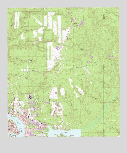
Niceville, FL USGS Topographic Map
Click on map above to begin viewing in our Map Viewer.

This topographic map contains these locations and features:
Feature Name Type Latitude Longitude GNIS ID View Map
Bass BranchStreamN30.5105°W86.4811°278158View Map
Bayou PlazaLocaleN30.5205°W86.4858°295832View Map
Bee BranchStreamN30.5294°W86.3908°278376View Map
Boggy BayouBayN30.5007°W86.4836°279143View Map
Bolton BranchStreamN30.5074°W86.4469°304991View Map
Brandt PondReservoirN30.5571°W86.4771°279330View Map
Brooks PondLakeN30.5074°W86.4998°279442View Map
Brown PondLakeN30.5842°W86.4162°279481View Map
C G Melgs BridgeBridgeN30.5044°W86.4416°303568View Map
C W Ruckel Middle SchoolSchoolN30.5216°W86.4755°298330View Map
Cedar Head BranchStreamN30.5496°W86.3755°280200View Map
City of NicevilleCivilN30.5299°W86.4826°2404378View Map
Deep HeadValleyN30.5360°W86.3982°281427View Map
Deer Moss CreekStreamN30.5079°W86.4243°292513View Map
Early BranchStreamN30.5099°W86.4549°281939View Map
Early CemeteryCemeteryN30.5137°W86.4607°281940View Map
East Niceville Fire DistrictBuildingN30.5127°W86.4580°2644189View Map
Fox Head BranchStreamN30.5421°W86.4702°282765View Map
Hazelwood PondReservoirN30.5735°W86.4749°283844View Map
Hickory BranchStreamN30.5371°W86.3819°283950View Map
Little Rocky CreekStreamN30.5452°W86.3788°285798View Map
Long CreekStreamN30.5063°W86.4163°285982View Map
Long CreekStreamN30.5141°W86.3986°285984View Map
Lula J Edge Elementary SchoolSchoolN30.5272°W86.4948°282084View Map
Middle Rocky CreekStreamN30.5816°W86.3911°286816View Map
Mill CreekStreamN30.5196°W86.4891°286870View Map
Nelson PointCapeN30.5027°W86.4455°287585View Map
NicevillePopulated PlaceN30.5169°W86.4822°294621View Map
Niceville Fire DepartmentBuildingN30.5200°W86.4876°2644003View Map
Niceville High SchoolSchoolN30.5204°W86.4767°298329View Map
Niceville Police DepartmentBuildingN30.5245°W86.4750°2754496View Map
Niceville Post OfficePost OfficeN30.5217°W86.4730°2759176View Map
Okaloosa County Emergency Medical Services Station 1BuildingN30.5152°W86.4686°2661883View Map
Okaloosa-Watson CollegeSchoolN30.5374°W86.4741°288072View Map
Palm PlazaLocaleN30.5224°W86.4952°295833View Map
Pine LakeLakeN30.5133°W86.4725°288892View Map
Pinecrest Community ChurchChurchN30.5269°W86.4674°288926View Map
Pinelog CreekStreamN30.5991°W86.4900°288940View Map
Plew Elementary SchoolSchoolN30.5135°W86.4621°289084View Map
Plew LakeReservoirN30.5284°W86.4870°289083View Map
Point Lookout CreekStreamN30.5991°W86.4897°289124View Map
Roberts LakeReservoirN30.5382°W86.4691°289785View Map
Rocky BayouBayN30.5036°W86.4273°289870View Map
Rocky Bayou State Park Aquatic PreserveParkN30.5035°W86.4280°304099View Map
Rocky CemeteryCemeteryN30.5106°W86.4493°289876View Map
Rocky CreekStreamN30.5060°W86.4186°289895View Map
Ruckel AirportAirportN30.5154°W86.4385°309719View Map
Sanders BranchStreamN30.5141°W86.4538°290589View Map
Sanders BranchStreamN30.5260°W86.3930°290590View Map
Sarah Ann BayouBayN30.5047°W86.4570°305003View Map
Sarah Ann BranchStreamN30.5044°W86.4552°290673View Map
Shaw Still BranchStreamN30.5149°W86.4552°290948View Map
Smith BranchStreamN30.5882°W86.4141°291242View Map
Smith BranchStreamN30.5113°W86.3891°291243View Map
Still BranchStreamN30.6044°W86.4830°291698View Map
Swift CreekStreamN30.5116°W86.4530°291960View Map
Toms BayouBayN30.5021°W86.4962°292349View Map
Trout LakeReservoirN30.5238°W86.4865°292482View Map
Turkey CreekStreamN30.5238°W86.5000°292520View Map
Twin Cities HospitalHospitalN30.5336°W86.4957°298681View Map
Valparaiso Post OfficePost OfficeN30.5131°W86.4944°2783479View Map
Valparaiso Volunteer Fire DepartmentBuildingN30.5094°W86.4988°2644176View Map
WBZR-AM (Destin)TowerN30.5096°W86.4761°310057View Map
WFSH-AM (Valparaiso-Niceville)TowerN30.5096°W86.4761°310147View Map

Note: Coordinates in the location and feature list above are referenced to NAD83 datum.


Copyright (C) 2008-2024 Ryan Niemi / Sunset Dynamics ... All Rights Reserved