TopoQuest Logo
Do you find TopoQuest useful?
Help keep TopoQuest running and adding new maps/features by donating!
Bitcoin:  19c7KJd3qBynnjoSw5npx9KScwjBe4ifkT
Litecoin:  LXs6TkuXGGXo1vDsWCkWVdjQX94eUKd6ui
Home View Maps Find Maps Find Places Resources & Links


Norfolk, Connecticut Topographic Map

USGS Map Title: Norfolk, CT
USGS Map MRC: 41073H2
DRG (GeoTIFF) Download: o41073h2.tif


Neighboring USGS Topographic Map Quads:


  South Canaan, CT  
41073H3
 

  Norfolk, CT  
41073H2
 

  Winsted, CT  
41073H1
 

  Cornwall, CT  
41073G3
 

  West Torrington, CT  
41073G2
 

  Torrington, CT  
41073G1


Map MRC Location:

N42°
W74°
N42°
W73°
H8 H7 H6 H5 H4 H3 H2 H1
G8 G7 G6 G5 G4 G3 G2 G1
F8 F7 F6 F5 F4 F3 F2 F1
E8 E7 E6 E5 E4 E3 E2 E1
D8 D7 D6 D5 D4 D3 D2 D1
C8 C7 C6 C5 C4 C3 C2 C1
B8 B7 B6 B5 B4 B3 B2 B1
A8 A7 A6 A5 A4 A3 A2 A1
N41°
W74°
N41°
W73°

Norfolk, CT USGS 1:24K Topographic Map Preview:
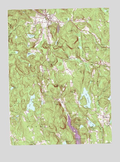
Norfolk, CT USGS Topographic Map
Click on map above to begin viewing in our Map Viewer.

This topographic map contains these locations and features:
Feature Name Type Latitude Longitude GNIS ID View Map
Beckley BogSwampN41.9685°W73.1615°1931788View Map
Beckley PondReservoirN41.9644°W73.1610°205394View Map
Beckley Pond BrookStreamN41.9501°W73.1601°205395View Map
Beecher PondReservoirN41.9135°W73.1632°1931791View Map
Bigelow ParkParkN41.9884°W73.1865°1931800View Map
Bigelow PondReservoirN41.9587°W73.2230°205502View Map
Bigelow Pond DamDamN41.9593°W73.2212°1771047View Map
Botelle Elementary SchoolSchoolN41.9876°W73.1884°1931810View Map
Burr MountainSummitN41.8912°W73.1862°1931833View Map
Camp BergerLocaleN41.8901°W73.1490°205934View Map
Camp PondReservoirN41.9746°W73.2397°205975View Map
Camp Wa-neeLocaleN41.8890°W73.1479°205986View Map
Case PondReservoirN41.9977°W73.2302°206056View Map
Chestnut HillSummitN41.9790°W73.1737°206246View Map
Church of the Immaculate Conception Roman Catholic ChurchChurchN41.9945°W73.2015°1931881View Map
Church of the Transfiguration Episcopal ChurchChurchN41.9940°W73.1957°1931883View Map
Crissey PondLakeN41.9607°W73.2396°206524View Map
Dam Number 6DamN41.9852°W73.1885°212922View Map
Danbury Quarter CemeteryCemeteryN41.9369°W73.1335°206585View Map
Dennis HillSummitN41.9487°W73.1987°206666View Map
Dennis Hill State ParkParkN41.9487°W73.1987°206667View Map
Dolphin PondReservoirN41.9491°W73.2241°206716View Map
Dutton MountainSummitN41.9768°W73.1946°206767View Map
Flagg HillSummitN41.9632°W73.1534°207100View Map
Fox BrookStreamN41.8884°W73.1376°207180View Map
Fox HillSummitN41.9829°W73.1982°1931982View Map
Ghilds PondReservoirN41.9665°W73.2257°207289View Map
Gillette ReservoirReservoirN41.9006°W73.2147°1931998View Map
Grant HillSummitN41.9415°W73.1590°207401View Map
Grant SwampSwampN41.9459°W73.1532°207403View Map
GrantvillePopulated PlaceN41.9512°W73.1565°212466View Map
Grantville CemeteryCemeteryN41.9533°W73.1828°207405View Map
Great Bear SwampSwampN41.9526°W73.2324°207427View Map
Hall MeadowSwampN41.9040°W73.1805°207612View Map
Hall Meadow CemeteryCemeteryN41.9030°W73.1780°207616View Map
Hillside GardensParkN41.9604°W73.2009°1932053View Map
Hoover PondReservoirN41.9136°W73.2096°1771528View Map
Hoover Pond DamDamN41.9149°W73.2082°1771527View Map
Hurlbut CemeteryCemeteryN41.8937°W73.1288°208044View Map
Hurlbut PondReservoirN41.8945°W73.1263°208045View Map
Hutterian Brethren ChurchChurchN41.9781°W73.2090°1932068View Map
John A Minetto State ParkParkN41.8834°W73.1537°1932089View Map
Kelly CornerPopulated PlaceN41.8784°W73.2065°212488View Map
Lake WinchesterReservoirN41.9171°W73.1547°212183View Map
Laurel SchoolSchoolN41.9884°W73.1857°1932125View Map
Maasser ParkParkN41.9762°W73.1434°1932166View Map
Mathews Pond DamDamN41.9823°W73.2209°1771327View Map
Mount OuleoutSummitN41.8962°W73.1682°209086View Map
NorfolkPopulated PlaceN41.9940°W73.2021°209306View Map
Norfolk BrookStreamN41.9898°W73.2046°209307View Map
Norfolk Brook DamDamN41.9851°W73.1879°1771128View Map
Norfolk Brook ReservoirReservoirN41.9851°W73.1879°1771129View Map
Norfolk Census Designated PlaceCensusN41.9929°W73.1954°2631569View Map
Norfolk Center CemeteryCemeteryN41.9958°W73.2053°206131View Map
Norfolk Country ClubLocaleN41.9831°W73.2157°212956View Map
Norfolk Fire Marshal's OfficeBuildingN41.9907°W73.1979°2420299View Map
Norfolk Historic DistrictParkN41.9906°W73.1996°1932246View Map
Norfolk Historical Society BuildingBuildingN41.9887°W73.1982°1932247View Map
Norfolk Historical Society MuseumBuildingN41.9887°W73.1982°1932248View Map
Norfolk LibraryBuildingN41.9898°W73.1982°1932249View Map
Norfolk Lions Club AmbulanceBuildingN41.9927°W73.1995°2660863View Map
Norfolk Post OfficePost OfficeN41.9915°W73.1976°1932250View Map
Norfolk Town HallBuildingN41.9909°W73.1968°1932252View Map
Norfolk Village GreenParkN41.9890°W73.1987°1932253View Map
Norfolk Volunteer Fire DepartmentBuildingN41.9926°W73.1993°2420391View Map
North GoshenPopulated PlaceN41.8987°W73.2123°212526View Map
North PondReservoirN41.9125°W73.2231°209371View Map
North PondReservoirN41.9201°W73.2179°1771506View Map
North Pond DamDamN41.9062°W73.2196°1771059View Map
North Pond DikesDamN41.9201°W73.2179°1771505View Map
Ouleout LakeReservoirN41.8911°W73.1620°209548View Map
Ouleout Lake DamDamN41.8895°W73.1642°1770385View Map
Park PondReservoirN41.8938°W73.1500°209620View Map
Park PondReservoirN41.9001°W73.1546°1771647View Map
Park Pond DamDamN41.8920°W73.1446°1771412View Map
Park Pond DikeDamN41.9001°W73.1546°1771646View Map
Parker HillSummitN41.9279°W73.1818°209625View Map
Phelps PondReservoirN41.9971°W73.1288°209733View Map
Pine MountainSummitN41.9665°W73.1851°209792View Map
Pond Hill PondReservoirN41.9902°W73.1749°209904View Map
Rebekahs HillSummitN41.9070°W73.1690°212368View Map
Riggs HillSummitN41.9229°W73.1701°210191View Map
Silas Hall PondReservoirN41.9316°W73.1492°210853View Map
Smith PondReservoirN41.9554°W73.1749°210925View Map
South CemeteryCemeteryN41.9446°W73.2078°210975View Map
South NorfolkPopulated PlaceN41.9232°W73.2073°212571View Map
Spaulding BrookStreamN41.9940°W73.2023°211042View Map
Spaulding PondReservoirN41.9689°W73.1904°211044View Map
Spaulding Pond DamDamN41.9687°W73.1909°1771288View Map
Tibbals HillSummitN41.9118°W73.1896°211465View Map
Tobey PondReservoirN41.9756°W73.2217°211483View Map
Tobey Pond BrookStreamN41.9884°W73.2059°211484View Map
Tobey Pond DamDamN41.9751°W73.2209°1771057View Map
Town of NorfolkCivilN41.9800°W73.1964°213476View Map
Turkey CobblePopulated PlaceN41.9290°W73.1926°212581View Map
Wampee PondReservoirN41.9275°W73.2463°211796View Map
Wampee Pond DamDamN41.9282°W73.2459°1771286View Map
West Side DamDamN41.9768°W73.2062°1771126View Map
Westside ReservoirReservoirN41.9768°W73.2062°1771127View Map
Wildcat SwampSwampN41.9147°W73.2398°212132View Map
Winchester CemeteryCemeteryN41.8915°W73.1264°212180View Map
Winchester CenterPopulated PlaceN41.9001°W73.1348°213162View Map
Winchester Center Fire DepartmentBuildingN41.8992°W73.1355°2656234View Map
Winchester Club PondReservoirN41.9165°W73.1263°212181View Map
Winchester Club Pond DamDamN41.9168°W73.1262°1770399View Map
Winchester Lake DamDamN41.9068°W73.1429°1770395View Map
Wood CreekStreamN41.9940°W73.2023°212229View Map
Wood Creek DamDamN41.9984°W73.2012°1771130View Map
Wood Creek ReservoirReservoirN41.9998°W73.1999°1771131View Map

Note: Coordinates in the location and feature list above are referenced to NAD83 datum.


Copyright (C) 2008-2025 Ryan Niemi / Sunset Dynamics ... All Rights Reserved