TopoQuest Logo
Do you find TopoQuest useful?
Help keep TopoQuest running and adding new maps/features by donating!
Bitcoin:  19c7KJd3qBynnjoSw5npx9KScwjBe4ifkT
Litecoin:  LXs6TkuXGGXo1vDsWCkWVdjQX94eUKd6ui
Home View Maps Find Maps Find Places Resources & Links


South Canaan, Connecticut Topographic Map

USGS Map Title: South Canaan, CT
USGS Map MRC: 41073H3
DRG (GeoTIFF) Download: o41073h3.tif


Neighboring USGS Topographic Map Quads:


  Sharon, CT  
41073H4
 

  South Canaan, CT  
41073H3
 

  Norfolk, CT  
41073H2
 

  Ellsworth, CT  
41073G4
 

  Cornwall, CT  
41073G3
 

  West Torrington, CT  
41073G2


Map MRC Location:

N42°
W74°
N42°
W73°
H8 H7 H6 H5 H4 H3 H2 H1
G8 G7 G6 G5 G4 G3 G2 G1
F8 F7 F6 F5 F4 F3 F2 F1
E8 E7 E6 E5 E4 E3 E2 E1
D8 D7 D6 D5 D4 D3 D2 D1
C8 C7 C6 C5 C4 C3 C2 C1
B8 B7 B6 B5 B4 B3 B2 B1
A8 A7 A6 A5 A4 A3 A2 A1
N41°
W74°
N41°
W73°

South Canaan, CT USGS 1:24K Topographic Map Preview:
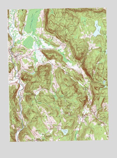
South Canaan, CT USGS Topographic Map
Click on map above to begin viewing in our Map Viewer.

This topographic map contains these locations and features:
Feature Name Type Latitude Longitude GNIS ID View Map
Adams BrookStreamN41.8893°W73.3573°205042View Map
Barrack CemeteryCemeteryN41.9216°W73.3188°205277View Map
Barrack MountainSummitN41.9298°W73.3387°205278View Map
Battle HillSummitN41.9612°W73.3571°205315View Map
Bear SwampSwampN41.9235°W73.2588°205354View Map
Bear Swamp PondReservoirN41.9254°W73.2532°205355View Map
Beebe HillSummitN41.9445°W73.3473°205407View Map
Bradford BrookStreamN41.8965°W73.2840°205664View Map
Bradford MountainSummitN41.9895°W73.2934°205667View Map
Brown BrookStreamN41.9265°W73.2809°205765View Map
Camp FreedmanLocaleN41.9409°W73.3412°205949View Map
Camp Freedman PondReservoirN41.9393°W73.3434°1771187View Map
Camp Freedman Pond DamDamN41.9407°W73.3415°1771186View Map
Canaan Historical LibraryBuildingN41.9548°W73.3643°1931853View Map
Canaan Historical Society LibraryBuildingN41.9548°W73.3643°1931854View Map
Canaan MountainSummitN41.9848°W73.2815°205999View Map
Cherry HillSummitN41.8845°W73.3418°206221View Map
Childs PondReservoirN41.9418°W73.3544°206260View Map
Cobble HillSummitN41.9570°W73.3221°206340View Map
Cornwall Consolidated Elementary SchoolSchoolN41.8768°W73.3415°206467View Map
Cornwall HollowLocaleN41.8976°W73.2826°206468View Map
Cornwall Volunteer Fire DepartmentBuildingN41.8754°W73.3411°2420389View Map
Cream HillSummitN41.9001°W73.3212°206509View Map
Cream Hill Agricultural School (historical)SchoolN41.8768°W73.3418°1931915View Map
Cream Hill LakeLakeN41.8839°W73.3053°206510View Map
Cream Hill Lake DamDamN41.8862°W73.3096°1771509View Map
Cream HollowValleyN41.9023°W73.3079°206511View Map
David M Hunt Library and School AssociationBuildingN41.9565°W73.3615°1931918View Map
Dean RavineValleyN41.9209°W73.3523°206636View Map
Deming BrookStreamN41.9593°W73.3087°206661View Map
Falls VillagePopulated PlaceN41.9559°W73.3632°207025View Map
Falls Village Census Designated PlaceCensusN41.9576°W73.3562°2631562View Map
Falls Village Congregational ChurchChurchN41.9559°W73.3623°1931954View Map
Falls Village Historic DistrictParkN41.9562°W73.3651°1931955View Map
Falls Village Post OfficePost OfficeN41.9547°W73.3615°1931956View Map
Falls Village Volunteer Fire DepartmentBuildingN41.9544°W73.3644°2420240View Map
Flat BrookStreamN41.9484°W73.3215°207108View Map
Great FallsFallsN41.9629°W73.3710°207438View Map
Great Falls DamDamN41.9628°W73.3713°1771184View Map
Great Falls ReservoirReservoirN41.9634°W73.3729°1771185View Map
Hedden PondLakeN41.8813°W73.3346°207765View Map
Hollenbeck PondReservoirN41.9236°W73.2770°207890View Map
Hollenbeck RiverStreamN41.9745°W73.3685°207891View Map
Hough MountainSummitN41.9151°W73.3490°207977View Map
Housatonic State ForestForestN41.9162°W73.3093°207979View Map
Howe MountainSummitN41.9073°W73.2990°207986View Map
Hunt Memorial CemeteryCemeteryN41.9608°W73.3642°208029View Map
HuntsvillePopulated PlaceN41.9448°W73.3126°212485View Map
Johnson HollowValleyN41.8761°W73.2897°208184View Map
Keep SwampSwampN41.9970°W73.3188°208235View Map
Kellogg PondLakeN41.9544°W73.3503°208241View Map
Ledgy BrookStreamN41.9615°W73.3121°208429View Map
Lee H Kellogg SchoolSchoolN41.9556°W73.3590°1932127View Map
Lookout PointCliffN41.9351°W73.3596°208594View Map
Lower CityPopulated PlaceN41.9248°W73.2762°212496View Map
Lower City CemeteryCemeteryN41.9328°W73.2793°208620View Map
Munson CemeteryCemeteryN41.9650°W73.2713°209146View Map
Music MountainSummitN41.9148°W73.3226°209155View Map
North Branch Brown BrookStreamN41.9306°W73.2704°209319View Map
Ocain BrookStreamN41.9034°W73.2782°209455View Map
Old Man McMullen PondLakeN41.9580°W73.2508°209485View Map
Pine GrovePopulated PlaceN41.9998°W73.3546°209770View Map
Pond HillSummitN41.8915°W73.2993°209903View Map
Preston BrookStreamN41.9062°W73.3601°209983View Map
Rattlesnake HillSummitN41.8790°W73.3260°210109View Map
Red Spruce SwampSwampN41.9879°W73.2785°1932314View Map
Reed BrookStreamN41.9176°W73.3607°210153View Map
Regional High SchoolSchoolN41.9373°W73.3626°210161View Map
Robbins SwampSwampN41.9925°W73.3424°210237View Map
Roberts HillSummitN41.8895°W73.2584°210240View Map
Root CemeteryCemeteryN41.9738°W73.2770°210294View Map
Rugg HillSummitN41.9020°W73.3460°210345View Map
Saint Patricks CemeteryCemeteryN41.9658°W73.3672°210560View Map
Salmon CreekStreamN41.9356°W73.3660°210614View Map
Sand Hill CemeteryCemeteryN41.9519°W73.3245°210629View Map
Sedgwick CemeteryCemeteryN41.8928°W73.2817°210744View Map
Seldom Seen PondLakeN41.9744°W73.2507°210757View Map
South CanaanPopulated PlaceN41.9618°W73.3335°212568View Map
Stone Man MountainSummitN41.9570°W73.2829°212387View Map
Swamp BrookStreamN41.9765°W73.3465°211310View Map
TarradiddleSummitN41.8812°W73.3571°211360View Map
The CoveBayN41.9648°W73.3710°1931912View Map
Titus MountainSummitN41.9131°W73.2843°211480View Map
Town of CanaanCivilN41.9598°W73.3102°213402View Map
Under Mountain CemeteryCemeteryN41.9650°W73.3028°208486View Map
Waller HillSummitN41.8970°W73.3404°211779View Map
Wangum LakeLakeN41.9798°W73.2622°211799View Map
Wangum Lake BrookStreamN41.9656°W73.3379°211800View Map
Wangum Lake DamDamN41.9806°W73.2612°1771188View Map
Wapato PondLakeN41.9298°W73.2546°211804View Map
Wapato Pond DamDamN41.9294°W73.2562°1771049View Map
Wetauwanchu BrookStreamN41.9587°W73.3712°212038View Map
Whiting BrookStreamN41.9698°W73.3385°212090View Map
Wildcat HollowValleyN41.9854°W73.3710°212129View Map
Yale University Forestry SchoolSchoolN41.9476°W73.2618°212301View Map
Yelping HillPopulated PlaceN41.9048°W73.2987°212602View Map

Note: Coordinates in the location and feature list above are referenced to NAD83 datum.


Copyright (C) 2008-2024 Ryan Niemi / Sunset Dynamics ... All Rights Reserved