TopoQuest Logo
Do you find TopoQuest useful?
Help keep TopoQuest running and adding new maps/features by donating!
Bitcoin:  19c7KJd3qBynnjoSw5npx9KScwjBe4ifkT
Litecoin:  LXs6TkuXGGXo1vDsWCkWVdjQX94eUKd6ui
Home View Maps Find Maps Find Places Resources & Links


Imlay City, Michigan Topographic Map

USGS Map Title: Imlay City, MI
USGS Map MRC: 43083A1
DRG (GeoTIFF) Download: o43083a1.tif


Neighboring USGS Topographic Map Quads:


  North Branch, MI  
43083B2
 

  Burnside, MI  
43083B1
 

  Brown City, MI  
43082B8
 

  Attica, MI  
43083A2
 

  Imlay City, MI  
43083A1
 

  Capac, MI  
43082A8
 

  Thornville, MI  
42083H2
 

  Almont, MI  
42083H1
 

  Allenton, MI  
42082H8


Map MRC Location:

N44°
W84°
N44°
W83°
H8 H7 H6 H5 H4 H3 H2 H1
G8 G7 G6 G5 G4 G3 G2 G1
F8 F7 F6 F5 F4 F3 F2 F1
E8 E7 E6 E5 E4 E3 E2 E1
D8 D7 D6 D5 D4 D3 D2 D1
C8 C7 C6 C5 C4 C3 C2 C1
B8 B7 B6 B5 B4 B3 B2 B1
A8 A7 A6 A5 A4 A3 A2 A1
N43°
W84°
N43°
W83°

Imlay City, MI USGS 1:24K Topographic Map Preview:
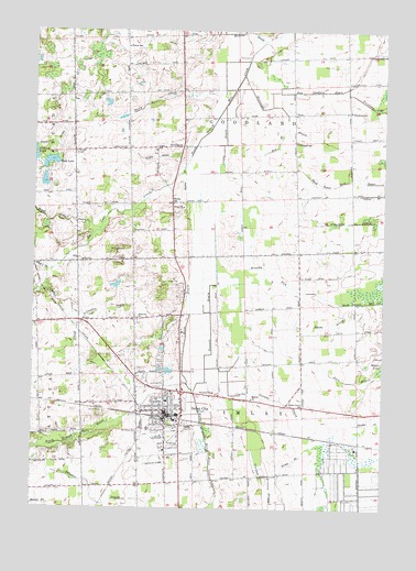
Imlay City, MI USGS Topographic Map
Click on map above to begin viewing in our Map Viewer.

This topographic map contains these locations and features:
Feature Name Type Latitude Longitude GNIS ID View Map
Anchor DrainCanalN43.0864°W83.0716°620083View Map
Assembly of God ChurchChurchN43.0517°W83.0542°2575654View Map
Bass LakeLakeN43.0905°W83.1192°620685View Map
Belle Valley PlazaLocaleN43.0311°W83.0728°2575729View Map
Borland Elementary SchoolSchoolN43.0125°W83.0753°2575722View Map
Brandy RunCanalN43.0597°W83.0424°621893View Map
Bunde DrainCanalN43.0478°W83.0174°622253View Map
Cadillac DrainCanalN43.0517°W83.0991°622425View Map
Cedar Medical CenterHospitalN43.0175°W83.0725°2575670View Map
Christ Evangelical Lutheran ChurchChurchN43.0069°W83.0775°2575653View Map
City of Imlay CityCivilN43.0169°W83.0764°1626510View Map
Clarks Corner DrainCanalN43.0292°W83.0397°623376View Map
Clarks Corner SchoolSchoolN43.0267°W83.0283°623377View Map
Cole SchoolSchoolN43.0931°W83.1108°623593View Map
Complete Family Health CareHospitalN43.0297°W83.0703°2575669View Map
Crowe DrainCanalN43.0953°W83.0577°624144View Map
Devall DrainCanalN43.0959°W83.1188°624591View Map
East Goodland DrainCanalN43.1092°W83.0233°625188View Map
Eastern Michigan FairgroundsLocaleN43.0153°W83.0744°2575717View Map
Elk Lake CreekStreamN43.0900°W83.0713°625457View Map
Family of Christ Lutheran ChurchChurchN43.0303°W83.0597°2575661View Map
First Baptist ChurchChurchN43.0206°W83.0792°2575656View Map
First Congregational ChurchChurchN43.0264°W83.0764°2575659View Map
Flansburg SchoolSchoolN43.1039°W83.0124°626140View Map
Folsom SchoolSchoolN43.1206°W83.0927°626210View Map
GoodlandPopulated PlaceN43.0947°W83.0724°1617590View Map
Goodland Post Office (historical)Post OfficeN43.0947°W83.0725°2575335View Map
Goodland Township CemeteryCemeteryN43.0939°W83.0717°2575798View Map
Goodland Township Fire DepartmentBuildingN43.1052°W83.0715°2620061View Map
Grand Trunk Depot Historical MarkerParkN43.0236°W83.0747°2571262View Map
Hughes DrainCanalN43.0225°W83.0035°628780View Map
Hunt DrainCanalN43.0514°W83.0691°628817View Map
Imlay CemeteryCemeteryN43.0384°W83.0794°629044View Map
Imlay Church of the NazareneChurchN43.0281°W83.0781°2575658View Map
Imlay CityPopulated PlaceN43.0247°W83.0777°628928View Map
Imlay City Christian Reformed ChurchChurchN43.0286°W83.0717°2575664View Map
Imlay City Church of ChristChurchN43.0311°W83.0708°2575660View Map
Imlay City Fire DepartmentBuildingN43.0237°W83.0734°2575671View Map
Imlay City High SchoolSchoolN43.0194°W83.0833°2575724View Map
Imlay City Historical MarkerParkN43.0236°W83.0747°2571263View Map
Imlay City Middle SchoolSchoolN43.0206°W83.0833°2575719View Map
Imlay City MuseumBuildingN43.0247°W83.0747°2575672View Map
Imlay City Police DepartmentBuildingN43.0244°W83.0724°2737456View Map
Imlay City Post OfficePost OfficeN43.0244°W83.0772°2575666View Map
Imlay City StationLocaleN43.0236°W83.0778°2575675View Map
Imlay Post Office (historical)Post OfficeN43.0500°W83.0889°2575333View Map
Indian CemeteryCemeteryN43.1180°W83.0319°2575797View Map
Jurn DrainCanalN43.0334°W83.0102°629425View Map
Kerney ParkParkN43.0272°W83.0764°2575727View Map
Kingdom Hall of Jehovah's WitnessesChurchN43.0656°W83.0778°2575662View Map
Kruse DrainCanalN43.0128°W83.0316°629882View Map
Lapeer County Emergency Medical Services Station 3BuildingN43.0238°W83.0734°2662122View Map
Lapeer County LibraryBuildingN43.0919°W83.0722°2575668View Map
Lions ParkParkN43.0275°W83.0883°2575728View Map
Lombar DrainCanalN43.0528°W83.1113°630888View Map
Maple Grove Mobile Home CommunitiesPopulated PlaceN43.0033°W83.0806°2575716View Map
Methodist Church of Imlay CityChurchN43.0258°W83.0772°2575657View Map
Michigan Department of Natural Resources Imlay City Field OfficeBuildingN43.0153°W83.0700°2620062View Map
Mount Calvary CemeteryCemeteryN43.0203°W83.0866°632778View Map
Nazarene ChurchChurchN43.0497°W83.0877°633243View Map
Pennell DrainCanalN43.0497°W83.0616°634588View Map
Pentecostal ChurchChurchN43.0359°W83.0724°634609View Map
Pickerel LakeLakeN43.0925°W83.1246°634798View Map
Rotary ParkParkN43.0222°W83.0750°2575726View Map
Ruth Hughes Memorial LibraryBuildingN43.0258°W83.0778°2575667View Map
Saint Paul's Lutheran ChurchChurchN43.0258°W83.0708°2575665View Map
Sheppard SchoolSchoolN43.0959°W83.0322°637743View Map
Stevenson DrainCanalN43.1036°W83.0358°638814View Map
Stony CreekStreamN43.1097°W83.0544°638893View Map
Stuart CemeteryCemeteryN43.1167°W83.0722°2575796View Map
Township of GoodlandCivilN43.1097°W83.0528°1626363View Map
Township of ImlayCivilN43.0233°W83.0459°1626509View Map
Trinity Baptist ChurchChurchN43.0219°W83.0767°2575655View Map
Venture High SchoolSchoolN43.0181°W83.0728°2575721View Map
Veteran's ParkParkN43.0175°W83.0792°2575725View Map
Walker SchoolSchoolN43.0797°W83.0755°1615703View Map
West Branch Stevenson DrainCanalN43.0959°W83.0385°1616073View Map
West Goodland United Methodist ChurchChurchN43.0797°W83.0753°2575663View Map
Weston Elementary SchoolSchoolN43.0206°W83.0819°2575718View Map
Wilkie DrainCanalN43.0917°W83.0816°1616480View Map

Note: Coordinates in the location and feature list above are referenced to NAD83 datum.


Copyright (C) 2008-2024 Ryan Niemi / Sunset Dynamics ... All Rights Reserved