TopoQuest Logo
Do you find TopoQuest useful?
Help keep TopoQuest running and adding new maps/features by donating!
Bitcoin:  19c7KJd3qBynnjoSw5npx9KScwjBe4ifkT
Litecoin:  LXs6TkuXGGXo1vDsWCkWVdjQX94eUKd6ui
Home View Maps Find Maps Find Places Resources & Links


North Branch, Minnesota Topographic Map

USGS Map Title: North Branch, MN
USGS Map MRC: 45092E8
DRG (GeoTIFF) Download: o45092e8.tif


Neighboring USGS Topographic Map Quads:


  Rush Lake, MN  
45093F1
 

  Rush City, MN  
45092F8
 

  Randall, WI  
45092F7
 

  Stark, MN  
45093E1
 

  North Branch, MN  
45092E8
 

  Sunrise, MN  
45092E7
 

  Typo Lake, MN  
45093D1
 

  Stacy, MN  
45092D8
 

  Lindstrom, MN  
45092D7


Map MRC Location:

N46°
W93°
N46°
W92°
H8 H7 H6 H5 H4 H3 H2 H1
G8 G7 G6 G5 G4 G3 G2 G1
F8 F7 F6 F5 F4 F3 F2 F1
E8 E7 E6 E5 E4 E3 E2 E1
D8 D7 D6 D5 D4 D3 D2 D1
C8 C7 C6 C5 C4 C3 C2 C1
B8 B7 B6 B5 B4 B3 B2 B1
A8 A7 A6 A5 A4 A3 A2 A1
N45°
W93°
N45°
W92°

North Branch, MN USGS 1:24K Topographic Map Preview:
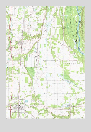
North Branch, MN USGS Topographic Map
Click on map above to begin viewing in our Map Viewer.

This topographic map contains these locations and features:
Feature Name Type Latitude Longitude GNIS ID View Map
Abundant Life ChurchChurchN45.5128°W92.9781°2069086View Map
Allina Medical North Branch CenterHospitalN45.5092°W92.9906°2069083View Map
Branch Mobile Home ParkPopulated PlaceN45.5128°W92.9906°2069076View Map
Camp SunriseLocaleN45.6072°W92.9133°1814964View Map
Central ParkParkN45.5119°W92.9817°2069120View Map
Checkerboard County ParkParkN45.5147°W92.9008°1814958View Map
Chisago CountyCivilN45.5025°W92.9083°659458View Map
City of Branch (historical)CivilN45.5137°W92.9601°2628228View Map
City of HarrisCivilN45.5976°W92.9868°2394302View Map
City of North BranchCivilN45.5137°W92.9601°2395250View Map
County Ditch Number ThreeCanalN45.5286°W92.9288°1814962View Map
Faith Community FellowshipChurchN45.5047°W92.9806°2069094View Map
Firemens ParkParkN45.5867°W92.9903°2069131View Map
Goose CreekStreamN45.5825°W92.8847°644234View Map
Goose Creek North Bound Rest AreaLocaleN45.5992°W92.9931°2069178View Map
Green Acres CemeteryCemeteryN45.5069°W92.9486°2069025View Map
Green Acres Country Care CenterHospitalN45.5039°W92.9489°2069116View Map
Harder ParkParkN45.5214°W92.9536°2069121View Map
HarrisPopulated PlaceN45.5863°W92.9747°644685View Map
HarrisLocaleN45.5847°W92.9750°2069134View Map
Harris City HallBuildingN45.5864°W92.9758°2069138View Map
Harris City ParkParkN45.5847°W92.9750°2069133View Map
Harris Covenant ChurchChurchN45.5844°W92.9769°2069141View Map
Harris Fire DepartmentBuildingN45.5820°W92.9733°2069137View Map
Harris First Lutheran ChurchChurchN45.5833°W92.9778°2069140View Map
Harris Post OfficePost OfficeN45.5847°W92.9757°2069139View Map
Interchange 147CrossingN45.5100°W92.9917°2069160View Map
Interchange 152CrossingN45.5778°W92.9917°2069159View Map
Lagoo CreekStreamN45.6169°W92.8841°1567720View Map
Lakes Region Emergency Medical Services North BranchBuildingN45.5255°W92.9726°2721301View Map
Living Branch Lutheran ChurchChurchN45.5056°W92.9597°2069095View Map
Lutheran Church CemeteryCemeteryN45.5860°W92.9825°2069024View Map
Minnesota's Arrowhead Region: A Tourist Mecca Historical MarkerParkN45.5992°W92.9931°2069177View Map
Mission Covenant CemeteryCemeteryN45.5794°W92.9849°1814963View Map
North BranchLocaleN45.5125°W92.9833°2069092View Map
North BranchPopulated PlaceN45.5114°W92.9802°648609View Map
North Branch Area High SchoolSchoolN45.5018°W92.9690°2069115View Map
North Branch Area LibraryBuildingN45.5111°W92.9811°2069079View Map
North Branch Area Middle SchoolSchoolN45.5076°W92.9664°2069113View Map
North Branch City HallBuildingN45.5125°W92.9811°2069077View Map
North Branch ClinicHospitalN45.5092°W92.9758°2069082View Map
North Branch Golf CourseLocaleN45.5083°W92.9778°2069110View Map
North Branch Mobile Home ParkPopulated PlaceN45.5083°W92.9861°2069111View Map
North Branch Police DepartmentBuildingN45.5129°W92.9784°2069078View Map
North Branch Post OfficePost OfficeN45.5129°W92.9776°2069080View Map
North Branch Primary SchoolSchoolN45.5106°W92.9694°2069114View Map
Northwoods ParkParkN45.5231°W92.9811°2069118View Map
Oak Grove CemeteryCemeteryN45.5613°W92.9767°648797View Map
Oakwood CourtPopulated PlaceN45.5056°W92.9794°2069081View Map
Peaceful Valley Mobile Home ParkPopulated PlaceN45.5500°W92.9500°2069136View Map
Pine IslandIslandN45.5647°W92.9508°649463View Map
Pinetree Airpark (historical)AirportN45.5803°W92.9651°2676854View Map
Riverwalk ParkParkN45.5239°W92.9783°2069119View Map
Saint Croix Wild River State ParkParkN45.5680°W92.8758°1815021View Map
Saint Gregory's Catholic ChurchChurchN45.5097°W92.9792°2069085View Map
Schoolyard ParkParkN45.5867°W92.9714°2069130View Map
Spring Hill ParkParkN45.5194°W92.9494°1814959View Map
Stark FieldParkN45.5819°W92.9806°2069132View Map
The Church of Jesus Christ of Latter Day SaintsChurchN45.5114°W92.9800°2069087View Map
Tower ParkParkN45.5189°W92.9811°2069117View Map
Township of SunriseCivilN45.5544°W92.8843°665745View Map
Trinity Christian SchoolSchoolN45.5058°W92.9694°2069091View Map
Trinity ChurchChurchN45.5058°W92.9694°1814960View Map
Trinity Lutheran CemeteryCemeteryN45.5147°W92.9874°1814961View Map
United Methodist ChurchChurchN45.5117°W92.9761°2069084View Map

Note: Coordinates in the location and feature list above are referenced to NAD83 datum.


Copyright (C) 2008-2025 Ryan Niemi / Sunset Dynamics ... All Rights Reserved