TopoQuest Logo
Do you find TopoQuest useful?
Help keep TopoQuest running and adding new maps/features by donating!
Bitcoin:  19c7KJd3qBynnjoSw5npx9KScwjBe4ifkT
Litecoin:  LXs6TkuXGGXo1vDsWCkWVdjQX94eUKd6ui
Home View Maps Find Maps Find Places Resources & Links


Belmont, Virginia Topographic Map

USGS Map Title: Belmont, VA
USGS Map MRC: 38077B7
DRG (GeoTIFF) Download: o38077b7.tif


Neighboring USGS Topographic Map Quads:


  Unionville, VA  
38077C8
 

  Mine Run, VA  
38077C7
 

  Chancellorsville, VA  
38077C6
 

  Lahore, VA  
38077B8
 

  Belmont, VA  
38077B7
 

  Brokenburg, VA  
38077B6
 

  Mineral, VA  
38077A8
 

  Lake Anna West, VA  
38077A7
 

  Lake Anna East, VA  
38077A6


Map MRC Location:

N39°
W78°
N39°
W77°
H8 H7 H6 H5 H4 H3 H2 H1
G8 G7 G6 G5 G4 G3 G2 G1
F8 F7 F6 F5 F4 F3 F2 F1
E8 E7 E6 E5 E4 E3 E2 E1
D8 D7 D6 D5 D4 D3 D2 D1
C8 C7 C6 C5 C4 C3 C2 C1
B8 B7 B6 B5 B4 B3 B2 B1
A8 A7 A6 A5 A4 A3 A2 A1
N38°
W78°
N38°
W77°

Belmont, VA USGS 1:24K Topographic Map Preview:
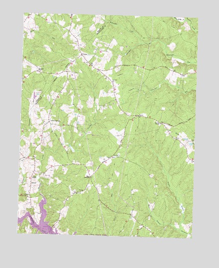
Belmont, VA USGS Topographic Map
Click on map above to begin viewing in our Map Viewer.

This topographic map contains these locations and features:
Feature Name Type Latitude Longitude GNIS ID View Map
Adams BranchStreamN38.1279°W77.8589°1740255View Map
Bells CrossroadPopulated PlaceN38.1582°W77.8239°1477106View Map
BelmontPopulated PlaceN38.1537°W77.8661°1492549View Map
Belmont ChapelChurchN38.1568°W77.8658°1463061View Map
Belmont Community Center (historical)BuildingN38.1546°W77.8667°1740169View Map
Branch Fork Baptist Church CemeteryCemeteryN38.1489°W77.8351°1740171View Map
Branch Fork ChurchChurchN38.1490°W77.8347°1463755View Map
Childs CovePopulated PlaceN38.1311°W77.8525°2071714View Map
Childs CoveBayN38.1315°W77.8539°1740269View Map
Craigs ChurchChurchN38.2218°W77.8258°1465403View Map
Craigs Church Baptist Church CemeteryCemeteryN38.2218°W77.8247°1740176View Map
Dillards BridgeBridgeN38.1346°W77.8661°1740273View Map
Fellowship ChurchChurchN38.2124°W77.8103°1466524View Map
Granite SpringsPopulated PlaceN38.1885°W77.8544°1467349View Map
Hunters LandingLocaleN38.1340°W77.8692°1740294View Map
JonesPopulated PlaceN38.1701°W77.8092°1477449View Map
Knights BranchStreamN38.1293°W77.7589°1469067View Map
Livingston ParkParkN38.1937°W77.7858°1740204View Map
LoganPopulated PlaceN38.2176°W77.7611°1477497View Map
Mastins CornerPopulated PlaceN38.1899°W77.7750°1477525View Map
McCracken CreekStreamN38.2346°W77.7905°1470245View Map
Mount Hermon Baptist Church CemeteryCemeteryN38.1463°W77.8687°1740210View Map
Mount Hermon ChurchChurchN38.1462°W77.8683°1470889View Map
Music BranchStreamN38.1296°W77.7586°1471285View Map
Olivet ChurchChurchN38.1693°W77.8108°1471918View Map
Olivet United Methodist Church CemeteryCemeteryN38.1696°W77.8101°1740214View Map
PanierPopulated PlaceN38.1810°W77.7636°1477609View Map
PaytesPopulated PlaceN38.2274°W77.8328°1472139View Map
Perkinson PointCapeN38.1349°W77.8581°1740310View Map
Plentiful CreekStreamN38.1482°W77.8589°1472523View Map
PortersPopulated PlaceN38.1937°W77.7914°1477641View Map
Prince DominionPopulated PlaceN38.1342°W77.8486°2071715View Map
Rams LakeReservoirN38.1813°W77.7564°1490884View Map
Rams Lake DamDamN38.1818°W77.7564°1490883View Map
Richards ShopLocaleN38.2171°W77.8633°1473185View Map
Seven Gables AirportAirportN38.1632°W77.8414°2717080View Map
Shanty Bridge CreekStreamN38.2485°W77.7586°1474433View Map
Spotsylvania County Fire and Rescue Station 9BuildingN38.1533°W77.8665°2075173View Map
StubbsPopulated PlaceN38.1504°W77.8286°1493666View Map
Stubbs BridgeBridgeN38.1271°W77.8514°1740244View Map
True Light CemeteryCemeteryN38.1701°W77.8058°1740248View Map
True Light ChurchChurchN38.1704°W77.8058°1475898View Map
White Owl LandingPopulated PlaceN38.1364°W77.8428°2071716View Map

Note: Coordinates in the location and feature list above are referenced to NAD83 datum.


Copyright (C) 2008-2025 Ryan Niemi / Sunset Dynamics ... All Rights Reserved