TopoQuest Logo
Do you find TopoQuest useful?
Help keep TopoQuest running and adding new maps/features by donating!
Bitcoin:  19c7KJd3qBynnjoSw5npx9KScwjBe4ifkT
Litecoin:  LXs6TkuXGGXo1vDsWCkWVdjQX94eUKd6ui
Home View Maps Find Maps Find Places Resources & Links


Brokenburg, Virginia Topographic Map

USGS Map Title: Brokenburg, VA
USGS Map MRC: 38077B6
DRG (GeoTIFF) Download: o38077b6.tif


Neighboring USGS Topographic Map Quads:


  Mine Run, VA  
38077C7
 

  Chancellorsville, VA  
38077C6
 

  Salem Church, VA  
38077C5
 

  Belmont, VA  
38077B7
 

  Brokenburg, VA  
38077B6
 

  Spotsylvania, VA  
38077B5
 

  Lake Anna West, VA  
38077A7
 

  Lake Anna East, VA  
38077A6
 

  Ladysmith, VA  
38077A5


Map MRC Location:

N39°
W78°
N39°
W77°
H8 H7 H6 H5 H4 H3 H2 H1
G8 G7 G6 G5 G4 G3 G2 G1
F8 F7 F6 F5 F4 F3 F2 F1
E8 E7 E6 E5 E4 E3 E2 E1
D8 D7 D6 D5 D4 D3 D2 D1
C8 C7 C6 C5 C4 C3 C2 C1
B8 B7 B6 B5 B4 B3 B2 B1
A8 A7 A6 A5 A4 A3 A2 A1
N38°
W78°
N38°
W77°

Brokenburg, VA USGS 1:24K Topographic Map Preview:
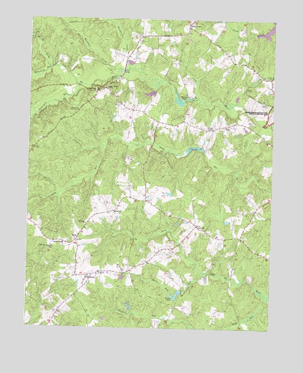
Brokenburg, VA USGS Topographic Map
Click on map above to begin viewing in our Map Viewer.

This topographic map contains these locations and features:
Feature Name Type Latitude Longitude GNIS ID View Map
AlsopPopulated PlaceN38.2071°W77.6494°1477069View Map
Black Rock RunStreamN38.1476°W77.6583°1463505View Map
BrokenburgPopulated PlaceN38.1457°W77.7189°1477145View Map
Catharpin RunStreamN38.2232°W77.7236°1464541View Map
Corbin BridgeBridgeN38.2293°W77.7017°1465239View Map
Dillard BridgeBridgeN38.1474°W77.6558°1465796View Map
Flythe DamDamN38.1318°W77.6964°1490869View Map
Flythe PondReservoirN38.1344°W77.6969°1490870View Map
Glady RunStreamN38.1885°W77.6422°1467128View Map
Goshen Baptist CemeteryCemeteryN38.2269°W77.6268°1740187View Map
Goshen ChurchChurchN38.2265°W77.6264°1467277View Map
Greenfield CreekStreamN38.2301°W77.6989°1467499View Map
Hebron Baptist Church CemeteryCemeteryN38.1466°W77.7125°1740190View Map
Hebron ChurchChurchN38.1471°W77.7119°1467904View Map
Jennings PondReservoirN38.1978°W77.6651°1502046View Map
Jennings Pond DamDamN38.1971°W77.6603°1490885View Map
Lanes CornerPopulated PlaceN38.1596°W77.7361°1477471View Map
Lebanon Church (historical)ChurchN38.1382°W77.7258°1740201View Map
Little Mine Road CemeteryCemeteryN38.1574°W77.7378°1740203View Map
Little Mine Road ChurchChurchN38.1571°W77.7378°1469595View Map
Livingston DistrictCivilN38.1892°W77.7493°1927378View Map
MargoPopulated PlaceN38.1607°W77.7242°1477520View Map
McHenryPopulated PlaceN38.1721°W77.7061°1493270View Map
Mine Road CemeteryCemeteryN38.1678°W77.7195°1740209View Map
Mine Road ChurchChurchN38.1671°W77.7197°1470593View Map
Norton ProngStreamN38.2301°W77.7386°1471670View Map
Olivers CornerPopulated PlaceN38.2060°W77.6558°1477592View Map
Piltzer CreekStreamN38.2182°W77.6636°1472324View Map
Post OakPopulated PlaceN38.1662°W77.6633°1477642View Map
Robertson RunStreamN38.2301°W77.7386°1473324View Map
Shady Grove CemeteryCemeteryN38.2218°W77.7161°1740226View Map
Shady Grove ChurchChurchN38.2210°W77.7158°1474204View Map
Shady Grove CornerPopulated PlaceN38.2218°W77.7111°1493540View Map
Spotsylvania Camp MeetingLocaleN38.2329°W77.6386°1740231View Map
Spotsylvania CountyCivilN38.1850°W77.6560°1480172View Map
Spotsylvania County Fire Station 2BuildingN38.1255°W77.7395°2075197View Map
Spotsylvania County Rescue Station 2BuildingN38.1259°W77.7389°2331749View Map
Spotsylvania High SchoolSchoolN38.1600°W77.6537°1740237View Map
Spotsylvania Lookout TowerTowerN38.2132°W77.7244°1491255View Map
Todds TavernPopulated PlaceN38.2482°W77.6686°1493712View Map
Towles PondReservoirN38.1388°W77.6730°1475806View Map
Towleys DamDamN38.1401°W77.6703°1490877View Map
Whitehall CreekStreamN38.2296°W77.7047°1476653View Map
WPLC-FM (Spotsylvania)TowerN38.1421°W77.6936°1499007View Map
Wrights PondReservoirN38.2175°W77.6726°1502121View Map
Wrights Pond DamDamN38.2176°W77.6667°1490886View Map

Note: Coordinates in the location and feature list above are referenced to NAD83 datum.


Copyright (C) 2008-2025 Ryan Niemi / Sunset Dynamics ... All Rights Reserved