TopoQuest Logo
Do you find TopoQuest useful?
Help keep TopoQuest running and adding new maps/features by donating!
Bitcoin:  19c7KJd3qBynnjoSw5npx9KScwjBe4ifkT
Litecoin:  LXs6TkuXGGXo1vDsWCkWVdjQX94eUKd6ui
Home View Maps Find Maps Find Places Resources & Links


North Peak, Arizona Topographic Map

USGS Map Title: North Peak, AZ
USGS Map MRC: 34111B4
DRG (GeoTIFF) Download: o34111b4.tif


Neighboring USGS Topographic Map Quads:


  Cane Springs Mountain, AZ  
34111C5
 

  Buckhead Mesa, AZ  
34111C4
 

  Payson North, AZ  
34111C3
 

  Cypress Butte, AZ  
34111B5
 

  North Peak, AZ  
34111B4
 

  Payson South, AZ  
34111B3
 

  Table Mountain, AZ  
34111A5
 

  Mazatzal Peak, AZ  
34111A4
 

  Gisela, AZ  
34111A3


Map MRC Location:

N35°
W112°
N35°
W111°
H8 H7 H6 H5 H4 H3 H2 H1
G8 G7 G6 G5 G4 G3 G2 G1
F8 F7 F6 F5 F4 F3 F2 F1
E8 E7 E6 E5 E4 E3 E2 E1
D8 D7 D6 D5 D4 D3 D2 D1
C8 C7 C6 C5 C4 C3 C2 C1
B8 B7 B6 B5 B4 B3 B2 B1
A8 A7 A6 A5 A4 A3 A2 A1
N34°
W112°
N34°
W111°

North Peak, AZ USGS 1:24K Topographic Map Preview:
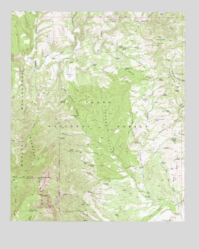
North Peak, AZ USGS Topographic Map
Click on map above to begin viewing in our Map Viewer.

This topographic map contains these locations and features:
Feature Name Type Latitude Longitude GNIS ID View Map
American GulchValleyN34.2448°W111.4199°25625View Map
Arrastre GulchValleyN34.1748°W111.4032°25768View Map
Arrastre TankReservoirN34.1909°W111.3867°25769View Map
Barnett SpringSpringN34.1960°W111.4652°25986View Map
Booth SpringSpringN34.1293°W111.4254°26609View Map
Boyd MountainSummitN34.1425°W111.4462°26695View Map
Boyd Mountain SpringSpringN34.1471°W111.4306°26696View Map
Browse TankReservoirN34.2188°W111.4420°26800View Map
Brushy HollowValleyN34.2009°W111.4974°26831View Map
Callahan CreekStreamN34.1536°W111.4162°27182View Map
Callahan MineMineN34.2056°W111.3824°27183View Map
Callahan TankReservoirN34.2035°W111.3799°27184View Map
City CreekStreamN34.2242°W111.4665°27677View Map
City Creek TrailheadLocaleN34.2159°W111.4646°40787View Map
City Creek WellWellN34.2153°W111.4785°39353View Map
Collom MineMineN34.1353°W111.4474°27822View Map
Collom SpringSpringN34.1356°W111.4471°2044824View Map
Cypress ThicketWoodsN34.1792°W111.4324°28232View Map
Delaware WashStreamN34.1581°W111.4057°28416View Map
Dennis CreekStreamN34.1625°W111.4229°28422View Map
Dennis SpringSpringN34.1667°W111.4584°28423View Map
Doll Baby RanchLocaleN34.2217°W111.4693°28525View Map
Doll Baby TrailheadLocaleN34.2150°W111.4776°40786View Map
Excursion MineMineN34.1973°W111.4037°28940View Map
Flume HollowValleyN34.2267°W111.4565°29075View Map
Gold HillSummitN34.1578°W111.4143°29386View Map
Gold Hill MineMineN34.1575°W111.4137°39467View Map
Gold Hill TankReservoirN34.1571°W111.4090°29388View Map
Goldfish TankReservoirN34.2279°W111.4089°29404View Map
Gould SpringsSpringN34.2284°W111.4181°29433View Map
Grapevine SpringSpringN34.2109°W111.3997°29524View Map
Grimes SpringSpringN34.2104°W111.3945°29605View Map
Hanging Rock SpringSpringN34.2157°W111.4189°29719View Map
Headquarters WellWellN34.2198°W111.4663°39498View Map
Hells HoleValleyN34.1723°W111.4899°29875View Map
Hi WindmillLocaleN34.1292°W111.3796°29919View Map
Hidden SpringSpringN34.2006°W111.3915°29939View Map
Hill CreekStreamN34.1873°W111.4532°29985View Map
Hill TankReservoirN34.2130°W111.3803°29986View Map
House CreekStreamN34.1556°W111.4182°30234View Map
House MineMineN34.1600°W111.4482°30235View Map
House Place SpringSpringN34.1587°W111.4408°30238View Map
Larsen SpringSpringN34.2290°W111.4235°30888View Map
Limestone CanyonValleyN34.2406°W111.4560°30971View Map
Little Green MineMineN34.1856°W111.3971°31073View Map
Little Maud MineMineN34.1773°W111.3762°31097View Map
Lousy GulchValleyN34.1884°W111.3751°31328View Map
Maggie MineMineN34.2092°W111.3760°31442View Map
Mantkin SpringSpringN34.1740°W111.3819°31489View Map
Marysville HillSummitN34.2109°W111.3865°31557View Map
Mazatzal Divide TrailTrailN34.1848°W111.4979°31613View Map
Mineral CreekStreamN34.1661°W111.4271°31903View Map
Mineral Creek TrailLocaleN34.1773°W111.4471°40794View Map
Mineral Creek TrailheadLocaleN34.1775°W111.4474°2056623View Map
Mineral SpringSpringN34.1743°W111.4624°31911View Map
Moore MountainSummitN34.1625°W111.3785°32005View Map
Moore WashStreamN34.1453°W111.3849°32009View Map
N B RanchLocaleN34.2220°W111.4885°32228View Map
North PeakSummitN34.1509°W111.4779°32388View Map
North Peak TrailTrailN34.1667°W111.4743°32389View Map
Pasture TankReservoirN34.2350°W111.3929°32711View Map
Pig SpringSpringN34.2224°W111.4269°32889View Map
Pine CreekStreamN34.2220°W111.4921°32925View Map
Pole Hollow CanyonValleyN34.2128°W111.4665°33084View Map
Pole Hollow SpringSpringN34.1874°W111.4530°33085View Map
Rock CreekStreamN34.1378°W111.3887°33704View Map
Rye Creek TankReservoirN34.1394°W111.4027°33901View Map
Saddle TankReservoirN34.2487°W111.3943°33935View Map
Saint Johns CreekStreamN34.1425°W111.4021°33957View Map
Sedge SpringSpringN34.2135°W111.4821°40795View Map
Simonton FlatFlatN34.2117°W111.4590°34454View Map
Snowstorm MountainSummitN34.2325°W111.3940°34595View Map
Snowstorm TankReservoirN34.2214°W111.3859°34596View Map
Summit CanyonValleyN34.2448°W111.4035°34941View Map
Surprise SpringSpringN34.2142°W111.4876°40796View Map
Table MountainSummitN34.1723°W111.4118°35093View Map
Table Mountain CanyonValleyN34.1703°W111.4068°35098View Map
The ParkFlatN34.1486°W111.4985°35236View Map
Thompson DrawValleyN34.1353°W111.3796°35281View Map
Waif MineMineN34.1942°W111.3762°35808View Map
Wonder GulchValleyN34.1892°W111.3807°36358View Map
Zulu MineMineN34.1564°W111.3857°36506View Map
Zulu TankReservoirN34.1689°W111.3915°36507View Map
Zulu Tank Number TwoReservoirN34.1603°W111.3930°36508View Map
Zulu WashStreamN34.1359°W111.3801°36509View Map

Note: Coordinates in the location and feature list above are referenced to NAD83 datum.


Copyright (C) 2008-2024 Ryan Niemi / Sunset Dynamics ... All Rights Reserved