TopoQuest Logo
Do you find TopoQuest useful?
Help keep TopoQuest running and adding new maps/features by donating!
Bitcoin:  19c7KJd3qBynnjoSw5npx9KScwjBe4ifkT
Litecoin:  LXs6TkuXGGXo1vDsWCkWVdjQX94eUKd6ui
Home View Maps Find Maps Find Places Resources & Links


North Village, Oklahoma Topographic Map

USGS Map Title: North Village, OK
USGS Map MRC: 35096H6
DRG (GeoTIFF) Download: o35096h6.tif


Neighboring USGS Topographic Map Quads:


  Twin Mounds, OK  
36096A7
 

  Yale, OK  
36096A6
 

  Oilton, OK  
36096A5
 

  Cushing, OK  
35096H7
 

  North Village, OK  
35096H6
 

  Drumright, OK  
35096H5
 

  Kendrick, OK  
35096G7
 

  Stroud North, OK  
35096G6
 

  Depew, OK  
35096G5


Map MRC Location:

N36°
W97°
N36°
W96°
H8 H7 H6 H5 H4 H3 H2 H1
G8 G7 G6 G5 G4 G3 G2 G1
F8 F7 F6 F5 F4 F3 F2 F1
E8 E7 E6 E5 E4 E3 E2 E1
D8 D7 D6 D5 D4 D3 D2 D1
C8 C7 C6 C5 C4 C3 C2 C1
B8 B7 B6 B5 B4 B3 B2 B1
A8 A7 A6 A5 A4 A3 A2 A1
N35°
W97°
N35°
W96°

North Village, OK USGS 1:24K Topographic Map Preview:
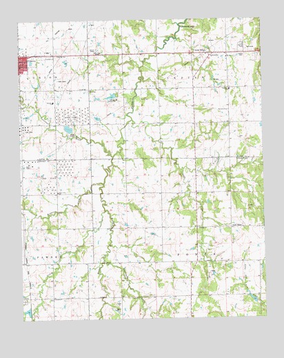
North Village, OK USGS Topographic Map
Click on map above to begin viewing in our Map Viewer.

This topographic map contains these locations and features:
Feature Name Type Latitude Longitude GNIS ID View Map
Cottonwood CreekStreamN35.9428°W96.7020°1091729View Map
Cushing Christian ChurchChurchN35.9781°W96.7497°1782805View Map
Cushing Country ClubLocaleN35.9667°W96.6992°1102003View Map
Cushing High SchoolSchoolN35.9837°W96.7420°1803942View Map
Euchee Valley Memorial ParkCemeteryN35.9849°W96.6963°2119755View Map
Happy Valley SchoolSchoolN35.9284°W96.7311°1093526View Map
Harmony Elementary SchoolSchoolN35.9660°W96.7330°1093555View Map
Harrell CemeteryCemeteryN35.9706°W96.7142°1093562View Map
Hunter CemeteryCemeteryN35.9667°W96.6867°1094024View Map
Immanuel ChurchChurchN35.8840°W96.7342°1094052View Map
Immanuel Lutheran CemeteryCemeteryN35.8836°W96.7339°2704478View Map
KUSH-AM (Cushing)TowerN35.9865°W96.7106°1102759View Map
Little Deep Fork Creek Site 1 DamDamN35.8817°W96.6286°1757791View Map
Little Deep Fork Creek Site 1 ReservoirReservoirN35.8832°W96.6319°1757792View Map
Little Deep Fork Creek Site 2 DamDamN35.9567°W96.6286°1757789View Map
Little Deep Fork Creek Site 2 ReservoirReservoirN35.9567°W96.6286°1757790View Map
Little Deep Fork Creek Site 3 DamDamN35.9467°W96.6303°1757787View Map
Little Deep Fork Creek Site 3 ReservoirReservoirN35.9458°W96.6291°1757788View Map
Living Word ChurchChurchN35.9837°W96.7456°1782814View Map
North VillagePopulated PlaceN35.9856°W96.6520°1096009View Map
Oak Grove ChurchChurchN35.9842°W96.6428°1096103View Map
Oak Grove Elementary SchoolSchoolN35.9707°W96.6421°1096109View Map
Oak Street Baptist ChurchChurchN35.9823°W96.7489°1782817View Map
Only Way ChurchChurchN35.9128°W96.6586°1096283View Map
Rattlesnake CreekStreamN35.8998°W96.7078°1097057View Map
Saint Leo CemeteryCemeteryN35.9706°W96.7153°1097621View Map
Sand CreekStreamN35.9584°W96.6917°1097747View Map
Silver Star CemeteryCemeteryN35.9853°W96.7309°1098051View Map
South VillagePopulated PlaceN35.9131°W96.6422°1100842View Map
Summit RidgeLocaleN35.9848°W96.7159°1763790View Map
Summit Ridge Shopping CenterLocaleN35.9848°W96.7159°1777982View Map
The Followers ChurchChurchN35.9620°W96.6422°1098833View Map
Township of IndianCivilN35.9751°W96.6614°1824866View Map
Township of PoncaCivilN35.8778°W96.6309°1824908View Map
Turkey CreekStreamN35.9201°W96.7070°1099035View Map
United Pentecostal ChurchChurchN35.9826°W96.7484°1782819View Map
Wildhorse CreekStreamN35.9317°W96.7070°1099794View Map

Note: Coordinates in the location and feature list above are referenced to NAD83 datum.


Copyright (C) 2008-2024 Ryan Niemi / Sunset Dynamics ... All Rights Reserved