TopoQuest Logo
Do you find TopoQuest useful?
Help keep TopoQuest running and adding new maps/features by donating!
Bitcoin:  19c7KJd3qBynnjoSw5npx9KScwjBe4ifkT
Litecoin:  LXs6TkuXGGXo1vDsWCkWVdjQX94eUKd6ui
Home View Maps Find Maps Find Places Resources & Links


Stroud North, Oklahoma Topographic Map

USGS Map Title: Stroud North, OK
USGS Map MRC: 35096G6
DRG (GeoTIFF) Download: o35096g6.tif


Neighboring USGS Topographic Map Quads:


  Cushing, OK  
35096H7
 

  North Village, OK  
35096H6
 

  Drumright, OK  
35096H5
 

  Kendrick, OK  
35096G7
 

  Stroud North, OK  
35096G6
 

  Depew, OK  
35096G5
 

  Davenport, OK  
35096F7
 

  Stroud South, OK  
35096F6
 

  Ritts Junction, OK  
35096F5


Map MRC Location:

N36°
W97°
N36°
W96°
H8 H7 H6 H5 H4 H3 H2 H1
G8 G7 G6 G5 G4 G3 G2 G1
F8 F7 F6 F5 F4 F3 F2 F1
E8 E7 E6 E5 E4 E3 E2 E1
D8 D7 D6 D5 D4 D3 D2 D1
C8 C7 C6 C5 C4 C3 C2 C1
B8 B7 B6 B5 B4 B3 B2 B1
A8 A7 A6 A5 A4 A3 A2 A1
N35°
W97°
N35°
W96°

Stroud North, OK USGS 1:24K Topographic Map Preview:
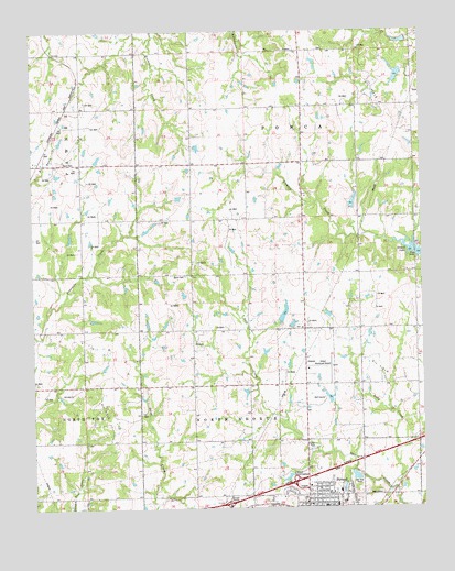
Stroud North, OK USGS Topographic Map
Click on map above to begin viewing in our Map Viewer.

This topographic map contains these locations and features:
Feature Name Type Latitude Longitude GNIS ID View Map
Black CemeteryCemeteryN35.8109°W96.7014°1090191View Map
Chapel of Faith ChurchChurchN35.7515°W96.6606°1810087View Map
City of StroudCivilN35.7680°W96.6473°2411990View Map
First Baptist ChurchChurchN35.7506°W96.6567°1810089View Map
First Church of the NazareneChurchN35.7542°W96.6609°1810088View Map
Henry CemeteryCemeteryN35.8403°W96.7403°1093671View Map
Lilly CreekStreamN35.7540°W96.6342°1094640View Map
Northeast Lincoln DivisionCivilN35.8227°W96.7080°1937792View Map
Oknoname 08109 DamDamN35.7984°W96.6703°1753017View Map
Oknoname 08109 ReservoirReservoirN35.7984°W96.6703°1753018View Map
Parkview Elementary SchoolSchoolN35.7568°W96.6532°1790728View Map
Plaza 66LocaleN35.7509°W96.6703°1778111View Map
Stroud Elementary SchoolSchoolN35.7509°W96.6539°1819373View Map
Stroud High SchoolSchoolN35.7540°W96.6557°1819371View Map
Stroud InterchangeCrossingN35.7565°W96.6675°1102088View Map
Stroud Middle SchoolSchoolN35.7545°W96.6523°1819372View Map
Stroud Municipal AirportAirportN35.7867°W96.6622°1102682View Map
Stroud Sewage LagoonReservoirN35.7582°W96.6473°1753020View Map
Stroud Sewage Lagoon DamDamN35.7584°W96.6453°1753019View Map
Tanger Factory Outlet CenterLocaleN35.7590°W96.6617°1778112View Map
Township of North KeokukCivilN35.7695°W96.6864°1824913View Map

Note: Coordinates in the location and feature list above are referenced to NAD83 datum.


Copyright (C) 2008-2025 Ryan Niemi / Sunset Dynamics ... All Rights Reserved