TopoQuest Logo
Do you find TopoQuest useful?
Help keep TopoQuest running and adding new maps/features by donating!
Bitcoin:  19c7KJd3qBynnjoSw5npx9KScwjBe4ifkT
Litecoin:  LXs6TkuXGGXo1vDsWCkWVdjQX94eUKd6ui
Home View Maps Find Maps Find Places Resources & Links


Belshazzar Mountain, Washington Topographic Map

USGS Map Title: Belshazzar Mountain, WA
USGS Map MRC: 48117H8
DRG (GeoTIFF) Download: o48117h8.tif


Neighboring USGS Topographic Map Quads:


  Churchill Mountain, WA  
48118H1
 

  Belshazzar Mountain, WA  
48117H8
 

  Northport, WA  
48117H7
 

  Bossburg, WA  
48118G1
 

  China Bend, WA  
48117G8
 

  Onion Creek, WA  
48117G7


Map MRC Location:

N49°
W118°
N49°
W117°
H8 H7 H6 H5 H4 H3 H2 H1
G8 G7 G6 G5 G4 G3 G2 G1
F8 F7 F6 F5 F4 F3 F2 F1
E8 E7 E6 E5 E4 E3 E2 E1
D8 D7 D6 D5 D4 D3 D2 D1
C8 C7 C6 C5 C4 C3 C2 C1
B8 B7 B6 B5 B4 B3 B2 B1
A8 A7 A6 A5 A4 A3 A2 A1
N48°
W118°
N48°
W117°

Belshazzar Mountain, WA USGS 1:24K Topographic Map Preview:
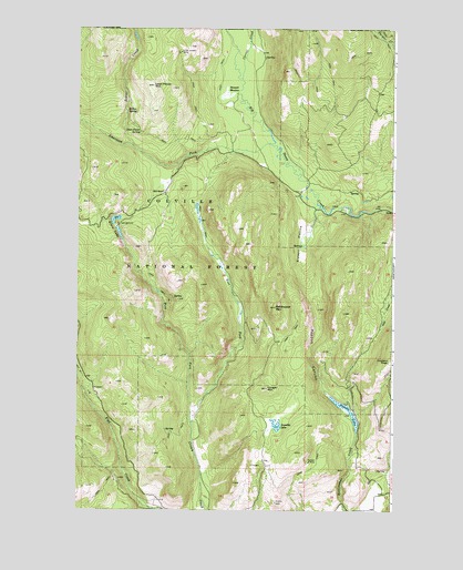
Belshazzar Mountain, WA USGS Topographic Map
Click on map above to begin viewing in our Map Viewer.

This topographic map contains these locations and features:
Feature Name Type Latitude Longitude GNIS ID View Map
American Fork Big Sheep CreekStreamN48.9702°W117.9250°1515849View Map
Ansaldo LakeLakeN48.8972°W117.9213°1515914View Map
Belshazzar MountainSummitN48.9277°W117.9219°1516397View Map
Bennett MeadowFlatN48.9824°W117.9419°1516414View Map
Bullion MineMineN48.8877°W117.9083°1517086View Map
Chief Joseph MineMineN48.9938°W117.9600°1517693View Map
Corral CreekStreamN48.9869°W117.9358°1518121View Map
Cougar MountainSummitN48.9066°W117.9253°1518186View Map
East Fork Crown CreekStreamN48.8969°W117.9542°1519091View Map
Elbow LakeLakeN48.9504°W117.9853°1519233View Map
Lead Pencil MountainSummitN48.9849°W117.9705°1521971View Map
Lead Pencil SpringSpringN48.9731°W117.9760°1521972View Map
Pepoon CanyonValleyN48.9088°W117.9042°1524330View Map
Pepoon LakeLakeN48.9023°W117.8946°1524331View Map
Rose RanchLocaleN48.9571°W117.9661°1525213View Map
Sleepy HollowBasinN48.9449°W117.9111°1525922View Map
West Fork Crown CreekStreamN48.8969°W117.9542°1527939View Map
Zodiac CreekStreamN48.9691°W117.9789°1528380View Map
Zodiac SpringSpringN48.9785°W117.9809°1528381View Map

Note: Coordinates in the location and feature list above are referenced to NAD83 datum.


Copyright (C) 2008-2025 Ryan Niemi / Sunset Dynamics ... All Rights Reserved