TopoQuest Logo
Do you find TopoQuest useful?
Help keep TopoQuest running and adding new maps/features by donating!
Bitcoin:  19c7KJd3qBynnjoSw5npx9KScwjBe4ifkT
Litecoin:  LXs6TkuXGGXo1vDsWCkWVdjQX94eUKd6ui
Home View Maps Find Maps Find Places Resources & Links


Onion Creek, Washington Topographic Map

USGS Map Title: Onion Creek, WA
USGS Map MRC: 48117G7
DRG (GeoTIFF) Download: o48117g7.tif


Neighboring USGS Topographic Map Quads:


  Belshazzar Mountain, WA  
48117H8
 

  Northport, WA  
48117H7
 

  Boundary, WA  
48117H6
 

  China Bend, WA  
48117G8
 

  Onion Creek, WA  
48117G7
 

  Spirit, WA  
48117G6
 

  Echo Valley, WA  
48117F8
 

  Gillette Mountain, WA  
48117F7
 

  Aladdin, WA  
48117F6


Map MRC Location:

N49°
W118°
N49°
W117°
H8 H7 H6 H5 H4 H3 H2 H1
G8 G7 G6 G5 G4 G3 G2 G1
F8 F7 F6 F5 F4 F3 F2 F1
E8 E7 E6 E5 E4 E3 E2 E1
D8 D7 D6 D5 D4 D3 D2 D1
C8 C7 C6 C5 C4 C3 C2 C1
B8 B7 B6 B5 B4 B3 B2 B1
A8 A7 A6 A5 A4 A3 A2 A1
N48°
W118°
N48°
W117°

Onion Creek, WA USGS 1:24K Topographic Map Preview:
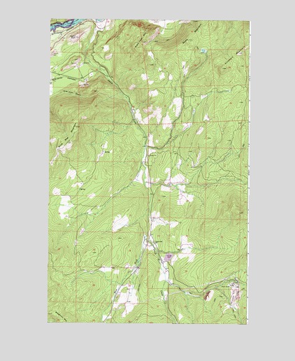
Onion Creek, WA USGS Topographic Map
Click on map above to begin viewing in our Map Viewer.

This topographic map contains these locations and features:
Feature Name Type Latitude Longitude GNIS ID View Map
Alice Mae MountainSummitN48.8238°W117.8633°1515805View Map
Black Hawk MountainSummitN48.8657°W117.8169°1516605View Map
Bodie MountainSummitN48.8749°W117.7794°1516748View Map
DolomiteLocaleN48.8552°W117.8580°1530110View Map
Island RockSummitN48.8674°W117.8589°1521271View Map
Kanes SidingLocaleN48.8746°W117.8419°1528814View Map
LimerockLocaleN48.8494°W117.8525°1530162View Map
Little DallesGapN48.8716°W117.8692°1522200View Map
Little DallesRapidsN48.8716°W117.8692°1530513View Map
Little Dalles (historical)Populated PlaceN48.8541°W117.8697°1530575View Map
Onion CreekPopulated PlaceN48.7838°W117.8117°1534135View Map
Onion CreekStreamN48.8721°W117.8447°1524061View Map
Onion Creek Elementary SchoolSchoolN48.7835°W117.8094°1531050View Map
Stevens County Fire District 11 Station 1 South EndBuildingN48.8503°W117.8589°2643972View Map
Van Stone MineMineN48.7628°W117.7597°1527675View Map
West Fork Onion CreekStreamN48.7860°W117.8136°1527963View Map
White Horse CanyonValleyN48.8452°W117.8694°1528062View Map

Note: Coordinates in the location and feature list above are referenced to NAD83 datum.


Copyright (C) 2008-2024 Ryan Niemi / Sunset Dynamics ... All Rights Reserved