TopoQuest Logo
Do you find TopoQuest useful?
Help keep TopoQuest running and adding new maps/features by donating!
Bitcoin:  19c7KJd3qBynnjoSw5npx9KScwjBe4ifkT
Litecoin:  LXs6TkuXGGXo1vDsWCkWVdjQX94eUKd6ui
Home View Maps Find Maps Find Places Resources & Links


Norwich, Kansas Topographic Map

USGS Map Title: Norwich, KS
USGS Map MRC: 37097D7
DRG (GeoTIFF) Download: o37097d7.tif


Neighboring USGS Topographic Map Quads:


  Murdock, KS  
37097E8
 

  Cheney SE, KS  
37097E7
 

  Lake Afton, KS  
37097E6
 

  Adams, KS  
37097D8
 

  Norwich, KS  
37097D7
 

  Conway Springs, KS  
37097D6
 

  Danville, KS  
37097C8
 

  Argonia, KS  
37097C7
 

  Milan, KS  
37097C6


Map MRC Location:

N38°
W98°
N38°
W97°
H8 H7 H6 H5 H4 H3 H2 H1
G8 G7 G6 G5 G4 G3 G2 G1
F8 F7 F6 F5 F4 F3 F2 F1
E8 E7 E6 E5 E4 E3 E2 E1
D8 D7 D6 D5 D4 D3 D2 D1
C8 C7 C6 C5 C4 C3 C2 C1
B8 B7 B6 B5 B4 B3 B2 B1
A8 A7 A6 A5 A4 A3 A2 A1
N37°
W98°
N37°
W97°

Norwich, KS USGS 1:24K Topographic Map Preview:
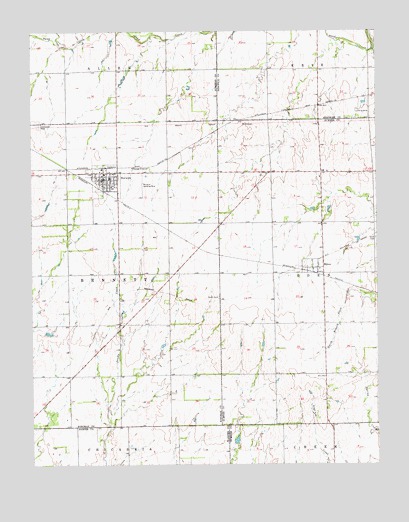
Norwich, KS USGS Topographic Map
Click on map above to begin viewing in our Map Viewer.

This topographic map contains these locations and features:
Feature Name Type Latitude Longitude GNIS ID View Map
City of NorwichCivilN37.4569°W97.8459°2395275View Map
Dotzour Senior CenterBuildingN37.4574°W97.8489°2692627View Map
Eden CemeteryCemeteryN37.4400°W97.7506°470276View Map
First Baptist ChurchChurchN37.4573°W97.8481°2690733View Map
Judson School (historical)SchoolN37.4886°W97.8262°483091View Map
MiltonPopulated PlaceN37.4317°W97.7714°470277View Map
Milton Baptist ChurchChurchN37.4319°W97.7720°2690774View Map
Milton Census Designated PlaceCensusN37.4432°W97.7694°2629165View Map
Milton United Methodist ChurchChurchN37.4575°W97.7696°2689487View Map
NorwichPopulated PlaceN37.4572°W97.8489°470274View Map
Norwich AirportAirportN37.4584°W97.8354°470275View Map
Norwich Christian ChurchChurchN37.4563°W97.8494°2690778View Map
Norwich Church of ChristChurchN37.4591°W97.8449°2690779View Map
Norwich City HallBuildingN37.4576°W97.8488°2693069View Map
Norwich Community LibraryBuildingN37.4583°W97.8475°2692628View Map
Norwich Elementary SchoolSchoolN37.4578°W97.8474°481062View Map
Norwich Elementary SchoolSchoolN37.4575°W97.8468°2497458View Map
Norwich High SchoolSchoolN37.4582°W97.8475°481061View Map
Norwich Middle SchoolSchoolN37.4578°W97.8469°2720291View Map
Norwich Police DepartmentBuildingN37.4577°W97.8489°2504053View Map
Norwich United Methodist ChurchChurchN37.4585°W97.8420°2689506View Map
Norwich Volunteer Fire DepartmentBuildingN37.4576°W97.8489°2111674View Map
Norwich Wastewater PlantLocaleN37.4678°W97.8307°2692143View Map
Stitch CemeteryCemeteryN37.4236°W97.8076°470278View Map
Suppesville Golf CourseLocaleN37.4630°W97.7688°2694537View Map
Suppesville Wastewater PlantLocaleN37.4689°W97.7702°2693569View Map
Township of BennettCivilN37.4298°W97.8620°470280View Map
Township of EdenCivilN37.4304°W97.7521°470269View Map
Upchurch CemeteryCemeteryN37.4727°W97.8726°470273View Map

Note: Coordinates in the location and feature list above are referenced to NAD83 datum.


Copyright (C) 2008-2025 Ryan Niemi / Sunset Dynamics ... All Rights Reserved