TopoQuest Logo
Do you find TopoQuest useful?
Help keep TopoQuest running and adding new maps/features by donating!
Bitcoin:  19c7KJd3qBynnjoSw5npx9KScwjBe4ifkT
Litecoin:  LXs6TkuXGGXo1vDsWCkWVdjQX94eUKd6ui
Home View Maps Find Maps Find Places Resources & Links


Lake Afton, Kansas Topographic Map

USGS Map Title: Lake Afton, KS
USGS Map MRC: 37097E6
DRG (GeoTIFF) Download: o37097e6.tif


Neighboring USGS Topographic Map Quads:


  Cheney, KS  
37097F7
 

  Garden Plain, KS  
37097F6
 

  Goddard, KS  
37097F5
 

  Cheney SE, KS  
37097E7
 

  Lake Afton, KS  
37097E6
 

  Clearwater, KS  
37097E5
 

  Norwich, KS  
37097D7
 

  Conway Springs, KS  
37097D6
 

  Millerton, KS  
37097D5


Map MRC Location:

N38°
W98°
N38°
W97°
H8 H7 H6 H5 H4 H3 H2 H1
G8 G7 G6 G5 G4 G3 G2 G1
F8 F7 F6 F5 F4 F3 F2 F1
E8 E7 E6 E5 E4 E3 E2 E1
D8 D7 D6 D5 D4 D3 D2 D1
C8 C7 C6 C5 C4 C3 C2 C1
B8 B7 B6 B5 B4 B3 B2 B1
A8 A7 A6 A5 A4 A3 A2 A1
N37°
W98°
N37°
W97°

Lake Afton, KS USGS 1:24K Topographic Map Preview:
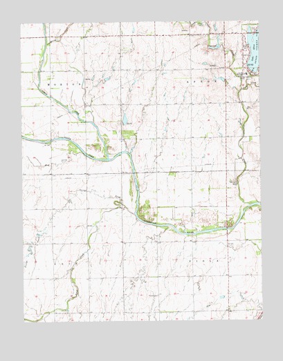
Lake Afton, KS USGS Topographic Map
Click on map above to begin viewing in our Map Viewer.

This topographic map contains these locations and features:
Feature Name Type Latitude Longitude GNIS ID View Map
Afton CreekStreamN37.5964°W97.6345°473999View Map
Camp HydeLocaleN37.5578°W97.6387°474304View Map
Clear CreekStreamN37.6014°W97.6362°473984View Map
Clearwater CreekStreamN37.5481°W97.6312°474305View Map
Hovorka Airport (historical)AirportN37.5972°W97.6606°481438View Map
Jocelyn CreekStreamN37.5492°W97.6989°474302View Map
Judge James V Riddel Boy's RanchBuildingN37.6028°W97.6323°474306View Map
Judge James V Riddel Boys Ranch SchoolSchoolN37.6027°W97.6321°474051View Map
Lake AftonReservoirN37.6113°W97.6273°474309View Map
Lake Afton County ParkParkN37.6117°W97.6281°473998View Map
Middle Branch Clearwater CreekStreamN37.5964°W97.6345°473985View Map
Mod CreekStreamN37.5700°W97.7176°474303View Map
North Fork Ninnescah RiverStreamN37.5681°W97.7053°473800View Map
Peotone CemeteryCemeteryN37.5105°W97.6801°474307View Map
Polecat CreekStreamN37.6242°W97.6548°473986View Map
Sand CreekStreamN37.5447°W97.6917°474301View Map
South Fork Ninnescah RiverStreamN37.5681°W97.7053°485476View Map
Spring CreekStreamN37.6161°W97.7367°473983View Map
Township of AftonCivilN37.6055°W97.6432°473997View Map
Township of ViolaCivilN37.5186°W97.6431°474308View Map
Venice (historical)LocaleN37.5625°W97.6837°482577View Map

Note: Coordinates in the location and feature list above are referenced to NAD83 datum.


Copyright (C) 2008-2025 Ryan Niemi / Sunset Dynamics ... All Rights Reserved