TopoQuest Logo
Do you find TopoQuest useful?
Help keep TopoQuest running and adding new maps/features by donating!
Bitcoin:  19c7KJd3qBynnjoSw5npx9KScwjBe4ifkT
Litecoin:  LXs6TkuXGGXo1vDsWCkWVdjQX94eUKd6ui
Home View Maps Find Maps Find Places Resources & Links


Norwood, Colorado Topographic Map

USGS Map Title: Norwood, CO
USGS Map MRC: 38108B3
DRG (GeoTIFF) Download: o38108b3.tif


Neighboring USGS Topographic Map Quads:


  Big Bucktail Creek, CO  
38108C4
 

  Ute, CO  
38108C3
 

  Antone Spring, CO  
38108C2
 

  Redvale, CO  
38108B4
 

  Norwood, CO  
38108B3
 

  Sanborn Park, CO  
38108B2
 

  Barkelew Draw, CO  
38108A4
 

  Oak Hill, CO  
38108A3
 

  Gurley Canyon, CO  
38108A2


Map MRC Location:

N39°
W109°
N39°
W108°
H8 H7 H6 H5 H4 H3 H2 H1
G8 G7 G6 G5 G4 G3 G2 G1
F8 F7 F6 F5 F4 F3 F2 F1
E8 E7 E6 E5 E4 E3 E2 E1
D8 D7 D6 D5 D4 D3 D2 D1
C8 C7 C6 C5 C4 C3 C2 C1
B8 B7 B6 B5 B4 B3 B2 B1
A8 A7 A6 A5 A4 A3 A2 A1
N38°
W109°
N38°
W108°

Norwood, CO USGS 1:24K Topographic Map Preview:
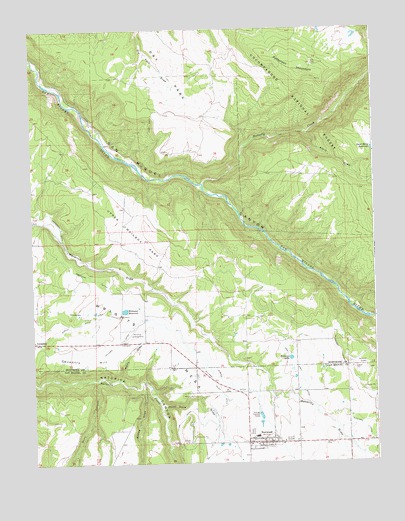
Norwood, CO USGS Topographic Map
Click on map above to begin viewing in our Map Viewer.

This topographic map contains these locations and features:
Feature Name Type Latitude Longitude GNIS ID View Map
Albin DrawValleyN38.2201°W108.2748°186079View Map
Big Mack MineMineN38.1308°W108.2909°1745372View Map
Browning DitchCanalN38.1805°W108.3618°203190View Map
Burn CanyonValleyN38.1491°W108.3528°186054View Map
CoventryPopulated PlaceN38.1600°W108.3748°203191View Map
Coventry HillSummitN38.1453°W108.3723°186046View Map
Dead Horse ReservoirReservoirN38.2152°W108.2507°203193View Map
Dearborn DitchCanalN38.1689°W108.3543°186044View Map
Dry ParkFlatN38.2394°W108.3159°203180View Map
Elder MineMineN38.1389°W108.3242°1745371View Map
Horsefly CreekStreamN38.2055°W108.3126°186126View Map
Issac Grey DitchCanalN38.1528°W108.2790°186062View Map
Keck-Reliance MineMineN38.1525°W108.3245°1745373View Map
Logging Camp DrawValleyN38.1703°W108.2598°186087View Map
Mad Jack Number One MineMineN38.1300°W108.2934°1745374View Map
Manly DrawValleyN38.1493°W108.3441°186048View Map
McKee DrawValleyN38.1481°W108.3350°186055View Map
Mineral MineMineN38.1255°W108.2970°1745375View Map
Nelson DitchCanalN38.1569°W108.2634°186051View Map
NorwoodPopulated PlaceN38.1305°W108.2923°186059View Map
Norwood Airport (historical)AirportN38.1514°W108.2534°186050View Map
Norwood CemeteryCemeteryN38.1305°W108.2701°186060View Map
Norwood Fire Protection DistrictBuildingN38.1321°W108.2894°2666866View Map
Norwood Police DepartmentBuildingN38.1295°W108.2888°2757260View Map
Norwood Post OfficePost OfficeN38.1310°W108.2900°2750970View Map
Palmers LakeReservoirN38.1550°W108.2816°186049View Map
Patterson MountainSummitN38.2375°W108.2770°186039View Map
Smugglers DitchCanalN38.1925°W108.3645°186041View Map
Stink Hole DrawValleyN38.1422°W108.3291°186056View Map
Sullivan DitchCanalN38.1342°W108.2540°186058View Map
Town of NorwoodCivilN38.1288°W108.2917°2413057View Map
Upper Mailbox ParkFlatN38.1917°W108.3367°186040View Map
Williams DitchCanalN38.1589°W108.3454°186047View Map
Williams Ranch AirportAirportN38.1631°W108.3390°186043View Map
Williams ReservoirReservoirN38.1691°W108.3418°186042View Map
Williams Truax DitchCanalN38.1478°W108.3098°186057View Map
Wrights MesaSummitN38.1258°W108.2923°186052View Map

Note: Coordinates in the location and feature list above are referenced to NAD83 datum.


Copyright (C) 2008-2024 Ryan Niemi / Sunset Dynamics ... All Rights Reserved