TopoQuest Logo
Do you find TopoQuest useful?
Help keep TopoQuest running and adding new maps/features by donating!
Bitcoin:  19c7KJd3qBynnjoSw5npx9KScwjBe4ifkT
Litecoin:  LXs6TkuXGGXo1vDsWCkWVdjQX94eUKd6ui
Home View Maps Find Maps Find Places Resources & Links


Antone Spring, Colorado Topographic Map

USGS Map Title: Antone Spring, CO
USGS Map MRC: 38108C2
DRG (GeoTIFF) Download: o38108c2.tif


Neighboring USGS Topographic Map Quads:


  Moore Mesa, CO  
38108D3
 

  Davis Point, CO  
38108D2
 

  Dry Creek Basin, CO  
38108D1
 

  Ute, CO  
38108C3
 

  Antone Spring, CO  
38108C2
 

  Pryor Creek, CO  
38108C1
 

  Norwood, CO  
38108B3
 

  Sanborn Park, CO  
38108B2
 

  Hotchkiss Reservoir, CO  
38108B1


Map MRC Location:

N39°
W109°
N39°
W108°
H8 H7 H6 H5 H4 H3 H2 H1
G8 G7 G6 G5 G4 G3 G2 G1
F8 F7 F6 F5 F4 F3 F2 F1
E8 E7 E6 E5 E4 E3 E2 E1
D8 D7 D6 D5 D4 D3 D2 D1
C8 C7 C6 C5 C4 C3 C2 C1
B8 B7 B6 B5 B4 B3 B2 B1
A8 A7 A6 A5 A4 A3 A2 A1
N38°
W109°
N38°
W108°

Antone Spring, CO USGS 1:24K Topographic Map Preview:
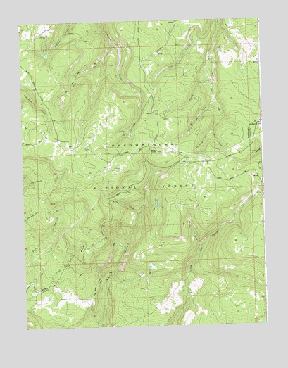
Antone Spring, CO USGS Topographic Map
Click on map above to begin viewing in our Map Viewer.

This topographic map contains these locations and features:
Feature Name Type Latitude Longitude GNIS ID View Map
Antone SpringSpringN38.3226°W108.1833°185928View Map
Antone Spring CampgroundLocaleN38.3230°W108.1831°201787View Map
Antone Spring CampgroundLocaleN38.3233°W108.1829°196676View Map
Bear CreekStreamN38.3300°W108.1509°185930View Map
Big A CreekStreamN38.2714°W108.2051°185936View Map
Box SpringSpringN38.3248°W108.2258°185925View Map
Darling LakeLakeN38.3266°W108.2305°185924View Map
Gray Cow CampLocaleN38.3705°W108.2395°185921View Map
Hanks Valley TrailTrailN38.2644°W108.1684°185920View Map
Iron SpringSpringN38.3166°W108.1651°185931View Map
Iron Spring CampgroundLocaleN38.3167°W108.1645°201806View Map
Iron Spring CampgroundLocaleN38.3169°W108.1642°196677View Map
Kelly CreekStreamN38.2947°W108.1904°185932View Map
Lazy Y Cow CampLocaleN38.3361°W108.1762°185926View Map
Mill CreekStreamN38.3411°W108.1504°185927View Map
Pool CreekStreamN38.3667°W108.2026°185922View Map
Pool Creek TrailTrailN38.3539°W108.2201°201814View Map
Pool Creek TrailTrailN38.3519°W108.2237°196680View Map
Raspberry CreekStreamN38.3300°W108.1509°185929View Map
Raspberry HeliportAirportN38.2997°W108.1845°204532View Map
Reade HillSummitN38.2989°W108.2117°185933View Map
Silesca Guard StationLocaleN38.3333°W108.1251°185944View Map
Spruce CreekStreamN38.3503°W108.1509°185923View Map
Spruce SpringSpringN38.3417°W108.1923°196681View Map
State DrawValleyN38.2811°W108.1593°185935View Map
Too High MineMineN38.2817°W108.1692°201769View Map

Note: Coordinates in the location and feature list above are referenced to NAD83 datum.


Copyright (C) 2008-2024 Ryan Niemi / Sunset Dynamics ... All Rights Reserved