TopoQuest Logo
Do you find TopoQuest useful?
Help keep TopoQuest running and adding new maps/features by donating!
Bitcoin:  19c7KJd3qBynnjoSw5npx9KScwjBe4ifkT
Litecoin:  LXs6TkuXGGXo1vDsWCkWVdjQX94eUKd6ui
Home View Maps Find Maps Find Places Resources & Links


Notus, Idaho Topographic Map

USGS Map Title: Notus, ID
USGS Map MRC: 43116F7
DRG (GeoTIFF) Download: o43116f7.tif


Neighboring USGS Topographic Map Quads:


  Parma, ID  
43116G8
 

  Parma SE, ID  
43116G7
 

  Sand Hollow, ID  
43116G6
 

  Wilder, ID  
43116F8
 

  Notus, ID  
43116F7
 

  Caldwell, ID  
43116F6
 

  Homedale, ID  
43116E8
 

  Marsing, ID  
43116E7
 

  Lake Lowell, ID  
43116E6


Map MRC Location:

N44°
W117°
N44°
W116°
H8 H7 H6 H5 H4 H3 H2 H1
G8 G7 G6 G5 G4 G3 G2 G1
F8 F7 F6 F5 F4 F3 F2 F1
E8 E7 E6 E5 E4 E3 E2 E1
D8 D7 D6 D5 D4 D3 D2 D1
C8 C7 C6 C5 C4 C3 C2 C1
B8 B7 B6 B5 B4 B3 B2 B1
A8 A7 A6 A5 A4 A3 A2 A1
N43°
W117°
N43°
W116°

Notus, ID USGS 1:24K Topographic Map Preview:
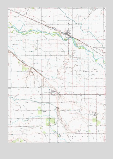
Notus, ID USGS Topographic Map
Click on map above to begin viewing in our Map Viewer.

This topographic map contains these locations and features:
Feature Name Type Latitude Longitude GNIS ID View Map
Allen LateralCanalN43.6829°W116.8624°371216View Map
AllendalePopulated PlaceN43.6763°W116.8749°396032View Map
Beal LateralCanalN43.6752°W116.8382°371393View Map
Benson GulchValleyN43.6915°W116.8463°371460View Map
Boone DitchCanalN43.7307°W116.8549°371645View Map
Bowman RanchLocaleN43.7163°W116.8682°371663View Map
Center Point SchoolSchoolN43.7121°W116.8385°371951View Map
Christian GulchValleyN43.7090°W116.8718°372017View Map
City of GreenleafCivilN43.6753°W116.8211°2410659View Map
City of NotusCivilN43.7266°W116.7999°2411282View Map
Conway GulchValleyN43.7346°W116.7838°372110View Map
Dailey LateralCanalN43.6579°W116.8696°372301View Map
Davison Ranch Airport (historical)AirportN43.6582°W116.7513°400772View Map
Deer Flat North CanalCanalN43.6371°W116.7607°372369View Map
Dickens DrainCanalN43.6565°W116.7710°372405View Map
Dixie GulchValleyN43.6860°W116.8301°372425View Map
DolesPopulated PlaceN43.6696°W116.7838°396408View Map
Dotson DrainCanalN43.6327°W116.8113°372443View Map
Dotson LateralCanalN43.6361°W116.8126°2785737View Map
Eureka CanalCanalN43.6999°W116.8076°372634View Map
Fowler LateralCanalN43.6365°W116.7546°372771View Map
Frank Field (historical)AirportN43.6732°W116.7721°400773View Map
Golden Gate DropDamN43.6413°W116.8151°372870View Map
GreenleafPopulated PlaceN43.6713°W116.8163°396590View Map
Greenleaf DrainCanalN43.6729°W116.8626°372926View Map
Greenleaf Friends AcademySchoolN43.6706°W116.8207°400629View Map
Greenleaf Post OfficePost OfficeN43.6696°W116.8196°2766817View Map
Greenleaf SchoolSchoolN43.6543°W116.8310°372927View Map
Guess GulchValleyN43.6946°W116.8465°372943View Map
Hibbs SublateralCanalN43.6582°W116.8503°2785753View Map
Holcomb DrainCanalN43.6602°W116.7807°373103View Map
Huston LateralCanalN43.6250°W116.7800°2785752View Map
Lower Bartlett LateralCanalN43.6554°W116.8507°373748View Map
Lower Center Point CanalCanalN43.7085°W116.7818°373753View Map
Mora Canal ExtensionCanalN43.6385°W116.8460°374021View Map
Mumford LateralCanalN43.7060°W116.8004°374079View Map
Myers DrainCanalN43.6265°W116.7957°374091View Map
North DrainCanalN43.7018°W116.7810°374183View Map
North DrainCanalN43.7093°W116.8293°374184View Map
NotusPopulated PlaceN43.7254°W116.8013°396974View Map
Notus DivisionCivilN43.7484°W116.7866°1936780View Map
Notus Elementary SchoolSchoolN43.7351°W116.7983°400665View Map
Notus Fire DepartmentBuildingN43.7304°W116.7980°2779551View Map
Notus High SchoolSchoolN43.7356°W116.7971°401004View Map
Notus Post OfficePost OfficeN43.7259°W116.8005°2779562View Map
Pickup DrainCanalN43.6560°W116.8590°374391View Map
Pipe GulchValleyN43.6693°W116.8113°374423View Map
Pleasant Ridge CemeteryCemeteryN43.6545°W116.7838°374440View Map
Pleasant Ridge GrangeLocaleN43.6515°W116.7629°374441View Map
Pleasant Ridge SchoolSchoolN43.6510°W116.7649°374442View Map
Red Top SchoolSchoolN43.6907°W116.7738°374625View Map
Rhoads LateralCanalN43.6757°W116.8471°374652View Map
Riverside CanalCanalN43.7018°W116.8601°374694View Map
Shelp Gulch DrainCanalN43.6507°W116.7521°375001View Map
South DrainCanalN43.6877°W116.7924°375141View Map
Street WellWellN43.6627°W116.7935°375302View Map
Super LateralCanalN43.6860°W116.8713°375360View Map
Upper Center Point CanalCanalN43.7035°W116.7713°375671View Map
WeitzPopulated PlaceN43.6693°W116.7596°397304View Map
West Canyon Elementary SchoolSchoolN43.6337°W116.7840°399685View Map
West End DrainCanalN43.6660°W116.7785°375802View Map

Note: Coordinates in the location and feature list above are referenced to NAD83 datum.


Copyright (C) 2008-2024 Ryan Niemi / Sunset Dynamics ... All Rights Reserved