TopoQuest Logo
Do you find TopoQuest useful?
Help keep TopoQuest running and adding new maps/features by donating!
Bitcoin:  19c7KJd3qBynnjoSw5npx9KScwjBe4ifkT
Litecoin:  LXs6TkuXGGXo1vDsWCkWVdjQX94eUKd6ui
Home View Maps Find Maps Find Places Resources & Links


Parma, Idaho Topographic Map

USGS Map Title: Parma, ID
USGS Map MRC: 43116G8
DRG (GeoTIFF) Download: o43116g8.tif


Neighboring USGS Topographic Map Quads:


  Cairo, OR  
43117H1
 

  Nyssa, OR  
43116H8
 

  New Plymouth, ID  
43116H7
 

  Owyhee, OR  
43117G1
 

  Parma, ID  
43116G8
 

  Parma SE, ID  
43116G7
 

  Adrian, OR  
43117F1
 

  Wilder, ID  
43116F8
 

  Notus, ID  
43116F7


Map MRC Location:

N44°
W117°
N44°
W116°
H8 H7 H6 H5 H4 H3 H2 H1
G8 G7 G6 G5 G4 G3 G2 G1
F8 F7 F6 F5 F4 F3 F2 F1
E8 E7 E6 E5 E4 E3 E2 E1
D8 D7 D6 D5 D4 D3 D2 D1
C8 C7 C6 C5 C4 C3 C2 C1
B8 B7 B6 B5 B4 B3 B2 B1
A8 A7 A6 A5 A4 A3 A2 A1
N43°
W117°
N43°
W116°

Parma, ID USGS 1:24K Topographic Map Preview:
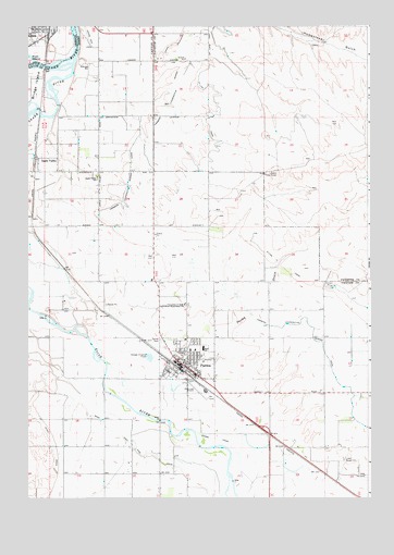
Parma, ID USGS Topographic Map
Click on map above to begin viewing in our Map Viewer.

This topographic map contains these locations and features:
Feature Name Type Latitude Longitude GNIS ID View Map
Alkali DrainCanalN43.7641°W116.9918°371210View Map
Apple ValleyPopulated PlaceN43.8399°W116.9965°396046View Map
Apple Valley SchoolSchoolN43.8346°W116.9754°371278View Map
City of ParmaCivilN43.7864°W116.9429°2411377View Map
D-Line CanalCanalN43.8552°W116.9327°396359View Map
Farmers Cooperative Sebree Canal ExtensionCanalN43.8599°W116.9485°397697View Map
Lower Boise CemeteryCemeteryN43.7598°W116.8846°373750View Map
Maxine Johnson ElementarySchoolN43.7892°W116.9383°400998View Map
McConnel IslandIslandN43.7563°W116.9271°399129View Map
ParmaPopulated PlaceN43.7852°W116.9432°397010View Map
Parma AirportAirportN43.7786°W116.9378°400895View Map
Parma CanalCanalN43.7674°W116.9371°374332View Map
Parma CemeteryCemeteryN43.7916°W116.9521°374333View Map
Parma DivisionCivilN43.7736°W116.9571°1936784View Map
Parma DrainStreamN43.7793°W116.9363°374334View Map
Parma High SchoolSchoolN43.7898°W116.9342°401058View Map
Parma Middle SchoolSchoolN43.7892°W116.9350°401049View Map
Parma Police DepartmentBuildingN43.7845°W116.9435°2722411View Map
Parma Post OfficePost OfficeN43.7862°W116.9435°2779563View Map
Parma Rural Fire DistrictBuildingN43.7954°W116.9507°2618950View Map
Pintail PondLakeN43.8089°W116.9861°394885View Map
Redhead PondLakeN43.8185°W116.9999°394981View Map
Ross East End DrainCanalN43.7604°W116.9521°397115View Map
South ParkParkN43.8738°W116.9996°1166867View Map
Takatori Access AreaLocaleN43.7949°W116.9857°399278View Map
Univ of Idaho Agriculture Experiment StationSchoolN43.8010°W116.9435°375663View Map
Wood Duck PondLakeN43.8066°W116.9954°399675View Map

Note: Coordinates in the location and feature list above are referenced to NAD83 datum.


Copyright (C) 2008-2025 Ryan Niemi / Sunset Dynamics ... All Rights Reserved