TopoQuest Logo
Do you find TopoQuest useful?
Help keep TopoQuest running and adding new maps/features by donating!
Bitcoin:  19c7KJd3qBynnjoSw5npx9KScwjBe4ifkT
Litecoin:  LXs6TkuXGGXo1vDsWCkWVdjQX94eUKd6ui
Home View Maps Find Maps Find Places Resources & Links


Oak Grove, Alabama Topographic Map

USGS Map Title: Oak Grove, AL
USGS Map MRC: 33087D2
DRG (GeoTIFF) Download: o33087d2.tif


Neighboring USGS Topographic Map Quads:


  Tutwiler School, AL  
33087E3
 

  Gilmore, AL  
33087E2
 

  Sylvan Springs, AL  
33087E1
 

  Burchfield Store, AL  
33087D3
 

  Oak Grove, AL  
33087D2
 

  Concord, AL  
33087D1
 

  Brookwood, AL  
33087C3
 

  Abernant, AL  
33087C2
 

  McCalla, AL  
33087C1


Map MRC Location:

N34°
W88°
N34°
W87°
H8 H7 H6 H5 H4 H3 H2 H1
G8 G7 G6 G5 G4 G3 G2 G1
F8 F7 F6 F5 F4 F3 F2 F1
E8 E7 E6 E5 E4 E3 E2 E1
D8 D7 D6 D5 D4 D3 D2 D1
C8 C7 C6 C5 C4 C3 C2 C1
B8 B7 B6 B5 B4 B3 B2 B1
A8 A7 A6 A5 A4 A3 A2 A1
N33°
W88°
N33°
W87°

Oak Grove, AL USGS 1:24K Topographic Map Preview:
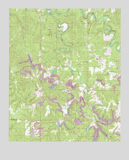
Oak Grove, AL USGS Topographic Map
Click on map above to begin viewing in our Map Viewer.

This topographic map contains these locations and features:
Feature Name Type Latitude Longitude GNIS ID View Map
Al HollowValleyN33.4062°W87.1908°112954View Map
Betty HillSummitN33.4262°W87.2478°114169View Map
Bible ChurchChurchN33.4418°W87.2069°162369View Map
Big BranchStreamN33.4073°W87.1636°114230View Map
Big Creek ChurchChurchN33.4932°W87.2153°114271View Map
Big Creek Church (historical)ChurchN33.4773°W87.2033°162773View Map
Brushy BranchStreamN33.4540°W87.2008°115055View Map
Cantrell BranchStreamN33.4498°W87.1939°115595View Map
Cedar CreekStreamN33.4957°W87.2067°115741View Map
Concord Fire District Station 3BuildingN33.4461°W87.1398°2682943View Map
Dick Gut BranchStreamN33.3943°W87.1533°117268View Map
Dry CreekStreamN33.3876°W87.1522°117553View Map
EzraPopulated PlaceN33.4459°W87.1431°118096View Map
Gin BranchStreamN33.4232°W87.2422°118980View Map
Glen Iris ChurchChurchN33.3759°W87.1822°162370View Map
Grindstone HollowValleyN33.4118°W87.2294°119425View Map
Ground Hog (historical)LocaleN33.4084°W87.1886°162371View Map
Huckleberry BranchStreamN33.4771°W87.1967°120502View Map
Jess BranchStreamN33.4459°W87.1844°120878View Map
Jordan Spring BranchStreamN33.4965°W87.2083°121055View Map
Lick BranchStreamN33.4526°W87.2044°121582View Map
Linney HollowValleyN33.4315°W87.2433°121677View Map
Moulton BranchStreamN33.4176°W87.2400°123134View Map
Mud CreekStreamN33.4976°W87.1972°123552View Map
Mud CreekPopulated PlaceN33.4029°W87.1569°144414View Map
Mud Creek Baptist ChurchChurchN33.4101°W87.1583°154254View Map
Nellie BranchStreamN33.4148°W87.2369°123690View Map
North Johns DivisionCivilN33.4119°W87.1729°165823View Map
Oak GrovePopulated PlaceN33.4548°W87.1536°124060View Map
Oak Grove ChurchChurchN33.4568°W87.1542°162372View Map
Oak Grove MineMineN33.4404°W87.1381°162373View Map
Oak Grove Mine LakeReservoirN33.4384°W87.1283°131539View Map
Oak Grove Mine Lake DamDamN33.4384°W87.1283°131540View Map
Oak Grove SchoolSchoolN33.4526°W87.1517°162374View Map
Oak Grove Second ChurchChurchN33.4501°W87.1267°162375View Map
Pit Twentyfive MineMineN33.4668°W87.1444°162642View Map
Razburg (historical)LocaleN33.4029°W87.1569°154293View Map
Sanders CreekStreamN33.4684°W87.1872°126346View Map
Scrap (historical)LocaleN33.4426°W87.2081°162128View Map
Sextons BendBendN33.4987°W87.2058°126568View Map
Shoal Creek Church (historical)ChurchN33.4407°W87.2428°162129View Map
Smithville Baptist ChurchChurchN33.4993°W87.1556°162130View Map
Stanley BranchStreamN33.4384°W87.2481°127307View Map
Starkey HollowValleyN33.4132°W87.2339°127316View Map
Tantrough BranchStreamN33.4409°W87.2433°127670View Map
The NarrowsGapN33.4951°W87.2108°127833View Map
ToadvinePopulated PlaceN33.4996°W87.1556°162131View Map
Toadvine CemeteryCemeteryN33.4968°W87.1514°162132View Map
Toadvine ChurchChurchN33.4996°W87.1567°128001View Map
Vines MillPopulated PlaceN33.4932°W87.1644°157204View Map
Woods CreekStreamN33.4251°W87.1661°129210View Map

Note: Coordinates in the location and feature list above are referenced to NAD83 datum.


Copyright (C) 2008-2025 Ryan Niemi / Sunset Dynamics ... All Rights Reserved