TopoQuest Logo
Do you find TopoQuest useful?
Help keep TopoQuest running and adding new maps/features by donating!
Bitcoin:  19c7KJd3qBynnjoSw5npx9KScwjBe4ifkT
Litecoin:  LXs6TkuXGGXo1vDsWCkWVdjQX94eUKd6ui
Home View Maps Find Maps Find Places Resources & Links


Tutwiler School, Alabama Topographic Map

USGS Map Title: Tutwiler School, AL
USGS Map MRC: 33087E3
DRG (GeoTIFF) Download: o33087e3.tif


Neighboring USGS Topographic Map Quads:


  Oakman, AL  
33087F4
 

  Parrish, AL  
33087F3
 

  Goodsprings, AL  
33087F2
 

  Wiley, AL  
33087E4
 

  Tutwiler School, AL  
33087E3
 

  Gilmore, AL  
33087E2
 

  Windham Springs, AL  
33087D4
 

  Burchfield Store, AL  
33087D3
 

  Oak Grove, AL  
33087D2


Map MRC Location:

N34°
W88°
N34°
W87°
H8 H7 H6 H5 H4 H3 H2 H1
G8 G7 G6 G5 G4 G3 G2 G1
F8 F7 F6 F5 F4 F3 F2 F1
E8 E7 E6 E5 E4 E3 E2 E1
D8 D7 D6 D5 D4 D3 D2 D1
C8 C7 C6 C5 C4 C3 C2 C1
B8 B7 B6 B5 B4 B3 B2 B1
A8 A7 A6 A5 A4 A3 A2 A1
N33°
W88°
N33°
W87°

Tutwiler School, AL USGS 1:24K Topographic Map Preview:
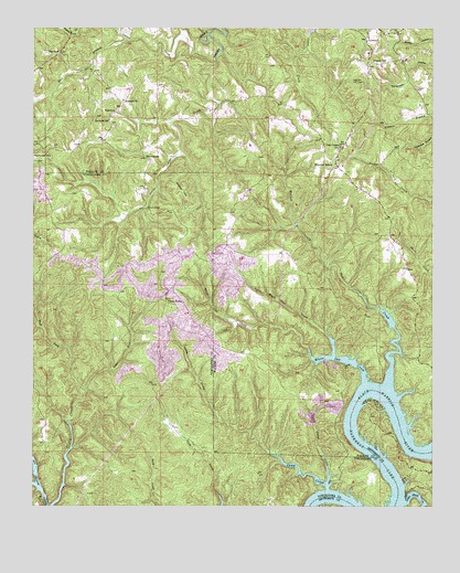
Tutwiler School, AL USGS Topographic Map
Click on map above to begin viewing in our Map Viewer.

This topographic map contains these locations and features:
Feature Name Type Latitude Longitude GNIS ID View Map
Black Rock ShoalsBarN33.5057°W87.2611°151611View Map
Brown Coal Bed MineMineN33.6029°W87.3208°135837View Map
BrowntownPopulated PlaceN33.5912°W87.3406°156121View Map
Camp CreekStreamN33.5046°W87.2828°115454View Map
Cedar Creek Church of ChristChurchN33.5940°W87.2792°115761View Map
Chapel HillSummitN33.6168°W87.2636°115953View Map
Clifty CreekStreamN33.5001°W87.3689°116268View Map
Coal SpringSpringN33.5473°W87.3508°147997View Map
Drummond AirportAirportN33.5159°W87.2567°129468View Map
East Branch Indian CreekStreamN33.6215°W87.3450°117737View Map
East Fork Clifty CreekStreamN33.5309°W87.3581°117756View Map
FairviewPopulated PlaceN33.6029°W87.3497°156335View Map
Fairview CemeteryCemeteryN33.6018°W87.3508°142331View Map
Freewell ChurchChurchN33.6062°W87.3469°118633View Map
Garganus (historical)LocaleN33.6159°W87.3731°142353View Map
Grant School (historical)SchoolN33.6021°W87.2922°142360View Map
Heards BendBendN33.5162°W87.2531°151622View Map
Henderson CampLocaleN33.5029°W87.2533°144263View Map
High Hill ChurchChurchN33.6173°W87.2592°142363View Map
High Hill Fire TowerTowerN33.6112°W87.2719°164343View Map
Humber BendBendN33.5279°W87.2692°151612View Map
Jug (historical)LocaleN33.6240°W87.2644°142378View Map
Knights School (historical)SchoolN33.5659°W87.3086°142385View Map
Little Camp CreekStreamN33.5065°W87.2828°121728View Map
Little Indian CreekStreamN33.6162°W87.3183°121801View Map
Little Shoal CreekStreamN33.5009°W87.2586°121890View Map
Little White Oak CreekStreamN33.5401°W87.2811°121909View Map
Lock Number Twelve (historical)DamN33.5040°W87.2608°151613View Map
Miller CemeteryCemeteryN33.6162°W87.2694°142395View Map
Perrys Store (historical)LocaleN33.5698°W87.2628°142416View Map
Reynolds School (historical)SchoolN33.6012°W87.3514°125581View Map
Rocky BranchStreamN33.6243°W87.3489°125837View Map
Starview ChurchChurchN33.6246°W87.2736°157399View Map
The WyeLocaleN33.6184°W87.3669°127848View Map
Three ForksPopulated PlaceN33.5534°W87.3331°157155View Map
TutwilerPopulated PlaceN33.5907°W87.2806°142449View Map
Tutwiler School (historical)SchoolN33.5901°W87.2822°128217View Map
Tutwiler Volunteer Fire and RescueBuildingN33.5932°W87.2778°2683374View Map
Walker County Shoal CreekStreamN33.5326°W87.2633°153866View Map
Wallace BridgeBridgeN33.5779°W87.3406°128534View Map
Wallace HillSummitN33.5826°W87.3294°128540View Map
West Fork Clifty CreekStreamN33.5423°W87.3647°128769View Map
White Oak CreekStreamN33.5329°W87.2714°128884View Map
Wilmington (historical)LocaleN33.5551°W87.2550°142463View Map
Wyatt CreekStreamN33.5059°W87.3742°129253View Map
Yacht Club CampLocaleN33.5043°W87.2583°140421View Map
Yellow Creek CampLocaleN33.5021°W87.3728°148773View Map

Note: Coordinates in the location and feature list above are referenced to NAD83 datum.


Copyright (C) 2008-2025 Ryan Niemi / Sunset Dynamics ... All Rights Reserved