TopoQuest Logo
Do you find TopoQuest useful?
Help keep TopoQuest running and adding new maps/features by donating!
Bitcoin:  19c7KJd3qBynnjoSw5npx9KScwjBe4ifkT
Litecoin:  LXs6TkuXGGXo1vDsWCkWVdjQX94eUKd6ui
Home View Maps Find Maps Find Places Resources & Links


Oak Grove Heights, Missouri Topographic Map

USGS Map Title: Oak Grove Heights, MO
USGS Map MRC: 37093B1
DRG (GeoTIFF) Download: o37093b1.tif


Neighboring USGS Topographic Map Quads:


  Bassville, MO  
37093C2
 

  Strafford, MO  
37093C1
 

  Marshfield, MO  
37092C8
 

  Galloway, MO  
37093B2
 

  Oak Grove Heights, MO  
37093B1
 

  Fordland, MO  
37092B8
 

  Ozark, MO  
37093A2
 

  Rogersville, MO  
37093A1
 

  Bruner, MO  
37092A8


Map MRC Location:

N38°
W94°
N38°
W93°
H8 H7 H6 H5 H4 H3 H2 H1
G8 G7 G6 G5 G4 G3 G2 G1
F8 F7 F6 F5 F4 F3 F2 F1
E8 E7 E6 E5 E4 E3 E2 E1
D8 D7 D6 D5 D4 D3 D2 D1
C8 C7 C6 C5 C4 C3 C2 C1
B8 B7 B6 B5 B4 B3 B2 B1
A8 A7 A6 A5 A4 A3 A2 A1
N37°
W94°
N37°
W93°

Oak Grove Heights, MO USGS 1:24K Topographic Map Preview:
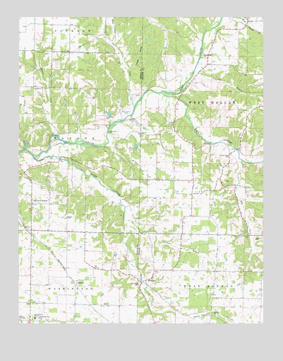
Oak Grove Heights, MO USGS Topographic Map
Click on map above to begin viewing in our Map Viewer.

This topographic map contains these locations and features:
Feature Name Type Latitude Longitude GNIS ID View Map
AllPopulated PlaceN37.1806°W93.0360°740507View Map
All Post OfficePost OfficeN37.1806°W93.0360°759972View Map
Antioch ChurchChurchN37.1981°W93.0271°713325View Map
Barnard LakeReservoirN37.2102°W93.0791°763262View Map
Barnard Lake DamDamN37.2100°W93.0785°763261View Map
Broad CreekStreamN37.2012°W93.1085°714727View Map
Buckeye School (historical)SchoolN37.2214°W93.0385°766178View Map
Buena Vista TrackLocaleN37.2112°W93.0699°755016View Map
Canyon HollowValleyN37.2287°W93.0680°715375View Map
Compton (historical)Populated PlaceN37.2337°W93.0368°755617View Map
Compton BranchStreamN37.2278°W93.0352°716160View Map
Cuinche AirportAirportN37.2474°W93.1075°2679392View Map
Davis CreekStreamN37.2131°W93.0655°716725View Map
Devils DenBasinN37.1595°W93.0038°716861View Map
DickersonsLocaleN37.1620°W93.1188°740508View Map
Dry ForkStreamN37.1920°W93.0113°717104View Map
Green Hill School (historical)SchoolN37.1887°W93.0874°732713View Map
HendersonPopulated PlaceN37.1412°W93.0599°719367View Map
Henderson CemeteryCemeteryN37.1409°W93.0638°719372View Map
KXUS-FM (Springfield)TowerN37.1862°W93.0232°759092View Map
Lake JamesReservoirN37.1981°W93.1214°763369View Map
Lake James DamDamN37.1967°W93.1218°763368View Map
Logan - Rogersville Fire Protection DistrictBuildingN37.1477°W93.1205°2620338View Map
Logan - Rogersville Fire Protection District Station 4BuildingN37.1812°W93.0363°2620693View Map
Logan - Rogersville Fire Protection District Station 5BuildingN37.1265°W93.1153°2621303View Map
LonPopulated PlaceN37.1837°W93.0593°740506View Map
Millan HollowValleyN37.2400°W93.0757°722363View Map
Mount Pleasant SchoolSchoolN37.1789°W93.0452°746804View Map
Mount Sinai ChapelChurchN37.1684°W93.1007°722892View Map
Norman BranchStreamN37.1659°W93.0702°723418View Map
North Star ChurchChurchN37.2209°W93.1135°723496View Map
Oak Grove HeightsPopulated PlaceN37.1739°W93.1185°723589View Map
Old Dallas SchoolSchoolN37.2470°W93.0080°746801View Map
Ozark ChurchChurchN37.2059°W93.0463°723938View Map
PalmettoPopulated PlaceN37.1423°W93.0955°741136View Map
Palmetto CemeteryCemeteryN37.1408°W93.0952°2702204View Map
Panther CreekStreamN37.2189°W93.0518°723986View Map
Panther ValleyPopulated PlaceN37.1889°W93.0177°755618View Map
Panther Valley CemeteryCemeteryN37.1934°W93.0171°724000View Map
Panther Valley School (historical)SchoolN37.1898°W93.0160°746802View Map
Pleasant Valley ChurchChurchN37.2339°W93.0293°724621View Map
Sayers CreekStreamN37.1923°W93.1171°726079View Map
Shiloh ChurchChurchN37.2020°W93.0618°726370View Map
Steel BridgeBridgeN37.2031°W93.0793°755414View Map
Township of BentonCivilN37.1576°W93.0292°2406941View Map
Township of TaylorCivilN37.1995°W93.1161°766695View Map
Township of WashingtonCivilN37.1263°W93.1184°766697View Map
Township of West Benton (historical)CivilN37.1301°W93.0055°767537View Map
Township of West Dallas (historical)CivilN37.2139°W93.0038°767538View Map
White Oak ChurchChurchN37.1284°W93.0249°730248View Map
White Oak HollowValleyN37.1306°W93.0507°730250View Map
Whiteoak SchoolSchoolN37.1426°W93.0255°746805View Map
Wilkerson CemeteryCemeteryN37.1273°W93.1218°728860View Map
Wilkerson Chapel (historical)ChurchN37.1839°W93.0535°734974View Map
Wilkerson Church (historical)ChurchN37.1778°W93.0313°746803View Map

Note: Coordinates in the location and feature list above are referenced to NAD83 datum.


Copyright (C) 2008-2025 Ryan Niemi / Sunset Dynamics ... All Rights Reserved