TopoQuest Logo
Do you find TopoQuest useful?
Help keep TopoQuest running and adding new maps/features by donating!
Bitcoin:  19c7KJd3qBynnjoSw5npx9KScwjBe4ifkT
Litecoin:  LXs6TkuXGGXo1vDsWCkWVdjQX94eUKd6ui
Home View Maps Find Maps Find Places Resources & Links


Oak Level, Virginia Topographic Map

USGS Map Title: Oak Level, VA
USGS Map MRC: 36079F1
DRG (GeoTIFF) Download: o36079f1.tif


Neighboring USGS Topographic Map Quads:


  Java, VA  
36079G2
 

  Vernon Hill, VA  
36079G1
 

  Halifax, VA  
36078G8
 

  Ingram, VA  
36079F2
 

  Oak Level, VA  
36079F1
 

  South Boston, VA  
36078F8
 

  Milton, NC  
36079E2
 

  Alton, VA  
36079E1
 

  Cluster Springs, VA  
36078E8


Map MRC Location:

N37°
W80°
N37°
W79°
H8 H7 H6 H5 H4 H3 H2 H1
G8 G7 G6 G5 G4 G3 G2 G1
F8 F7 F6 F5 F4 F3 F2 F1
E8 E7 E6 E5 E4 E3 E2 E1
D8 D7 D6 D5 D4 D3 D2 D1
C8 C7 C6 C5 C4 C3 C2 C1
B8 B7 B6 B5 B4 B3 B2 B1
A8 A7 A6 A5 A4 A3 A2 A1
N36°
W80°
N36°
W79°

Oak Level, VA USGS 1:24K Topographic Map Preview:
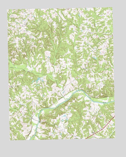
Oak Level, VA USGS Topographic Map
Click on map above to begin viewing in our Map Viewer.

This topographic map contains these locations and features:
Feature Name Type Latitude Longitude GNIS ID View Map
Ballous CreekStreamN36.6904°W79.0145°1462746View Map
Bass DamDamN36.6385°W79.0014°1489986View Map
Big LakeReservoirN36.6824°W79.0897°1463370View Map
Big Toby CreekStreamN36.6496°W79.0900°1463424View Map
Birch CreekStreamN36.6632°W79.0547°1463447View Map
BossesPopulated PlaceN36.7121°W79.1142°1496666View Map
Carlton CreekStreamN36.6940°W79.1156°1464444View Map
Chalmers CreekStreamN36.6615°W79.0278°1464716View Map
Colmans CornerLocaleN36.6860°W79.0414°1496681View Map
Cross Road Baptist ChurchChurchN36.6254°W79.0292°1496687View Map
Crossroad ChurchChurchN36.6274°W79.0470°1465482View Map
Crossroads CemeteryCemeteryN36.6271°W79.0475°1690110View Map
DanripplePopulated PlaceN36.6299°W79.0239°1496869View Map
East Temple DamDamN36.6818°W79.0847°1489989View Map
ElmoPopulated PlaceN36.6765°W79.1222°1477305View Map
Five Oaks DamDamN36.7418°W79.0931°1489992View Map
Five Oaks PondReservoirN36.7428°W79.0936°1489993View Map
Flint Rock School (historical)SchoolN36.6257°W79.0267°1496699View Map
Fye DamDamN36.6651°W79.1214°1489988View Map
JonesPopulated PlaceN36.7290°W79.0300°1496721View Map
Little Toby CreekStreamN36.6551°W79.0783°1469671View Map
Locust CreekStreamN36.6585°W79.0120°1469723View Map
Mount Pleasant ChurchChurchN36.7490°W79.0520°1471032View Map
Mount Zion School (historical)SchoolN36.7326°W79.0039°1496735View Map
New Arbor ChurchChurchN36.6762°W79.1172°1471384View Map
New Arbor School (historical)SchoolN36.6765°W79.1097°1496739View Map
New Vernon ChurchChurchN36.7365°W79.1036°1471501View Map
News FerryLocaleN36.6701°W79.0320°1471522View Map
Oak LevelLocaleN36.7351°W79.1058°1471758View Map
Oak Level CemeteryCemeteryN36.7335°W79.1072°1690137View Map
Oak Level Presbyterian ChurchChurchN36.7337°W79.1067°1496741View Map
Oak Level Volunteer Fire DepartmentBuildingN36.7394°W79.1015°2075368View Map
Oakes DamDamN36.7018°W79.0197°1489991View Map
Owens StorePopulated PlaceN36.6810°W79.0295°1496746View Map
PacesPopulated PlaceN36.6454°W79.0986°1477603View Map
Pleasant GrovePopulated PlaceN36.7335°W79.0567°1496749View Map
Pleasant Grove CemeteryCemeteryN36.7307°W79.0572°1690141View Map
Pleasant Grove ChurchChurchN36.7312°W79.0567°1472472View Map
Ragland DamDamN36.7418°W79.0397°1489994View Map
Ruddy Bottom ShoalsBarN36.6551°W79.0695°1496753View Map
Temple DamDamN36.6868°W79.0914°1489966View Map
Temple PondReservoirN36.6868°W79.0914°1489967View Map
Terry School (historical)SchoolN36.6824°W79.0178°1496760View Map
Terrys CornerPopulated PlaceN36.6835°W79.0322°1496761View Map
Turbeville Elementary SchoolSchoolN36.6257°W79.0406°1496762View Map
Union CemeteryCemeteryN36.7224°W79.0033°1690150View Map
Union CemeteryCemeteryN36.7265°W79.0264°1690151View Map
Union ChurchChurchN36.7224°W79.0031°1476036View Map
Union Grove ChurchChurchN36.7260°W79.0256°1476064View Map
Wade Dam Number FourDamN36.6301°W79.0597°1489987View Map
Wade Dam Number OneDamN36.6435°W79.0597°1489983View Map
Wade Dam Number ThreeDamN36.6485°W79.0581°1489985View Map
Wade Dam Number TwoDamN36.6435°W79.0564°1489984View Map
Wesley ChapelChurchN36.7293°W79.1020°1476455View Map
Wesley Chapel School (historical)SchoolN36.7299°W79.1025°1496767View Map
West Temple DamDamN36.6818°W79.0947°1489990View Map
Wilson Memorial School (historical)SchoolN36.7393°W79.1011°1496773View Map

Note: Coordinates in the location and feature list above are referenced to NAD83 datum.


Copyright (C) 2008-2024 Ryan Niemi / Sunset Dynamics ... All Rights Reserved