TopoQuest Logo
Do you find TopoQuest useful?
Help keep TopoQuest running and adding new maps/features by donating!
Bitcoin:  19c7KJd3qBynnjoSw5npx9KScwjBe4ifkT
Litecoin:  LXs6TkuXGGXo1vDsWCkWVdjQX94eUKd6ui
Home View Maps Find Maps Find Places Resources & Links


Vernon Hill, Virginia Topographic Map

USGS Map Title: Vernon Hill, VA
USGS Map MRC: 36079G1
DRG (GeoTIFF) Download: o36079g1.tif


Neighboring USGS Topographic Map Quads:


  Mount Airy, VA  
36079H2
 

  Republican Grove, VA  
36079H1
 

  Nathalie, VA  
36078H8
 

  Java, VA  
36079G2
 

  Vernon Hill, VA  
36079G1
 

  Halifax, VA  
36078G8
 

  Ingram, VA  
36079F2
 

  Oak Level, VA  
36079F1
 

  South Boston, VA  
36078F8


Map MRC Location:

N37°
W80°
N37°
W79°
H8 H7 H6 H5 H4 H3 H2 H1
G8 G7 G6 G5 G4 G3 G2 G1
F8 F7 F6 F5 F4 F3 F2 F1
E8 E7 E6 E5 E4 E3 E2 E1
D8 D7 D6 D5 D4 D3 D2 D1
C8 C7 C6 C5 C4 C3 C2 C1
B8 B7 B6 B5 B4 B3 B2 B1
A8 A7 A6 A5 A4 A3 A2 A1
N36°
W80°
N36°
W79°

Vernon Hill, VA USGS 1:24K Topographic Map Preview:
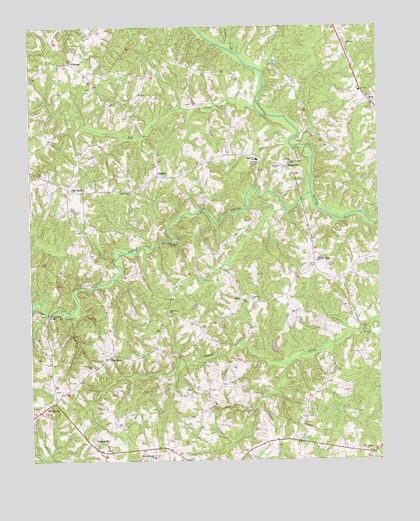
Vernon Hill, VA USGS Topographic Map
Click on map above to begin viewing in our Map Viewer.

This topographic map contains these locations and features:
Feature Name Type Latitude Longitude GNIS ID View Map
Asbury CemeteryCemeteryN36.7971°W79.0458°1690098View Map
Asbury ChurchChurchN36.7968°W79.0450°1462575View Map
Banister Hill ChurchChurchN36.8357°W79.0308°1462762View Map
Blue Rock ChurchChurchN36.7926°W79.0750°1463591View Map
Blue Rock School (historical)SchoolN36.8015°W79.0706°1496665View Map
Bradley CreekStreamN36.8682°W79.0508°1463744View Map
Bye CreekStreamN36.8518°W79.0431°1464201View Map
Chaneys StorePopulated PlaceN36.8424°W79.1181°1496676View Map
County Line ChurchChurchN36.8276°W79.0883°1465306View Map
County Line School (historical)SchoolN36.8182°W79.1050°1496684View Map
District 3CivilN36.7610°W79.0758°1927223View Map
ElkhornPopulated PlaceN36.8646°W79.1097°1477298View Map
Elkhorn Baptist ChurchChurchN36.8649°W79.1109°1496692View Map
Elkhorn School (historical)SchoolN36.8654°W79.1095°1496693View Map
Fox Fire AirportAirportN36.7788°W79.0506°1498693View Map
Haskins School (historical)SchoolN36.8035°W79.0206°1496712View Map
High RockPopulated PlaceN36.7796°W79.0970°1477413View Map
MeadvillePopulated PlaceN36.8346°W79.0320°1477532View Map
Meadville Elementary SchoolSchoolN36.8367°W79.0433°1470331View Map
Millstone ChurchChurchN36.8696°W79.0106°1470586View Map
New Bethel CemeteryCemeteryN36.7529°W79.0042°1690133View Map
New Bethel ChurchChurchN36.7526°W79.0042°1471391View Map
New Zion ChurchChurchN36.8349°W79.0356°1471506View Map
Pine Ridge FarmLocaleN36.7608°W79.0558°2676091View Map
PlatoPopulated PlaceN36.7965°W79.0483°1477629View Map
RoddenPopulated PlaceN36.8321°W79.0781°1477693View Map
RosaPopulated PlaceN36.8526°W79.0014°1477699View Map
Sandy CreekStreamN36.8268°W79.0233°1474015View Map
Sign RockPopulated PlaceN36.8287°W79.1108°1500104View Map
ThompsonsPopulated PlaceN36.7668°W79.1170°1500222View Map
Vernon HillPopulated PlaceN36.7565°W79.1028°1500255View Map
Vernon Hill Post OfficePost OfficeN36.7544°W79.1024°2766429View Map
White OakPopulated PlaceN36.8062°W79.0225°1477873View Map
Wilson Memorial Elementary SchoolSchoolN36.7510°W79.0813°1476825View Map

Note: Coordinates in the location and feature list above are referenced to NAD83 datum.


Copyright (C) 2008-2025 Ryan Niemi / Sunset Dynamics ... All Rights Reserved