TopoQuest Logo
Do you find TopoQuest useful?
Help keep TopoQuest running and adding new maps/features by donating!
Bitcoin:  19c7KJd3qBynnjoSw5npx9KScwjBe4ifkT
Litecoin:  LXs6TkuXGGXo1vDsWCkWVdjQX94eUKd6ui
Home View Maps Find Maps Find Places Resources & Links


Oak Ridge, Mississippi Topographic Map

USGS Map Title: Oak Ridge, MS
USGS Map MRC: 32090D6
DRG (GeoTIFF) Download: o32090d6.tif


Neighboring USGS Topographic Map Quads:


  Floweree, MS  
32090E7
 

  Eldorado, MS  
32090E6
 

  Phoenix, MS  
32090E5
 

  Redwood, MS  
32090D7
 

  Oak Ridge, MS  
32090D6
 

  Queens Hill Lake, MS  
32090D5
 

  Vicksburg East, MS  
32090C7
 

  Bovina, MS  
32090C6
 

  Edwards, MS  
32090C5


Map MRC Location:

N33°
W91°
N33°
W90°
H8 H7 H6 H5 H4 H3 H2 H1
G8 G7 G6 G5 G4 G3 G2 G1
F8 F7 F6 F5 F4 F3 F2 F1
E8 E7 E6 E5 E4 E3 E2 E1
D8 D7 D6 D5 D4 D3 D2 D1
C8 C7 C6 C5 C4 C3 C2 C1
B8 B7 B6 B5 B4 B3 B2 B1
A8 A7 A6 A5 A4 A3 A2 A1
N32°
W91°
N32°
W90°

Oak Ridge, MS USGS 1:24K Topographic Map Preview:
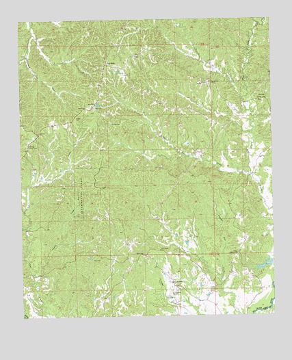
Oak Ridge, MS USGS Topographic Map
Click on map above to begin viewing in our Map Viewer.

This topographic map contains these locations and features:
Feature Name Type Latitude Longitude GNIS ID View Map
Bear Creek School (historical)SchoolN32.4276°W90.7101°686294View Map
Bethlehem ChurchChurchN32.4013°W90.6432°666998View Map
Bethlehem School (historical)SchoolN32.4013°W90.6429°686302View Map
Bluff Experimental ForestParkN32.4315°W90.7184°667334View Map
Brickhouse CemeteryCemeteryN32.4737°W90.6556°667560View Map
Brickhouse School (historical)SchoolN32.4788°W90.6670°686309View Map
China Grove ChurchChurchN32.4660°W90.6312°686315View Map
Clear Creek School (historical)SchoolN32.3935°W90.7462°686316View Map
Cowan CreekStreamN32.3929°W90.7423°668896View Map
Dornbusch Lake DamDamN32.3985°W90.6301°681313View Map
Flower Hill CemeteryCemeteryN32.4296°W90.7095°670049View Map
Flower Hill Church (historical)ChurchN32.4296°W90.7109°686326View Map
FlowersPopulated PlaceN32.3893°W90.6740°691863View Map
Flowers CemeteryCemeteryN32.3879°W90.6723°670056View Map
Fox CreekStreamN32.3924°W90.6504°670147View Map
Hackler CemeteryCemeteryN32.4562°W90.6995°670817View Map
Holy Hill ChurchChurchN32.4646°W90.7118°671373View Map
Holy Hill School (historical)SchoolN32.4654°W90.7109°686335View Map
Jones ChapelChurchN32.4032°W90.6809°671978View Map
Lewis CemeteryCemeteryN32.4635°W90.7120°672423View Map
Little Bear CreekStreamN32.4346°W90.6354°672538View Map
Marley School (historical)SchoolN32.4910°W90.6254°686350View Map
Neely CemeteryCemeteryN32.4632°W90.7170°674544View Map
Northeast Warren County Volunteer Fire DepartmentBuildingN32.4917°W90.7047°2667966View Map
Oak RidgePopulated PlaceN32.4813°W90.7065°675089View Map
Oak Ridge Lookout TowerTowerN32.4476°W90.7465°711284View Map
Oak Ridge School (historical)SchoolN32.4757°W90.7076°686362View Map
Oakland CemeteryCemeteryN32.3843°W90.6748°675118View Map
Oakland ChurchChurchN32.3826°W90.6757°675120View Map
Oren Bailess Lake DamDamN32.3835°W90.7001°681277View Map
Parker CemeteryCemeteryN32.4587°W90.7220°675458View Map
RawhidePopulated PlaceN32.4663°W90.6279°676487View Map
Ridgeway ChurchChurchN32.4526°W90.7407°676657View Map
Supervisor District 1CivilN32.4358°W90.7109°712120View Map
Taylor CemeteryCemeteryN32.4015°W90.6895°678587View Map

Note: Coordinates in the location and feature list above are referenced to NAD83 datum.


Copyright (C) 2008-2025 Ryan Niemi / Sunset Dynamics ... All Rights Reserved