TopoQuest Logo
Do you find TopoQuest useful?
Help keep TopoQuest running and adding new maps/features by donating!
Bitcoin:  19c7KJd3qBynnjoSw5npx9KScwjBe4ifkT
Litecoin:  LXs6TkuXGGXo1vDsWCkWVdjQX94eUKd6ui
Home View Maps Find Maps Find Places Resources & Links


Oakhurst, Texas Topographic Map

USGS Map Title: Oakhurst, TX
USGS Map MRC: 30095F3
DRG (GeoTIFF) Download: o30095f3.tif


Neighboring USGS Topographic Map Quads:


  Riverside, TX  
30095G4
 

  Staley, TX  
30095G3
 

  Carlisle, TX  
30095G2
 

  Phelps, TX  
30095F4
 

  Oakhurst, TX  
30095F3
 

  Stephen Creek, TX  
30095F2
 

  New Waverly, TX  
30095E4
 

  Maynard, TX  
30095E3
 

  Coldspring, TX  
30095E2


Map MRC Location:

N31°
W96°
N31°
W95°
H8 H7 H6 H5 H4 H3 H2 H1
G8 G7 G6 G5 G4 G3 G2 G1
F8 F7 F6 F5 F4 F3 F2 F1
E8 E7 E6 E5 E4 E3 E2 E1
D8 D7 D6 D5 D4 D3 D2 D1
C8 C7 C6 C5 C4 C3 C2 C1
B8 B7 B6 B5 B4 B3 B2 B1
A8 A7 A6 A5 A4 A3 A2 A1
N30°
W96°
N30°
W95°

Oakhurst, TX USGS 1:24K Topographic Map Preview:
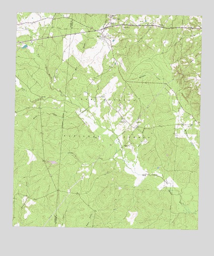
Oakhurst, TX USGS Topographic Map
Click on map above to begin viewing in our Map Viewer.

This topographic map contains these locations and features:
Feature Name Type Latitude Longitude GNIS ID View Map
Center Hill CemeteryCemeteryN30.7416°W95.3030°1383462View Map
Center Hill ChurchChurchN30.7421°W95.3033°1381615View Map
Cleveland CemeteryCemeteryN30.7132°W95.3492°1381665View Map
Cobb CreekStreamN30.6977°W95.3366°1381671View Map
Enterprise ChurchChurchN30.7488°W95.3122°1381846View Map
Grace LakeReservoirN30.6630°W95.3488°1864316View Map
Grace Lake DamDamN30.6619°W95.3469°1864315View Map
Hoby CemeteryCemeteryN30.7035°W95.2974°1382005View Map
Hoby ChurchChurchN30.6871°W95.2924°1382006View Map
Hopewell ChurchChurchN30.7438°W95.2761°1382025View Map
Jenkins CemeteryCemeteryN30.6574°W95.3127°1382075View Map
Johnson CreekStreamN30.6649°W95.3013°1382084View Map
Maple Hill ChurchChurchN30.6735°W95.3005°1382229View Map
Mill BranchStreamN30.7016°W95.3397°1382289View Map
Mount Gideon ChurchChurchN30.7010°W95.3574°1382335View Map
OakhurstPopulated PlaceN30.7371°W95.3161°1382413View Map
Oakhurst Census Designated PlaceCensusN30.7433°W95.3073°2586964View Map
Oakhurst Post OfficePost OfficeN30.7403°W95.3200°2731762View Map
Oakhurst SchoolSchoolN30.7388°W95.3144°1383464View Map
Oakhurst Volunteer Fire DepartmentBuildingN30.7399°W95.3216°2655325View Map
Palmetto ParkPopulated PlaceN30.7494°W95.3116°1383456View Map
Palmetto ParkParkN30.7494°W95.3119°1383463View Map
Raven Hill Historical MonumentParkN30.6871°W95.3002°1384652View Map
Roark CreekStreamN30.6930°W95.3308°1382624View Map
Wheatfield BranchStreamN30.6580°W95.2927°1382944View Map
White Hill Missionary ChurchChurchN30.7449°W95.3124°1382949View Map

Note: Coordinates in the location and feature list above are referenced to NAD83 datum.


Copyright (C) 2008-2024 Ryan Niemi / Sunset Dynamics ... All Rights Reserved