TopoQuest Logo
Do you find TopoQuest useful?
Help keep TopoQuest running and adding new maps/features by donating!
Bitcoin:  19c7KJd3qBynnjoSw5npx9KScwjBe4ifkT
Litecoin:  LXs6TkuXGGXo1vDsWCkWVdjQX94eUKd6ui
Home View Maps Find Maps Find Places Resources & Links


Staley, Texas Topographic Map

USGS Map Title: Staley, TX
USGS Map MRC: 30095G3
DRG (GeoTIFF) Download: o30095g3.tif


Neighboring USGS Topographic Map Quads:


  Trinity West, TX  
30095H4
 

  Trinity East, TX  
30095H3
 

  Chita, TX  
30095H2
 

  Riverside, TX  
30095G4
 

  Staley, TX  
30095G3
 

  Carlisle, TX  
30095G2
 

  Phelps, TX  
30095F4
 

  Oakhurst, TX  
30095F3
 

  Stephen Creek, TX  
30095F2


Map MRC Location:

N31°
W96°
N31°
W95°
H8 H7 H6 H5 H4 H3 H2 H1
G8 G7 G6 G5 G4 G3 G2 G1
F8 F7 F6 F5 F4 F3 F2 F1
E8 E7 E6 E5 E4 E3 E2 E1
D8 D7 D6 D5 D4 D3 D2 D1
C8 C7 C6 C5 C4 C3 C2 C1
B8 B7 B6 B5 B4 B3 B2 B1
A8 A7 A6 A5 A4 A3 A2 A1
N30°
W96°
N30°
W95°

Staley, TX USGS 1:24K Topographic Map Preview:
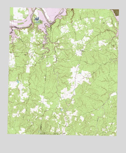
Staley, TX USGS Topographic Map
Click on map above to begin viewing in our Map Viewer.

This topographic map contains these locations and features:
Feature Name Type Latitude Longitude GNIS ID View Map
980 North Volunteer Fire DepartmentBuildingN30.8600°W95.3122°2655384View Map
Belle and Ford LakeLakeN30.8638°W95.3438°1351847View Map
Bethea CreekStreamN30.8560°W95.3713°1372518View Map
Bethea CreekStreamN30.8555°W95.3713°1383443View Map
Black LakeLakeN30.8627°W95.3411°1383477View Map
Black LakeLakeN30.8625°W95.3408°1352334View Map
Browns CreekStreamN30.8530°W95.2558°1383044View Map
Burge BranchStreamN30.8680°W95.3197°1353315View Map
Camp HillSummitN30.8552°W95.2549°1353639View Map
Carolina Creek (historical)StreamN30.8591°W95.3286°1353837View Map
Chapel CemeteryCemeteryN30.7638°W95.3513°1383471View Map
Chapel CemeteryCemeteryN30.7641°W95.3513°1354295View Map
Clear CreekStreamN30.8199°W95.2697°1354613View Map
Community Relief CemeteryCemeteryN30.7588°W95.3069°1354846View Map
Deans CreekStreamN30.7766°W95.3216°1355792View Map
East Carolina CreekStreamN30.8296°W95.3358°1356590View Map
Gospel HillSummitN30.8294°W95.3552°1383475View Map
Gospel HillPopulated PlaceN30.8291°W95.3552°1379848View Map
Gospel Hill CemeteryCemeteryN30.8277°W95.3472°1383476View Map
Gospel Hill CemeteryCemeteryN30.8274°W95.3469°1358206View Map
Gospel Hill SchoolSchoolN30.8269°W95.3680°1383472View Map
Gospel Hill SchoolSchoolN30.8269°W95.3677°1358207View Map
Jameson DamDamN30.8035°W95.3652°1860129View Map
Jameson LakeReservoirN30.8019°W95.3643°1860130View Map
McGown CemeteryCemeteryN30.7791°W95.2527°1362466View Map
Mount Capers CemeteryCemeteryN30.8255°W95.2583°1363233View Map
Newton BranchStreamN30.8663°W95.3033°1363861View Map
Palmetto ParkLocaleN30.7513°W95.3119°1364728View Map
Pools CreekStreamN30.8255°W95.2516°1382552View Map
Rocky HillSummitN30.8613°W95.2686°1366787View Map
StaleyPopulated PlaceN30.8338°W95.2922°1380596View Map
Sulphur BluffsCliffN30.8607°W95.3244°1369346View Map
Sutton CreekStreamN30.8194°W95.3447°1376347View Map
Thomas LakeLakeN30.8610°W95.3427°1369841View Map
Thomas Lake Road Volunteer Fire DepartmentBuildingN30.8567°W95.3459°2655498View Map
West Carolina CreekStreamN30.8363°W95.3233°1371090View Map
Zwickey CreekStreamN30.8480°W95.2547°1372109View Map

Note: Coordinates in the location and feature list above are referenced to NAD83 datum.


Copyright (C) 2008-2025 Ryan Niemi / Sunset Dynamics ... All Rights Reserved