TopoQuest Logo
Do you find TopoQuest useful?
Help keep TopoQuest running and adding new maps/features by donating!
Bitcoin:  19c7KJd3qBynnjoSw5npx9KScwjBe4ifkT
Litecoin:  LXs6TkuXGGXo1vDsWCkWVdjQX94eUKd6ui
Home View Maps Find Maps Find Places Resources & Links


Oakland, Texas Topographic Map

USGS Map Title: Oakland, TX
USGS Map MRC: 29096E7
DRG (GeoTIFF) Download: o29096e7.tif


Neighboring USGS Topographic Map Quads:


  Schulenburg, TX  
29096F8
 

  Weimar, TX  
29096F7
 

  Borden, TX  
29096F6
 

  Moravia, TX  
29096E8
 

  Oakland, TX  
29096E7
 

  Sawmill Branch, TX  
29096E6
 

  Hallettsville, TX  
29096D8
 

  Sublime, TX  
29096D7
 

  Sheridan, TX  
29096D6


Map MRC Location:

N30°
W97°
N30°
W96°
H8 H7 H6 H5 H4 H3 H2 H1
G8 G7 G6 G5 G4 G3 G2 G1
F8 F7 F6 F5 F4 F3 F2 F1
E8 E7 E6 E5 E4 E3 E2 E1
D8 D7 D6 D5 D4 D3 D2 D1
C8 C7 C6 C5 C4 C3 C2 C1
B8 B7 B6 B5 B4 B3 B2 B1
A8 A7 A6 A5 A4 A3 A2 A1
N29°
W97°
N29°
W96°

Oakland, TX USGS 1:24K Topographic Map Preview:
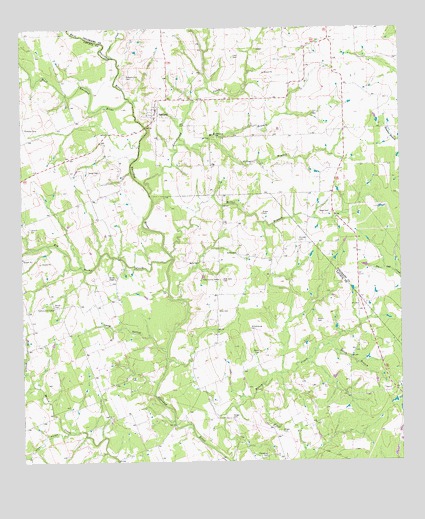
Oakland, TX USGS Topographic Map
Click on map above to begin viewing in our Map Viewer.

This topographic map contains these locations and features:
Feature Name Type Latitude Longitude GNIS ID View Map
Allen BranchStreamN29.5930°W96.8122°1329380View Map
Allen CemeteryCemeteryN29.5436°W96.8097°1329382View Map
Austin CemeteryCemeteryN29.5602°W96.8039°1329845View Map
Big Rocky CreekStreamN29.5588°W96.8250°1372562View Map
Bila Hora CemeteryCemeteryN29.5527°W96.8083°1330683View Map
Bock CemeteryCemeteryN29.5577°W96.8197°1330977View Map
Brown ChapelChurchN29.5530°W96.8444°1331342View Map
Clear CreekStreamN29.6166°W96.8439°1332929View Map
Cottonwood CreekStreamN29.5772°W96.8325°1333454View Map
County Line CemeteryCemeteryN29.5636°W96.7837°1347064View Map
Eason CemeteryCemeteryN29.5716°W96.7950°1334870View Map
East Navidad RiverStreamN29.6044°W96.8386°1334971View Map
Fenner Ranch Airport (historical)AirportN29.5212°W96.8462°2676627View Map
Geiger CemeteryCemeteryN29.5089°W96.7900°1336463View Map
Geiger CemeteryCemeteryN29.5125°W96.8053°1336464View Map
Honey CreekStreamN29.5011°W96.8053°1338012View Map
Keilers CemeteryCemeteryN29.5408°W96.7775°1338989View Map
King BranchStreamN29.5264°W96.8739°1374376View Map
Laas CemeteryCemeteryN29.6170°W96.8050°1339694View Map
Long HollowValleyN29.5316°W96.8278°1340459View Map
McKinnon BranchStreamN29.5919°W96.8203°1341248View Map
Miller BranchStreamN29.5600°W96.8261°1341643View Map
OaklandPopulated PlaceN29.6016°W96.8300°1343015View Map
Oakland Hill CemeteryCemeteryN29.6111°W96.8403°1343026View Map
Oakland Post OfficePost OfficeN29.6019°W96.8303°2731958View Map
Oakland Volunteer Fire DepartmentBuildingN29.6017°W96.8313°2552442View Map
Obelgoner CemeteryCemeteryN29.5016°W96.7941°1343052View Map
Pine HollowValleyN29.5088°W96.8606°1344058View Map
Redus CemeteryCemeteryN29.5319°W96.7961°1344988View Map
Rees CemeteryCemeteryN29.5722°W96.7735°1345008View Map
Shiloh CemeteryCemeteryN29.5452°W96.8650°1347040View Map
Simpson CemeteryCemeteryN29.5963°W96.8739°1347153View Map
Smith BranchStreamN29.5339°W96.7736°1347251View Map
Turner CemeteryCemeteryN29.5838°W96.8491°1348904View Map
West Navidad RiverStreamN29.6044°W96.8389°1349769View Map
Willowsburg CemeteryCemeteryN29.5383°W96.7994°1350239View Map

Note: Coordinates in the location and feature list above are referenced to NAD83 datum.


Copyright (C) 2008-2025 Ryan Niemi / Sunset Dynamics ... All Rights Reserved