TopoQuest Logo
Do you find TopoQuest useful?
Help keep TopoQuest running and adding new maps/features by donating!
Bitcoin:  19c7KJd3qBynnjoSw5npx9KScwjBe4ifkT
Litecoin:  LXs6TkuXGGXo1vDsWCkWVdjQX94eUKd6ui
Home View Maps Find Maps Find Places Resources & Links


Schulenburg, Texas Topographic Map

USGS Map Title: Schulenburg, TX
USGS Map MRC: 29096F8
DRG (GeoTIFF) Download: o29096f8.tif


Neighboring USGS Topographic Map Quads:


  Muldoon, TX  
29097G1
 

  Swiss Alp, TX  
29096G8
 

  Ammannsville, TX  
29096G7
 

  Flatonia, TX  
29097F1
 

  Schulenburg, TX  
29096F8
 

  Weimar, TX  
29096F7
 

  Komensky, TX  
29097E1
 

  Moravia, TX  
29096E8
 

  Oakland, TX  
29096E7


Map MRC Location:

N30°
W97°
N30°
W96°
H8 H7 H6 H5 H4 H3 H2 H1
G8 G7 G6 G5 G4 G3 G2 G1
F8 F7 F6 F5 F4 F3 F2 F1
E8 E7 E6 E5 E4 E3 E2 E1
D8 D7 D6 D5 D4 D3 D2 D1
C8 C7 C6 C5 C4 C3 C2 C1
B8 B7 B6 B5 B4 B3 B2 B1
A8 A7 A6 A5 A4 A3 A2 A1
N29°
W97°
N29°
W96°

Schulenburg, TX USGS 1:24K Topographic Map Preview:
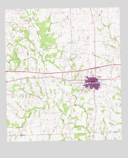
Schulenburg, TX USGS Topographic Map
Click on map above to begin viewing in our Map Viewer.

This topographic map contains these locations and features:
Feature Name Type Latitude Longitude GNIS ID View Map
Bee CreekStreamN29.7061°W96.9625°1372474View Map
Brushy CreekStreamN29.6594°W96.9461°1331426View Map
City of SchulenburgCivilN29.6818°W96.9073°2411839View Map
Corinth ChurchChurchN29.6400°W96.8864°1333358View Map
Fayette County Emergency Medical Service SchulenburgBuildingN29.6849°W96.8992°2655986View Map
Fitzgerald CemeteryCemeteryN29.6311°W96.9933°1335845View Map
Forest High SchoolSchoolN29.6752°W96.8986°1336022View Map
Foster CreekStreamN29.6758°W96.9269°1336081View Map
Freyburg Community HallBuildingN29.7305°W96.9922°1336211View Map
Greene SchoolSchoolN29.6725°W96.9175°1336963View Map
Hackberry BranchStreamN29.7019°W96.9850°1337177View Map
High HillPopulated PlaceN29.7180°W96.9272°1337702View Map
Kehrer ParkParkN29.6800°W96.8983°1338985View Map
Lyons CemeteryCemeteryN29.6416°W96.8875°1340764View Map
Marty Ranch AirportAirportN29.6769°W96.9705°1387512View Map
Mulberry CreekStreamN29.6372°W96.9139°1342241View Map
Mulberry Creek BridgeBridgeN29.6522°W96.9389°2030670View Map
Nativity of the Blessed Virgin Mary Catholic ChurchChurchN29.7175°W96.9275°2032243View Map
Old High Hill CemeteryCemeteryN29.7025°W96.9294°1343162View Map
Rocky CreekStreamN29.7016°W96.9539°1345457View Map
Saint JohnPopulated PlaceN29.6313°W96.9533°1379004View Map
Schonest - Welt ParkParkN29.6852°W96.8980°2029362View Map
Schulenberg City HallBuildingN29.6801°W96.9062°2753445View Map
SchulenburgPopulated PlaceN29.6819°W96.9030°1346794View Map
Schulenburg Cotton CompressLocaleN29.6788°W96.9128°2032030View Map
Schulenburg Elementary SchoolSchoolN29.6875°W96.9055°2005817View Map
Schulenburg High SchoolSchoolN29.6847°W96.9000°2005818View Map
Schulenburg Historical MuseumBuildingN29.7130°W96.9250°2014149View Map
Schulenburg Junior High SchoolSchoolN29.6863°W96.9058°2005819View Map
Schulenburg Police DepartmentBuildingN29.6813°W96.9067°2739194View Map
Schulenburg Post OfficePost OfficeN29.6807°W96.9076°2731232View Map
Schulenburg Volunteer Fire DepartmentBuildingN29.6783°W96.9074°2552213View Map
Walker BranchStreamN29.7208°W96.9619°1349367View Map
Wolters ParkParkN29.6761°W96.9111°1350494View Map
Wright ParkParkN29.6716°W96.9130°1350614View Map

Note: Coordinates in the location and feature list above are referenced to NAD83 datum.


Copyright (C) 2008-2025 Ryan Niemi / Sunset Dynamics ... All Rights Reserved