TopoQuest Logo
Do you find TopoQuest useful?
Help keep TopoQuest running and adding new maps/features by donating!
Bitcoin:  19c7KJd3qBynnjoSw5npx9KScwjBe4ifkT
Litecoin:  LXs6TkuXGGXo1vDsWCkWVdjQX94eUKd6ui
Home View Maps Find Maps Find Places Resources & Links


Oakwood, South Carolina Topographic Map

USGS Map Title: Oakwood, SC
USGS Map MRC: 33081E5
DRG (GeoTIFF) Download: o33081e5.tif


Neighboring USGS Topographic Map Quads:


  Aiken NW, SC  
33081F6
 

  Foxtown, SC  
33081F5
 

  Seivern, SC  
33081F4
 

  Aiken, SC  
33081E6
 

  Oakwood, SC  
33081E5
 

  Kitchings Mill, SC  
33081E4
 

  New Ellenton, SC  
33081D6
 

  Windsor, SC  
33081D5
 

  Williston, SC  
33081D4


Map MRC Location:

N34°
W82°
N34°
W81°
H8 H7 H6 H5 H4 H3 H2 H1
G8 G7 G6 G5 G4 G3 G2 G1
F8 F7 F6 F5 F4 F3 F2 F1
E8 E7 E6 E5 E4 E3 E2 E1
D8 D7 D6 D5 D4 D3 D2 D1
C8 C7 C6 C5 C4 C3 C2 C1
B8 B7 B6 B5 B4 B3 B2 B1
A8 A7 A6 A5 A4 A3 A2 A1
N33°
W82°
N33°
W81°

Oakwood, SC USGS 1:24K Topographic Map Preview:
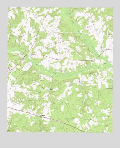
Oakwood, SC USGS Topographic Map
Click on map above to begin viewing in our Map Viewer.

This topographic map contains these locations and features:
Feature Name Type Latitude Longitude GNIS ID View Map
Apia (historical)Populated PlaceN33.5035°W81.5401°1236213View Map
Cedar BranchStreamN33.5590°W81.5421°1247198View Map
Cedar Branch CemeteryCemeteryN33.5312°W81.5326°1221427View Map
Cedar Branch ChurchChurchN33.5179°W81.5243°1221428View Map
Cedar Branch Church (historical)ChurchN33.5479°W81.5357°1236271View Map
Cedar CreekStreamN33.5738°W81.5104°1221435View Map
Cedar LakeReservoirN33.5335°W81.5382°1237993View Map
Cedar LakeReservoirN33.5495°W81.5385°1247215View Map
Cedar Lake School (historical)SchoolN33.5513°W81.5359°1236276View Map
Chavous CreekStreamN33.5563°W81.5676°1247262View Map
Clarks Mill CreekStreamN33.6176°W81.5534°1221614View Map
Clearwater BranchStreamN33.5829°W81.6218°1221628View Map
Clearwater Branch ChurchChurchN33.5990°W81.6221°1247310View Map
CouchtonPopulated PlaceN33.5615°W81.6221°1231199View Map
Couchton Fire Department Station 2BuildingN33.5836°W81.5052°2578292View Map
Couchton Fire RescueBuildingN33.5630°W81.6210°2578428View Map
Darien Baptist ChurchChurchN33.5399°W81.5751°1247485View Map
Darien CemeteryCemeteryN33.5399°W81.5748°1236296View Map
Goss CemeteryCemeteryN33.5604°W81.5215°1222782View Map
Haden School (historical)SchoolN33.5893°W81.5840°1236355View Map
Hayden Baptist ChurchChurchN33.5896°W81.5851°1245924View Map
Hayden Church (historical)ChurchN33.5918°W81.5529°1236362View Map
Hayden School (historical)SchoolN33.5701°W81.5654°1236363View Map
Johnson MillpondLakeN33.5434°W81.5754°1246187View Map
Joyce Branch School (historical)SchoolN33.6229°W81.6204°1236394View Map
Jumping Branch FarmLocaleN33.5650°W81.6031°2652248View Map
Livingstons Mill (historical)LocaleN33.5801°W81.5259°1236417View Map
Mount Hill Memorial Baptist ChurchChurchN33.5307°W81.6076°1249589View Map
Neeses LakeReservoirN33.5875°W81.5115°1224947View Map
Oak Ridge Hunting Preserve PondReservoirN33.5435°W81.5315°1238017View Map
OakwoodPopulated PlaceN33.5165°W81.5862°1225153View Map
Oakwood Baptist ChurchChurchN33.5163°W81.5834°1236464View Map
Oakwood School (historical)SchoolN33.5288°W81.5648°1236465View Map
Oakwood Windsor Elementary SchoolSchoolN33.5161°W81.5755°1236466View Map
Ocean Grove ChurchChurchN33.6207°W81.5987°1249939View Map
Ocean Grove School (historical)SchoolN33.6204°W81.5979°1236467View Map
Plunkett CemeteryCemeteryN33.5915°W81.6045°1225566View Map
Rock Hill ChurchChurchN33.5718°W81.5323°1225931View Map
Round Top School (historical)SchoolN33.6160°W81.5132°1236505View Map
Scott CemeteryCemeteryN33.5612°W81.5620°1226454View Map
Scotts LakeReservoirN33.5764°W81.5976°1236527View Map
Shaw CreekStreamN33.5665°W81.5020°1250853View Map
Shaw Fork School (historical)SchoolN33.5838°W81.5507°1236531View Map
Shaws Fork Baptist ChurchChurchN33.5790°W81.5654°1250854View Map
Shaws Fork School (historical)SchoolN33.5785°W81.5657°1236532View Map
South Carolina Noname 02010 D-1994 DamDamN33.5835°W81.5118°1237953View Map
South Carolina Noname 02037 D-2028 DamDamN33.5515°W81.5384°1237992View Map
South Carolina Noname 02060 D-2013 DamDamN33.5435°W81.5315°1238016View Map
South Carolina Noname 02082 D-2019 DamDamN33.5001°W81.5832°1238036View Map
Tarrants MillpondReservoirN33.5002°W81.5823°1251120View Map
Upper PondReservoirN33.6001°W81.5061°1227324View Map
Upper Pond Dam D-2027DamN33.5976°W81.5062°1239135View Map

Note: Coordinates in the location and feature list above are referenced to NAD83 datum.


Copyright (C) 2008-2024 Ryan Niemi / Sunset Dynamics ... All Rights Reserved