TopoQuest Logo
Do you find TopoQuest useful?
Help keep TopoQuest running and adding new maps/features by donating!
Bitcoin:  19c7KJd3qBynnjoSw5npx9KScwjBe4ifkT
Litecoin:  LXs6TkuXGGXo1vDsWCkWVdjQX94eUKd6ui
Home View Maps Find Maps Find Places Resources & Links


Oakwood, Ohio Topographic Map

USGS Map Title: Oakwood, OH
USGS Map MRC: 41084A4
DRG (GeoTIFF) Download: o41084a4.tif


Neighboring USGS Topographic Map Quads:


  Paulding, OH  
41084B5
 

  Junction, OH  
41084B4
 

  Ayersville, OH  
41084B3
 

  Latty, OH  
41084A5
 

  Oakwood, OH  
41084A4
 

  Continental, OH  
41084A3
 

  Scott, OH  
40084H5
 

  Wetsel, OH  
40084H4
 

  Ottoville, OH  
40084H3


Map MRC Location:

N42°
W85°
N42°
W84°
H8 H7 H6 H5 H4 H3 H2 H1
G8 G7 G6 G5 G4 G3 G2 G1
F8 F7 F6 F5 F4 F3 F2 F1
E8 E7 E6 E5 E4 E3 E2 E1
D8 D7 D6 D5 D4 D3 D2 D1
C8 C7 C6 C5 C4 C3 C2 C1
B8 B7 B6 B5 B4 B3 B2 B1
A8 A7 A6 A5 A4 A3 A2 A1
N41°
W85°
N41°
W84°

Oakwood, OH USGS 1:24K Topographic Map Preview:
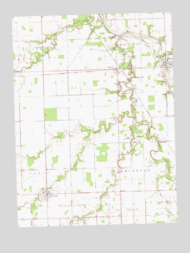
Oakwood, OH USGS Topographic Map
Click on map above to begin viewing in our Map Viewer.

This topographic map contains these locations and features:
Feature Name Type Latitude Longitude GNIS ID View Map
Auglaize ChapelChurchN41.0481°W84.3877°1037534View Map
Auglaize Chapel CemeteryCemeteryN41.0481°W84.3883°1960992View Map
Barcer RunStreamN41.1139°W84.4669°1037629View Map
Big RunStreamN41.0059°W84.4458°1038032View Map
Boutwell CemeteryCemeteryN41.0329°W84.3807°1038215View Map
Bowholtz CemeteryCemeteryN41.1074°W84.4696°1038223View Map
Brown Township HallBuildingN41.0895°W84.3791°1960997View Map
Burt LakeReservoirN41.1051°W84.4218°1078445View Map
Burt Lake DamDamN41.1067°W84.4183°1078444View Map
Canal FarmsLocaleN41.0175°W84.3778°2567336View Map
CanalportPopulated PlaceN41.1173°W84.4277°1065860View Map
Carlton CemeteryCemeteryN41.0302°W84.3827°1038819View Map
Deer Run FarmLocaleN41.0533°W84.4872°2567338View Map
Dog CreekStreamN41.0284°W84.3824°1039730View Map
Dog RunStreamN41.0412°W84.4936°1065978View Map
Fort BrownPopulated PlaceN41.1120°W84.4202°1066005View Map
Fought CemeteryCemeteryN41.0123°W84.3841°1040601View Map
Germann Swine FarmLocaleN41.1131°W84.4564°2711000View Map
GoodwinLocaleN41.0923°W84.4574°1065495View Map
Goodwin (historical)Populated PlaceN41.0920°W84.4577°1961011View Map
Grover HillPopulated PlaceN41.0192°W84.4766°1064773View Map
Grover Hill Elementary SchoolSchoolN41.0203°W84.4794°1053832View Map
Grover Hill Fire DepartmentBuildingN41.0187°W84.4769°2550254View Map
Grover Hill Post OfficePost OfficeN41.0189°W84.4769°1961012View Map
Hertel CemeteryCemeteryN41.0573°W84.3941°1041507View Map
Hoaglin CreekStreamN41.0156°W84.4852°1041632View Map
Hog RunStreamN41.0159°W84.4855°1041653View Map
Kingery CemeteryCemeteryN41.1139°W84.4108°1042278View Map
Latty Township HallBuildingN41.0189°W84.4741°1961023View Map
Little Auglaize RiverStreamN41.1117°W84.4152°1066072View Map
Mellinger CemeteryCemeteryN41.0365°W84.3918°1043213View Map
MelrosePopulated PlaceN41.0923°W84.4197°1061507View Map
Melrose Post OfficePost OfficeN41.0917°W84.4194°2041514View Map
Melrose Town ParkParkN41.0917°W84.4155°1961027View Map
Middle CreekStreamN41.0600°W84.4055°1066095View Map
Middle Creek CemeteryCemeteryN41.0050°W84.4513°1961029View Map
Middle Creek CemeteryCemeteryN41.0342°W84.4188°1961030View Map
Middle Creek ChurchChurchN41.0048°W84.4522°1043271View Map
Middle Creek ChurchChurchN41.0337°W84.4186°1043272View Map
Mount Zion CemeteryCemeteryN41.0537°W84.4583°1961033View Map
Murat (historical)Populated PlaceN41.0625°W84.3758°1961034View Map
Newburgh (historical)Populated PlaceN41.0828°W84.4083°1961037View Map
OakwoodPopulated PlaceN41.0956°W84.3805°1084031View Map
Oakwood CemeteryCemeteryN41.0998°W84.3807°1961040View Map
Oakwood Community ParkParkN41.0939°W84.3813°1961041View Map
Oakwood Elementary SchoolSchoolN41.0967°W84.3794°1053831View Map
Oakwood Post OfficePost OfficeN41.0956°W84.3802°1961042View Map
Plumbs Cross Roads (historical)Populated PlaceN41.0087°W84.3899°1961053View Map
Prairie CreekStreamN41.0637°W84.4080°1066152View Map
Prairie CreekStreamN41.0992°W84.3858°1044740View Map
Rose Grove FarmLocaleN41.0653°W84.4906°2567337View Map
RoselmsPopulated PlaceN41.0195°W84.4191°1045199View Map
Roselms ChurchChurchN41.0173°W84.4194°1961058View Map
Roselms Post Office (historical)Post OfficeN41.0195°W84.4194°2041503View Map
Saint Andrews (historical)Populated PlaceN41.1042°W84.4266°1961059View Map
Sycamore Flats FarmLocaleN41.0758°W84.4439°2567334View Map
Timberville (historical)Populated PlaceN41.0484°W84.3808°1074243View Map
Timberville Post Office (historical)Post OfficeN41.0487°W84.3805°2042141View Map
Township of BrownCivilN41.1200°W84.3980°1086769View Map
Township of WashingtonCivilN41.0328°W84.4013°1086777View Map
Village of Grover HillCivilN41.0190°W84.4776°2398214View Map
Village of MelroseCivilN41.0887°W84.4200°2399307View Map
Village of OakwoodCivilN41.0931°W84.3763°2399546View Map
Washington Township HallBuildingN41.0192°W84.4186°1961066View Map
Welcome ParkParkN41.0220°W84.4788°1047664View Map
West Branch FarmLocaleN41.0425°W84.4358°2567335View Map
West Branch Prairie CreekStreamN41.0564°W84.4405°1047714View Map
Wilson CemeteryCemeteryN41.0521°W84.4051°1047978View Map
Young CemeteryCemeteryN41.0124°W84.3854°1048213View Map
Zion ChurchChurchN41.0531°W84.4574°1048278View Map

Note: Coordinates in the location and feature list above are referenced to NAD83 datum.


Copyright (C) 2008-2025 Ryan Niemi / Sunset Dynamics ... All Rights Reserved